El Sereno Open Space Preserve
This 1,415 acre preserve in the Los Gatos hills is named for 2,580-foot El Sereno Mountain, part of a prominent ridge located west of Los Gatos. The preserve is not heavily used, since there is very limited parking at any of the trailheads. Most users are bikers who ride up from Los Gatos to tackle the challenging climb up to El Sereno Mountain.
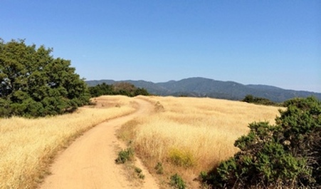
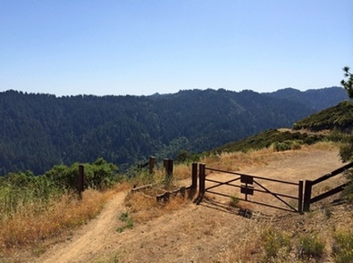
The preserve's seven miles of trails are entirely fire roads. The longest trail, Aquinas Trail, begins at the end of Sheldon Road, a narrow and windy paved road above Monte Sereno. It starts at just over 1000' and climbs to almost 2600' in 3.5 miles. The trail offers spectacular views of the South Bay, Sierra Azul, and Lexington Reservoir.
There are three options for parking at El Sereno Open Space Preserve:
- There are a few public parking spots at the end of Montevina Road, three miles west of Highway 17. This trailhead is at 2400', so any route you take will require a uphill climb back to your car.
- A six-car parking lot is available at the Overlook Trailhead; however, a permit is required to park in this lot. For additional details, refer to the preserve website.
- There is room for 2-3 cars to park at the intersection of Overlook Road and Sheldon Road. From there, it is a 0.4-mile climb up Sheldon Road to the Aquinas Trailhead. This is where the Favorite Run below starts. As of 2014 is there is not a "No Parking" sign; however, these are private roads so park at your own risk!
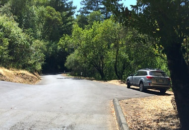
Parking at the junction of Overlook & Sheldon Road
|
The Dirt:
Extras:
|
Favorite Run: El Sereno Climb (8.9 mi, 1700' elevation gain) 🐾
|
This route is an out-and-back that starts at just under 1000' and climbs up the Aquinas Trail to the 2600' Montevina Ridge. The views of the Bay Area are spectacular. Note that these trails are exposed and can be very hot in the summer! This run starts from the intersection of Overlook Road and Sheldon Road.
GPX Track Printable Trail Map Driving Directions |
|
Route Details:
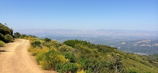
View from the upper part of Aquinas Trail
|
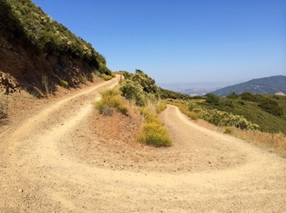
Hairpin turn on the Aquinas Trail
End of the Montevina Trail
|