Calero County Park and Reservoir (and Rancho Canada del Oro Open Space Preserve)
Calero County Park and Reservoir is located in the Santa Teresa hills south of San Jose. When combined with the adjoining Rancho Canada del Oro Open Space Preserve, the two parks offer about 7,000 acres and 20 miles of challenging trails. In addition, the reservoir is open year-round for boating, sailing, fishing, water-skiing and jet-skiing. Calero also offers two first-come, first-serve picnic sites near the water's edge that include tables and barbecues. A reservable group picnic area is also available. Refer to the park website for more details or to make reservations. Equestrians are also allowed on the trails in the parks.
The trails in the two parks are challenging with steep climbs. Elevations in the parks ranges from about 400' at the reservoir to over 1,800' at the summit of Bald Peaks. Most of the trails are fire roads, with the exception of some very nice singletrack sections in the southern portion of Calero and the Rancho Canada del Oro area, including the Chisnantuck Peak Trail and Longwall Canyon Trail. Most of the trails are exposed to the sun, and can be scorching hot and dusty in the summer, so run/hike in the morning and bring plenty of water! (The best time to run/hike at Calero is in the spring before the weather is hot and when the hills are covered in wildflowers!).
The trails in the two parks are challenging with steep climbs. Elevations in the parks ranges from about 400' at the reservoir to over 1,800' at the summit of Bald Peaks. Most of the trails are fire roads, with the exception of some very nice singletrack sections in the southern portion of Calero and the Rancho Canada del Oro area, including the Chisnantuck Peak Trail and Longwall Canyon Trail. Most of the trails are exposed to the sun, and can be scorching hot and dusty in the summer, so run/hike in the morning and bring plenty of water! (The best time to run/hike at Calero is in the spring before the weather is hot and when the hills are covered in wildflowers!).
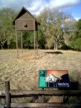 The strange Calero Bat Inn (or "Bat Box")
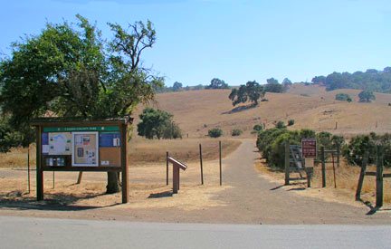
There are two trailheads for Calero County Park. The main parking area is off McKean Road in south San Jose. There is also a southern entrance to Calero and Rancho Canada del Oro off of Casa Loma Road. The runs on this page both start from the main parking area off McKean Road just south of the intersection with Bailey Ave.
The Dirt:
Extras:
The Dirt:
- Click here for a printable trail map of the Favorite Runs listed below!
- Click here for the official Calero County Park web site and trail map .
- Click here for the official Rancho Canada del Oro web site and trail map. (Note: the link to the trail map is on the left-hand side of the page under the boot prints)
- Click here for driving directions to the main parking lot off of McKean Road.
- Dogs on leash are allowed on most trails in the park, EXCEPT for those within and surrounding Rancho Canada del Oro Open Space Preserve. Refer to the trail map for details)
Extras:
- The reservoir is open year-round for boating, sailing, fishing, water-skiing and jet-skiing.
- Note that there is NO drinking water available in the park.
Favorite Run #1: "Bat Box" Figure-8 (6.2 mi, ~1000 feet elevation gain) 🐾
|
This run is a nice introduction to challenging trails in Calero County Park. It is entirely on fire roads. One interesting oddity along the way is the Calero Bat Inn, or "bat box", which is like a condominium for bats built on stilts along the Javelina Loop Trail.
The run starts from the main parking lot off of McKean Road. Cross over the paved road and head up the Access Trail past the trailhead sign. GPX Track Printable Trail Map Driving Directions |
|
Route Details:
|
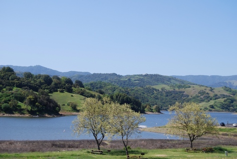
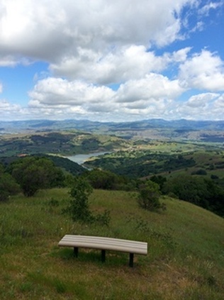
Calero Reservoir
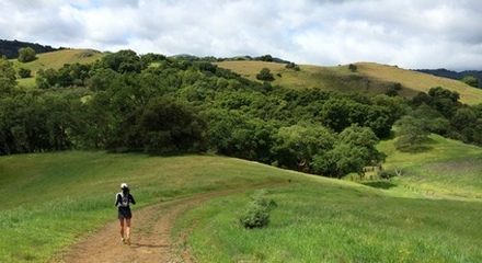
On the Javelina Loop Trail
|
Favorite Run #2: Bald Peaks Big Loop (13.1/15.1 mi, ~2500/2900 ft elevation gain)
|
This run is a challenging grand tour of both Calero Park and Rancho Canada del Oro OSP. You first climb steeply to the ridge behind the reservoir. After a relaxing rolling section, you then head up a very steep singletrack climb to Bald Peaks. At over 1,800', Bald Peaks offers stunning views of the entire South Bay Area. After a great 3-mile singletrack descent, it's time for more climbing back over the ridge and back to your car. There is also an option to add another 2 miles and 400' of climbing to the run if you want! Note that some turns on this run can be confusing so we recommend printing out the trail map or downloading the GPX track to your GPS device!
The run starts from the main parking lot off of McKean Road. Cross over the paved road and head up the Access Trail past the trailhead sign. GPX Track Printable Trail Map Driving Directions |
|
Route Details:
|
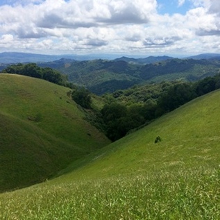
View from Chisnantuck Peak Trail
View from Bald Peaks Trail
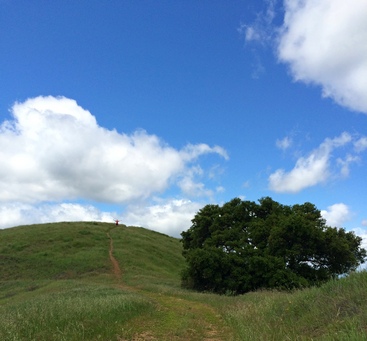
The grassy Bald Peak summit
|
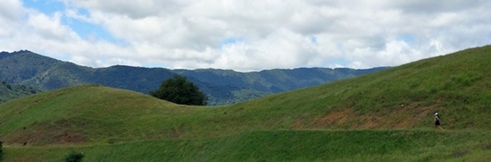
Running along the backside of Bald Peaks