Santa Teresa County Park
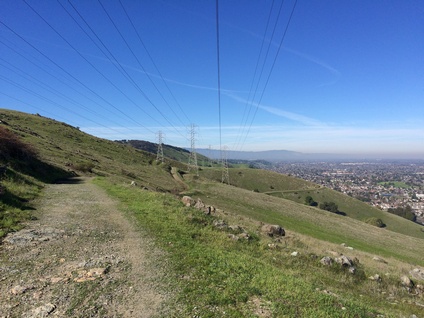
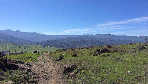
Santa Teresa County Park is located in the Santa Teresa Hills about ten miles south of downtown San Jose. The park offers 1,627 acres of rolling grassland hills and secluded valleys, conveniently located only minutes off of highway 101. The crown jewel of the park is 1,155' Coyote Peak, which offers a challenging climb and spectacular views of the Almaden and Santa Clara Valleys from the top.
Santa Theresa County Park offers over 18 miles of trails for equestrian, hiking, and bicycle use. Most of the trails are dirt roads, with the exceptions being the singletrack Rocky Ridge, Ohlone, and Stile Ranch trails. Elevations in the park range from about 200' in the northeast section to 1,155' at the summit of Coyote Peak. Some of the trails are steep, particularly around Coyote Peak. Please note that there is almost no shade in the park, so it can get quite hot in the summer. If you plan to visit on a hot summer day, bring extra water and wear sunscreen!
In addition to recreational trails, Santa Teresa County Park boasts an 18-hole championship golf course and a 9-hole par-three course. The clubhouse includes a restaurant and pro shop. Also located at the golf course is a banquet facility, available by reservation. Please refer to the official website for details and reservation information. An archery range, operated and maintained by the Black Mountain Bowmen Archery Club, is open for public use except when tournaments are scheduled. The Pueblo Day Use area includes parking for over 170 vehicles and a reservable group picnic area for up to 100 people. The park also includes the historic Bernal-Gulnac-Joice Ranch and Santa Teresa Springs. The ranch was owned and operated by the Bernal family for over 100 years. Today, a self-guided walk around the ranch takes you back in time, through a historic ranch house, gardens and barn, all restored and equipped with furnishings and tools typical of California farm life in the early 1900’s.
|
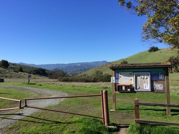
There are a few different trailheads for Santa Theresa County Park. All of the runs on this page start from the Mine Trailhead, at the last parking lot along the park road. To park here, you must first stop in the first parking area and purchase a parking permit from the automated machine. Park rangers will give you a ticket if you do not display a parking permit!
The Dirt:
Extras:
|
Favorite Run #1: Coyote Peak Loop (3.8 mi, ~700' elevation gain) 🐾
|
This is a short but challenging loop that takes you directly to the 1,155' summit of Coyote Peak for spectacular views of San Jose and the surrounding hills. The climb to the peak is entirely on fire roads, while the descent includes the challenging and aptly named Rocky Ridge Trail.
This run starts from the Main Trailhead at the end of the paved park road. Begin the loop by running around the gate, past the sign, then turning left onto the Mine Trail. You will initially run parallel to the park road that you drove in on. GPX Track Printable Trail Map Driving Directions |
|
Route Details:
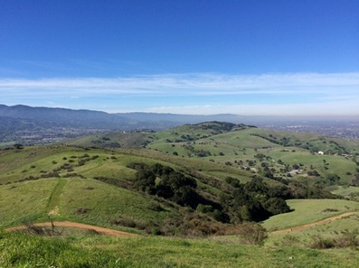 The view from Coyote Peak
- 0.0 mi: From the far end of the parking lot, run around the gate and turn left on Mine Trail and follow it as it runs parallel to the parking lot. If you are running away from the parking lot, you're going the wrong way.
- 0.4 mi: When Mine Trail ends, turn right onto Hidden Springs Trail.
- 0.9 mi: Hidden Springs Trail ends on Coyote Peak Trail. Turn right and continue climbing toward the peak.
- 1.4 mi: At 1,155' Coyote Peak! Enjoy the view, then continue on the Coyote Peak trail in the direction you were heading. You will start descending down the back side of the peak.
- 1.8 mi: Turn right onto the Rocky Ridge Trail (singletrack). This aptly named trail is extremely rocky and technical. Follow Rocky Ridge trail for almost two miles until it ends on Mine Trail.
- 3.6 mi: When Rocky Ridge Trail ends, veer right toward the parking lot.
- 3.8 mi: Back at your car!
Favorite Run #2: Big Loop (10.2 mi, ~1700' elevation gain) 🐾
|
This loop is the grand tour of Santa Teresa County Park, hitting almost all of the singletrack trails in the park. You first climb the narrow and rocky Stile Ranch Trail past the IBM Almaden Research Center. You then head up to the ridge followed by a descent past the Santa Teresa Spring and Norred Ranch. This is followed by a sweet section of rolling singletrack on the Ohlone Trail, then a tough climb to the 1,155' summit of Coyote Peak for spectacular views of San Jose and the surrounding hills. The final descent includes the challenging and aptly named Rocky Ridge Trail.
This run starts from the Main Trailhead at the end of the paved park road. Begin the loop by running around the gate, past the sign, then turning left onto the Mine Trail. You will initially run parallel to the park road that you drove in on. GPX Track Printable Trail Map Driving Directions |
|
Route Details:
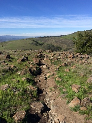 The aptly named Rocky Ridge Trail
- 0.0 mi: From the far end of the parking lot, run around the gate and continue away from the parking lot on Mine Trail. If find yourself running back toward the direction you drove in, you're going the wrong way.
- 0.1 mi: At Rocky Ridge Trail, veer right to stay on Mine Trail.
- 0.4 mi: Turn left onto Fortini Trail heading toward the Stile Entrance.
- 1.2 mi: At the Fortini Road parking lot, turn right onto the singletrack Stile Ranch Trail and start climbing the rocky switchbacks. The next 1.5 miles are sweet, technical singletrack. You'll soon see the IBM Almaden Research Center.
- 2.7 mi: When Stile Ranch Trail ends, turn left onto Mine Trail.
- 3.1 mi: Veer left and cross over Bernal Road to stay on Mine Trail.
- 3.2 mi: Turn left onto Bernal Hill Trail, then shortly thereafter veer right to stay on Bernal Hill Trail. Stay on Bernal Hill Trail until it ends.
- 4.1 mi: Bernal Hill Trail ends at Joyce Trail. Turn right then descend steeply toward the residential area. Keep an eye out for the Norred Trail on your right.
- 4.6 mi: Near the bottom of the hill, turn right onto Norred Trail.
- 5.4 mi: When Norred Trail ends, turn right onto Mine Trail. This section is paved and climbs steeply up to Bernal Road.
- 5.6 mi: Veer left to cross over Bernal Road, then continue up the trail on the other side. Shortly after crossing the road, veer left onto the singletrack Ohlone Trail. This next mile is some of the best singletrack in the park.
- 6.7 mi: Turn right onto Coyote Peak Trail and start climbing to the peak. In the next mile, you will gain almost 800' and the trail is steep in sections.
- 7.8 mi: At 1,155' Coyote Peak! Enjoy the view, then continue on the Coyote Peak trail in the direction you were heading. You will start descending down the back side of the peak.
- 8.2 mi: Turn right onto the Rocky Ridge Trail (singletrack). This aptly named trail is extremely rocky and technical. Follow Rocky Ridge trail for almost two miles until it ends on Mine Trail.
- 10.0 mi: When Rocky Ridge Trail ends, veer right toward the parking lot.
- 10.2 mi: Back at your car!
