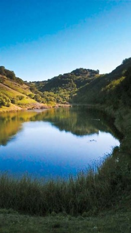
Skyline Wilderness Park
 Lake Marie
Skyline Wilderness Park is an 850-acre wilderness area at the southeast corner of Napa. Until 1979, the land was part of the grounds of the Napa Asylum for the Insane (now called Napa State Hospital), which once drew its water from several man-made lakes that still dot the park. When the state decided it no longer needed the land and was poised to sell it off, locals stepped in and struck a deal to run the park on their own, making Skyline Wilderness Park one of the state’s only large parks managed entirely by volunteers.
Skyline has over 25 miles of trails for hiking, running, biking and equestrian use. The main trail, Lake Marie Road, is a dirt road that extends two miles from the park entrance to Lake Marie. All of the other trails in the park are narrow, sometimes steep and rocky singletrack. Elevations in the park range from about 200' at the entrance to 1,630' at the summit of Sugarloaf Peak, the park’s highest point. The peak is accessed via Thatchers Rim Rock Trail, a steep rugged singletrack trail with one section that gains over 900' in only 0.6 miles! However, your effort is rewarded with panoramic views of Mount St. Helena to the north, San Francisco Bay to south, Mount Tamalpais to the west, and Mount Diablo to the east.
In addition to miles of trails, Skyline Wilderness Park also offers an archery range, disc golf course, picnic and barbecue areas, an RV park, and tent camping.
The Dirt:
Extras:
Skyline has over 25 miles of trails for hiking, running, biking and equestrian use. The main trail, Lake Marie Road, is a dirt road that extends two miles from the park entrance to Lake Marie. All of the other trails in the park are narrow, sometimes steep and rocky singletrack. Elevations in the park range from about 200' at the entrance to 1,630' at the summit of Sugarloaf Peak, the park’s highest point. The peak is accessed via Thatchers Rim Rock Trail, a steep rugged singletrack trail with one section that gains over 900' in only 0.6 miles! However, your effort is rewarded with panoramic views of Mount St. Helena to the north, San Francisco Bay to south, Mount Tamalpais to the west, and Mount Diablo to the east.
In addition to miles of trails, Skyline Wilderness Park also offers an archery range, disc golf course, picnic and barbecue areas, an RV park, and tent camping.
The Dirt:
- Click here for the official Skyline Wilderness Park website.
- There is a fee to use the park, even if you walk in.
- You can obtain a trail map from the entrance kiosk, or download one here.
- Click here for driving directions to the park entrance via Google Maps.
- Dogs are not allowed on trails in the park.
Extras:
- There is no drinking water available in the park, so bring your own!