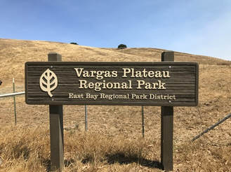
Vargas Plateau Regional Park
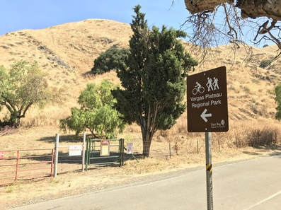
Vargas Plateau Regional Park may not be the largest or most spectacular park in the Bay Area, but it certainly is one of the most controversial. During the mid-1990's, the park district spent millions of dollars purchasing the parcels that were to make up the park. After much time and effort, the park finally opened in the spring of 2016, only to be closed two months later due to a lawsuit filed by two neighbors concerned about traffic and parking on Vargas Road and Morrison Canyon Road. After several additional improvements to the roads, the park was finally reopened on May 15, 2017. As part of the whole lawsuit hullabaloo, any references to using Morrison Canyon Road as an access to the park have been removed from the directions and park maps, and notices have been put on the park map reading "No Park Access From Mission Blvd" and "The Park is Accessible Only From the I-680 Vargas Road Exit." On the contrary, the park actually is easily accessed from Mission Blvd in Fremont, and we tell you how to do this in The Dirt section below.
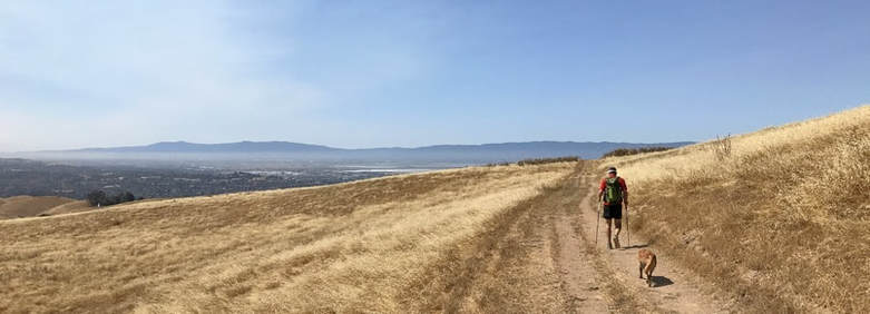
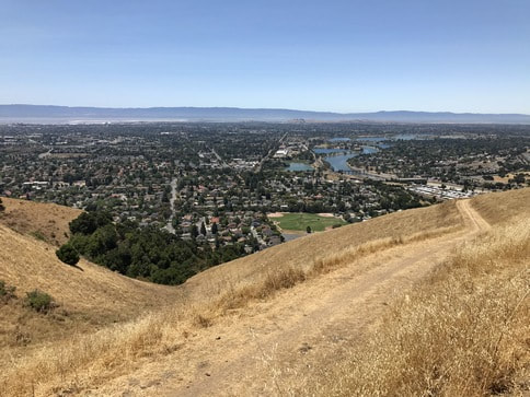
The 1,249-acre Vargas Plateau Regional Park contains about six miles of trails which offer tremendous views of the East Bay cities to the west and Niles Canyon and Sunol Peak to the east. Elevations in the park range from about 100' at the lower Morrison Canyon Road entrance to 1188' at the high point and lookout. From the lower entrance, the trail climbs steeply and gains over 800' in just one mile. The trails in the park are old ranch roads which offer excellent views but no shade, so a hot summer day is not the best time to visit. Also, there is no drinking water in the park, so you'd better bring your own!
The 1,249-acre Vargas Plateau Regional Park contains about six miles of trails which offer tremendous views of the East Bay cities to the west and Niles Canyon and Sunol Peak to the east. Elevations in the park range from about 100' at the lower Morrison Canyon Road entrance to 1188' at the high point and lookout. From the lower entrance, the trail climbs steeply and gains over 800' in just one mile. The trails in the park are old ranch roads which offer excellent views but no shade, so a hot summer day is not the best time to visit. Also, there is no drinking water in the park, so you'd better bring your own!
The Dirt:
|
The lower Morrison Canyon Road entrance
|
Favorite Run #1: Bottom-to-Top Lollypop (8.4 mi, ~1500 feet elevation gain) 🐾
|
This route takes you from the lowest point in the park (around 100') to the high point at just under 1200'. The first mile is fairly flat, followed by a steep one-mile climb up to the plateau. After a rolling loop, you visit the high point of the park for a panoramic view of the Bay Area. The last few miles are mostly downhill back to the start.
The run starts from the intersection of Morrison Canyon Road and Canyon Heights Drive in Fremont and enters the park through the lower Morrison Canyon Road entrance. There is street parking available on Canyon Heights Drive. GPX Track Printable Trail Map Driving Directions |
|
|
Route Details:
|
Steep section of the Cliff Trail
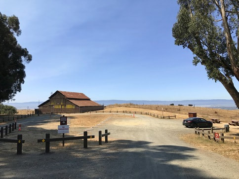
The official staging and parking area
|