Almaden Quicksilver County Park
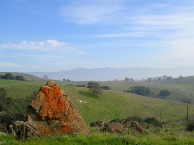
Almaden Quicksilver County Park, located in San Jose just south of Almaden Expressway, consists of more than 4,000 acres of rolling grassy hills. Even though the park is wild and undeveloped today, it was the site of more than 135 years of mining activities and former home to more than 1,800 miners and their families. Today, all mining has ceased and most of the tunnels have been sealed up. However, remnants of the park's mining history can be seen scattered throughout the park and in the Almaden Quicksilver Mining Museum in New Almaden.
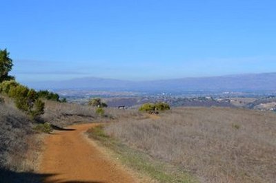
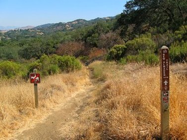
Almaden Quicksilver County Park has over 30 miles of trails. The trails in the park are primarily fire roads, with the exception of the 6-mile long New Almaden Trail and a few short trails such as the Prospect #3 Trail and Yellow Kid Trail. Elevations in the park range from around 400' at the entrance to over 1700' feet at Mine Hill. The trails here are challenging! For example, starting from the Mockingbird Hill entrance, the Hacienda Trail climbs 500' in the first mile! Also, the trails are mostly exposed to the sun. The weather in the park is typically temperate in the winter but can be quite hot in the summer, so bring plenty of water!
There are four main trailheads from which to enter the park: McAbee Road, Mockingbird Hill Lane, Hacienda, and Hicks/Wood Road. The Favorite Runs on this page start from either the McAbee entrance or the Mockingbird Hill entrance.
The Dirt:
- Click here for a printable trail map of all three Favorite Runs below!
- For the official web site and a decent trail map click here.
- For driving directions to the two entrances via Google maps, click: McAbee Road or Mockingbird Hill.
- Dogs on leash are allowed on ALL TRAILS in the park!
- Note that the only drinking water available in the park is at the Mockingbird Hill entrance.
- Boy Scout Troop 466 created a self-guided 5-mile historic trail with brochure to experience first-hand some of the history of the park.
History of the Park
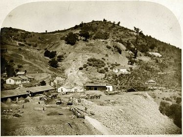 New Almaden Quicksilver Mine circa 1863
Image from: http://albumen.conservation-us.org
Mining operations in New Almaden began in 1845 under the claim of Mexican Cavalry Officer Captain Andres Castillero. Castillero discovered that the cinnabar being used by the Ohlone Indians contained mercury, which was needed to process silver in Mexican mines as well as gold in California. The mercury was used in the process of removing the precious metal from the ore. The mine became the world’s second largest producer of mercury, also known as “quicksilver”. American companies eventually acquired ownership of the mines, which were in operation from 1847 to 1976. By the time Santa Clara County bought the mines in 1976 and ended operations, 83,974,076 pounds of mercury worth more than US$70 million had been extracted. The hills in the park are still honeycombed with tunnels that run for thousands of feet, some below sea level.
Today, the Almaden Quicksilver Mining Museum, located just east of the park on Almaden Road, presents visitors with an interesting array of exhibits about the history of mercury mining and the lifestyles of mining communities at New Almaden. For more information on the museum, visit to the museum website.
For more information on the rich mining history of the area, check out the following sites:
Favorite Run #1: "Bull Run" Climb (6.0 mi, ~1200 feet elevation gain) 🐾
|
This run is a challenging and rewarding hill climb up to the high point of the park known as "Bull Run". Although the thick brush makes it is hard to visualize now, this site was once a flat field filled with wildflowers and used by the miners on holidays for picnics, baseball games and celebrations. Note that this route is entirely on fire roads that get pretty steep!
The run starts from the Mockingbird Hill entrance. When you drive into the large parking lot, you will find the trailhead at the opposite side of the lot. Begin the run by turning right at the trailhead and starting the climb up Hacienda Trail. GPX Track Printable Trail Map Driving Directions |
|
Route Details:
|
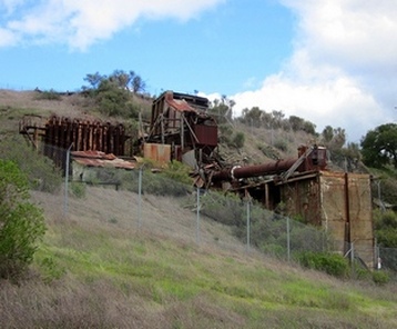
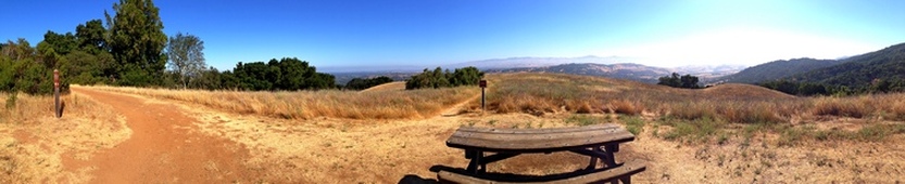
Remains of the old Rotary Furnace
The Hacienda Trail
|
Favorite Run #2: Randol/Mine Hill Loop (10.8 mi, ~1900 feet elevation gain) 🐾
|
This run hits all of the highlights of the previous one, but adds a nice rolling section of the Randol Trail and passes by several more old mining sites. Note that this route is entirely on fire roads that get pretty steep!
The run starts from the Mockingbird Hill entrance. When you drive into the large parking lot, you will find the trailhead at the opposite side of the lot. Begin the run by turning right at the trailhead and starting the climb up Hacienda Trail. GPX Track Printable Trail Map Driving Directions |
|
Route Details:
 The Randol Trail, near the intersection with Prospect #3 Trail
- 0.0 mi: From the trailhead, turn right to start heading up the Hacienda Trail. The climbing starts right away!
- 0.2 mi: Pass the New Almaden Trail on your right. Continue climbing up the Hacienda Trail.
- 1.0 mi: After a brief descent, turn right onto the Capehorn Pass Trail. You will descend briefly and then intersect the Mine Hill Trail and Randol Trail.
- 1.3 mi: Intersection with Mine Hill Trail and Randol Trail. Turn right onto the Randol Trail. You will follow the Randol Trail for the next 4 miles, except for a brief 0.4-mile diversion onto the Santa Isabel Trail. The next 4 miles are rolling with no large climbs and offer several excellent viewpoints.
- 2.3 mi: Veer left onto the Santa Isabel Trail. You will soon pass the site of the old Santa Isabel mine. In 0.4-miles the trail will join back up with the Randol Trail.
- 2.7 mi: Stay left to get back on the Randol Trail. You will stay on the Randol Trail for the next 2.6 mi.
- 5.6 mi: Randol Trail ends. Turn left onto Mine Hill Trail and start a 2-mile climb up to Bull Run.
- 6.0 mi: Pass the Providencia Trail on your right (in the switchback section). Stay left and continue climbing up the Mine Hill Trail.
- 6.6 mi: Pass the Providencia Trail on your right. Stay left and continue climbing up the Mine Hill Trail.
- 6.9 mi: Pass the Prospect #3 Trail on your left. Continue climbing up the Mine Hill Trail.
- 7.7 mi: You will see the site of the old Catherine Tunnel on your left, then the intersection with the Castillero Trail. Veer right onto the Castillero Trail. This area is known as "Bull Run" and was the site of gatherings and celebrations for the miners.
- 8.4 mi: Intersection with Wood Road Trail. Continue downhill on the Castillero Trail. You will see the remains of the old Rotary Furnace to your right, once used to separate mercury from the ore.
- 8.9 mi: Intersection with the Mine Hill Trail. Turn right onto Mine Hill Trail and keep descending. From now on, you will retrace your steps back to the car.
- 9.6 mi: Continue straight onto Capehorn Pass Trail to climb back up to Hacienda Trail.
- 9.8 mi: Turn left onto Hacienda Trail, climb briefly, and then begin the steep descent back down to the car.
- 10.8 mi: Back at the car!
Favorite Run #3: Big New Almaden Loop (12.7 mi, ~2100 feet elevation gain) 🐾
|
This loop is a "grand tour" of Almaden Quicksilver Park. Whereas the previous two runs were primarily fire road, this loop is about 50% shaded singletrack. The route is challenging: it has several miles of extended climbing on the Senador Mine Trail and Mine Hill Trail, followed by many technical short up-and-down sections on the New Almaden Trail. The turns on this run can be confusing, so we recommend that you print out the trail map or download the GPX route to your GPS device!
Unlike the previous two runs, this run starts from the McAbee Road entrance, at the corner of McAbee Road and Whispering Pines Dr. Begin the run by heading up the paved trail along McAbee Creek. GPX Track Printable Trail Map Driving Directions |
|
Route Details:
|
Sweet singletrack on the New Almaden Trail
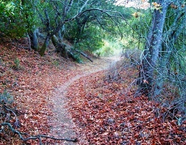
A shaded section of the New Almaden Trail
|
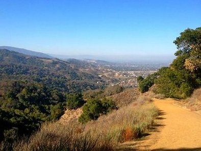
View from Randol Trail (at intersection of Prospect #3 Trail)