Andrew Molera State Park
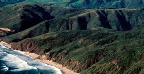
Andrew Molera State Park is located 22 miles south of Carmel along Highway 1 on the Big Sur Coast. The park comprises about 4,800 acres of relatively undeveloped coastal land. The Big Sur River also passes through the park and empties into the ocean at Molera Point. The park is named in honor of Andrew Molera, who popularized the artichoke in California in 1922. His sister Frances Molera sold the land to the Nature Conservancy in 1968 under the conditions that it not be developed, and that it be named after her brother.
Andrew Molera State Park offers about 15 miles of trails. The trails on the west side of Highway 1 (between Highway 1 and the ocean) are relatively well-developed and moderate. The East Molera Trail, which begins on Highway 1 and leads inland, is very steep and obscure in places, but offers spectacular 360-degree views from the top of the ridge. Elevations in the park range from sea level to over 3,000' along the ridge.
For those who want bigger and longer adventures, Andrew Molera adjoins the Los Padres National Forest, which contains over 1,200 MILES of back-country trails through TWO MILLION ACRES of wilderness. (If that's not enough for you, I don't know what to say...).
In addition to hiking, Andrew Molera State Park offers a walk-in campground and guided horseback tours. Refer to the Andrew Molera State Park website for details.
Important note: You won't find a lot of people along the Big Sur coast, but you will find a lot of two things: poison oak and ticks. This is particularly true in the wilderness areas on the east side of Highway 1. Be careful, and check yourself thoroughly for ticks after your adventure!
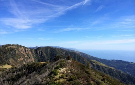
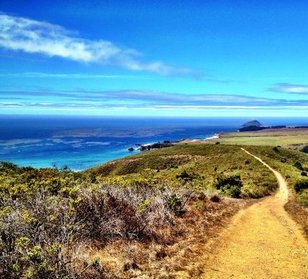 View from the Ridge Trail
The Dirt:
Extras:
- Click here to download a printable map of the Favorite Runs below!
- Click here for the official website with a link to the trail map.
- National Geographic publishes a Trail Map of Big Sur - Ventana Wilderness, an excellent and comprehensive map of the entire region.
- Click here for driving directions to the parking lot via Google maps.
- There are no dogs allowed on the trails in the park.
Extras:
- Andrew Molera State Park adjoins the 2-million acre Los Padres National Forest, which features over 1,200 miles of trails.
- For more hikes and runs in Big Sur, check out the Big Sur Coast page.
- There are several excellent web resources for hiking in Big Sur including: HikingInBigSur.com, RedwoodHikes.com, and BigSurCalifornia.org.
Favorite Run #1: Molera Big Loop (8.2 mi, ~1300 feet elevation gain)
|
This very scenic loop takes you along the Ridge Trail and then back along the Panorama Trail and Bluffs Trail for outstanding ocean views. To begin this run, head out the west side of the parking lot (toward the ocean) and follow the River Trail to the Creamery Meadow Trail, heading toward the beach.
Note: Shortly after leaving the parking lot you will need to cross the Big Sur River on the seasonal bridge provided. If the bridge has been removed, it may not be possible to cross to the other side! GPX Track Printable Trail Map Driving Directions Route Details:
|
|
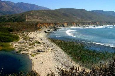 View of the Ridge Trail from near Molera Point
- 0.0 mi: From the parking lot, follow signs to follow the River Trail toward the Creamery Meadow Trail.
- 0.2 mi: Turn right onto the Creamery Meadow Trail toward the beach. (Note: as an alternate route, you can also take the Beach Trail as they go to the same place.)
- 0.9 mi: Turn left onto the Ridge Trail and start climbing up the ridge. You will follow the Ridge Trail for almost 3 miles to the park boundary where it intersects the narrow Panorama Trail at the high point of the run.
- 3.6 mi: Turn right onto the Panorama Trail, heading toward Bluffs Trail. Panorama Trail will lead onto Bluffs Trail, which you will follow all of the way back to Creamery Meadow Trail.
- 7.1 mi: Bluffs Trail ends at Creamery Meadow Trail. Turn right and follow Creamery Meadow Trail all of the way back to the parking lot.
- 8.2 mi: Back at your car!!
Favorite Run #2: Post Summit (9.0 mi, ~3400 feet elevation gain)
|
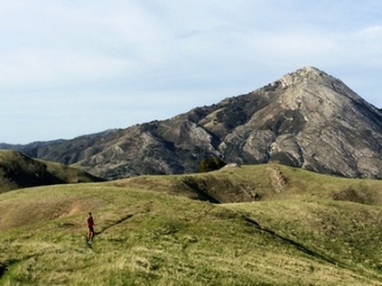
This route follows the narrow and relatively unmaintained East Molera Trail up to the ridge where there are spectacular views of 3,709-foot Pico Blanco, a solid limestone mountain in the Los Padres National Forest. (Click here to learn more about climbing Pico Blanco!) The trail then rolls along the ridge before turning sharply east for a very steep and loose climb up to 3,455-foot Post Summit for amazing 360-degree views. (Note that the last mile of the trail is actually outside the park boundary.)
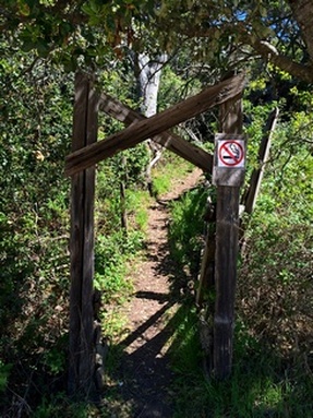
The views from this trail are spectacular, but you have to pay! The trail is very steep, partially overgrown, full of poison oak and ticks, and hot in the summer. But, these negatives are outweighed by the spectacular views and the feeling of accomplishment you feel at the top! The East Molera Trail starts at an unmarked trailhead along Highway 1. The trailhead is difficult to find, so here is the location in Google Maps. To reach the trailhead, you can either walk from the main parking lot or park in one of the small dirt pull-outs near the trailhead along the side of Highway 1. |
|
Route Details:
|
