Anthony Chabot Regional Park and Lake Chabot
Anthony Chabot Regional Park is a 3,314 acre park located in the East Bay Hills just east of Oakland. The park is named after Anthony Chabot, who founded the Contra Costa Water Company in 1866. In 1874-75 he built the reservoir that is now called Lake Chabot. The lake, which initially served as the primary source of water for the East Bay, currently serves as a standby emergency water supply. Anthony Chabot also donated a telescope and the funds to build the Oakland Observatory, which was later relocated and expanded to become the Chabot Space & Science Center.
Anthony Chabot Regional Park extends from Castro Valley northward to Redwood Regional Park which is connected to Anthony Chabot Regional Park via the MacDonald Trail. The 70 miles of trails in the park are a mix of fire roads and singletrack, and many of the trails are shaded with scenic views of the lake. Elevations in the park range from under 300' at the reservoir to over 1100' at the north end of the park, and the climbs are typically moderate. In addition, water is available at several trailheads within the park, so routes can be planned that include water stops.
In addition to running and hiking, Anthony Chabot Regional Park offers boating and fishing on the lake, camping, and a marksmanship range. Bicycles are also allowed on fire road trails in the park.
Of interesting historical note, the hilltop just south of Lake Chabot was the location of Nike Missile site SF-31L, one of twelve such sites circling the Bay Area that were built during the Cold War. The buildings are now either boarded up or used as East Bay Regional Park District administration buildings.
There are multiple trailheads to access Anthony Chabot Regional Park. Directions to several of these are given on the official park site. The runs on this page start from the Willow Park Public Golf Course parking lot, located off Redwood Road a few miles north of Castro Valley.
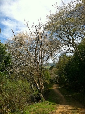
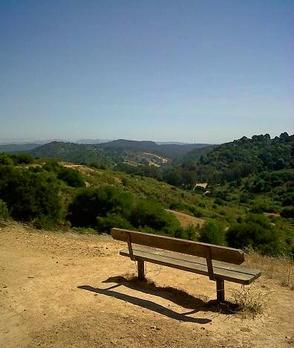 Overlook along the MacDonald Trail
The Dirt:
Extras:
- Click here to download a printable map of the Favorite Runs below!
- Click here for the official park site with trail maps.
- Click here for directions to the Willow Park Golf Course parking lot via Google Maps.
- Dogs are allowed, and may be off-leash away from trailheads, parking lots, and areas marked as on-leash only. Note that dogs are NOT allowed to swim in the reservoir. Refer to the East Bay Regional Park page on Dogs for more information.
Extras:
- Drinking water is available at several trailheads within the park. Refer to the park map for locations.
- Anthony Chabot Regional Park connects to Redwood Regional Park to the north via the MacDonald Trail.
- Seven East Bay Parks, including Anthony Chabot, can be connected by a 28.5-mile point to point run along the Ridge Trail. Read more about this challenging run.
Favorite Run #1: Brandon-Redtail Loop (9.8 mi, ~1500' elevation gain) 🐾
|
This is a lollipop route that first takes you up and along the rolling Brandon Trail through shady eucalyptus groves, with the occasional view of the Bay below. The trail then drops down and along Grass Valley Creek. You then climb up to the ridge and follow the Redtail Trail along the ridge for great views, and finish with a two-mile descent back to your car.
The run starts from the Willow Park Public Golf Course parking lot. Start the run by heading up the Brandon Trail at the north end of the parking lot. GPX Track Printable Trail Map Driving Directions |
|
|
Route Details:
|
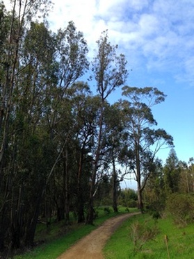
Eucalyptus grove along Brandon Trail
|
Favorite Run #2: The Big Honker Loop (13.0 mi, 1800' elevation gain) 🐾
|
This big loop has everything: smooth flat trail with views of Lake Chabot, swooping singletrack through eucalyptus forests, wooded ravines, and ridgeline vistas. The route first heads to Honker Bay, followed by a great section of rolling singletrack on the Columbine Trail. The trail then climbs up a steep-walled ravine above Grass Valley Creek. You then climb up to the ridge and follow the Redtail Trail along the ridge for great views, and finish with a two-mile descent back to your car.
The run starts from the Willow Park Public Golf Course parking lot. Start the run by heading back down the driveway toward Redwood Road. Note: In the wintertime the Grass Valley Creek crossing on Columbine Trail may be flooded. So be prepared for wet feet if you do this route in the winter! GPX Track Printable Trail Map Driving Directions |
|
|
Route Details:
|
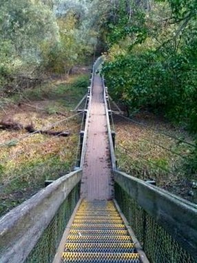
The bridge leading to Honker Bay
Singletrack section of Redtail Trail
|
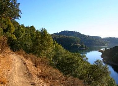
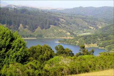
View of Lake Chabot from Columbine Trail
|
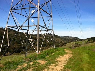
The climb up Redtrail Trail under the power lines
|