Redwood Regional Park
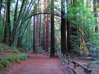
What? A real redwood forest in the Oakland hills? Believe it or not, it's true. Nestled in the hills just above the city of Oakland is the 1,830-acre Redwood Regional Park. The peaceful redwood groves that exist today give little evidence of the park's bustling past. In the mid-1800's the area was the scene of extensive logging to supply building materials for the San Francisco Bay Area. The logging era has long since passed, and a stately forest of 150-foot coast redwoods (Sequoia sempervirens) has replaced those that were cut down. This forest in Redwood Regional Park is the largest remaining natural stand of coast redwood found in the East Bay.
The park features a mix of fire roads and singletrack with moderate climbs and great options for trail running or hiking. In addition, the park is bordered by Anthony Chabot Regional Park to the south, Huckleberry Regional Preserve to the north, and EBMUD lands to the east, offering the possibility of longer multi-park runs. In addition, drinking water is available at several locations within the park (refer to the trail map for locations). The elevations in the park range from about 500' at the park entrance to over 1600' at Redwood Peak. The topography of the park is like a hot-dog bun, for lack of a better analogy, with a deep valley running north-south between two ridges that are aptly named East Ridge and West Ridge.
The park features a mix of fire roads and singletrack with moderate climbs and great options for trail running or hiking. In addition, the park is bordered by Anthony Chabot Regional Park to the south, Huckleberry Regional Preserve to the north, and EBMUD lands to the east, offering the possibility of longer multi-park runs. In addition, drinking water is available at several locations within the park (refer to the trail map for locations). The elevations in the park range from about 500' at the park entrance to over 1600' at Redwood Peak. The topography of the park is like a hot-dog bun, for lack of a better analogy, with a deep valley running north-south between two ridges that are aptly named East Ridge and West Ridge.
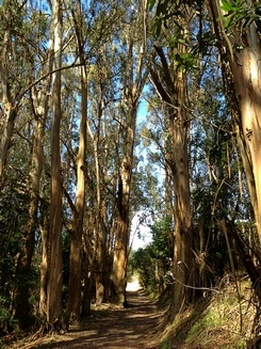 Eucalyptus on the West Ridge Trail
There are many trailheads that offer access to Redwood Regional Park. Two popular access points are the Skyline Gate Staging Area on Skyline Blvd and the Canyon Meadow Staging Area off of Redwood Road. In addition, access is available via the 1.7-mile long Redwood Trail from the Valle Vista Staging Area near Moraga. Use of this trail requires a permit from EBMUD. The Favorite Runs on this page start from the Canyon Meadow Staging Area.
The Dirt:
Extras:
The Dirt:
- Click here to download a printable trail map of the Favorite Runs below!
- Click here for the official park website.
- Click here for directions to the Canyon Meadow Staging Area via Google Maps. Note that there is a parking fee.
- Dogs are allowed, and may be off-leash away from trailheads, parking lots, and areas marked as on-leash only. Refer to the East Bay Regional Park page on Dogs for more information.
Extras:
- There is drinking water is available at several locations. Refer to the trail map for locations.
- The park also offers picnic and camping sites. Refer to the webpage for reservation information.
Favorite Run #1: Stream/East Ridge Loop (6.2 mi, 800' elevation gain) 🐾
|
This route takes you up the Stream Trail, which gradually climbs along Redwood Creek through the dense redwood forest and then climbs more steeply to the Skyline Gate Staging Area. You then run along the rolling East Ridge Trail which has stunning views of the East Bay hills, reservoirs, and redwood forest below. The run ends with a steep descent back to your car.
The run starts from the Canyon Meadow Staging Area. After paying the fee at the entrance kiosk, continue driving along the paved road and park in the last parking lot. From the parking lot, run north on the Stream Trail through the play area. GPX Track Printable Trail Map Driving Directions |
|
|
Route Details:
|
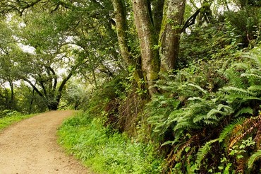
The East Ridge Trail
|
Favorite Run #2: Golden/Graham/French Loop (13.3 mi, ~2300' elevation gain) 🐾
|
The name of this loop may sound like a kid's breakfast cereal, but don't be fooled: it's a challenging and beautiful route that includes some of the best singletrack in the East Bay. The first part is on the rolling, shaded Golden Spike Trail. You then climb through Roberts Regional Recreation Area to Redwood Bowl and the West Ridge Trail. After a brief side-trip for water, the route follows the beautiful and tough French Trail along its entire length, followed by a steep descent back to your car.
The run starts from the Canyon Meadow Staging Area. After paying the fee at the entrance kiosk, continue driving along the paved road and park in the last parking lot. From the parking lot, run north on the Stream Trail through the play area. GPX Track Printable Trail Map Driving Directions |
|
Route Details:
|
Please note that there are some confusing intersections on the West Ridge Trail and on the French Trail, so we recommend that you print out the map or download the GPX track to your GPS device!
|
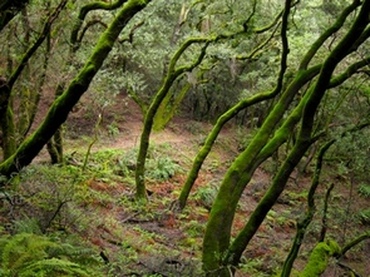
The Golden Spike Trail
The Graham Trail
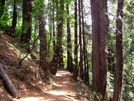
The French Trail in the winter
|
Favorite Run #3: The 1+2=3 Loop (19.5 mi, 3100' elevation gain) 🐾
|
For the ultimate challenging tour of the park, simply combine Favorite Run #1 and Favorite Run #2 into a giant double-loop! One great thing about this epic loop is that you are never more than 6 miles away from drinking water!
For turn-by-turn directions, simply follow the route details from Favorite Run #1 above, followed by Favorite Run #2 above. The run starts from the Canyon Meadow Staging Area. After paying the fee at the entrance kiosk, continue driving along the paved road and park in the last parking lot. From the parking lot, run north on the Stream Trail through the play area. GPX Track Printable Trail Map Driving Directions |
|
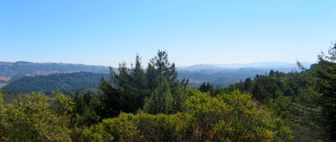
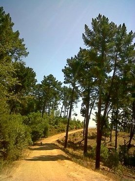
View from West Ridge Trail