Bolinas Ridge (Golden Gate National Recreation Area)
Bolinas Ridge is one of the lesser-known jewels in the Golden Gate National Recreation Area (GGNRA). The trail follows the crest of the Bolinas Ridge from Sir Francis Drake Blvd southward to Bolinas-Fairfax Road. It is an 11-mile trail that can be done as either an 11-mile point-to-point with shuttle, or any out-and-back route of up to 22 miles. The trail is well marked, and offers spectacular views along the way. The trail is mostly fire road or double-track. It starts out from Sir Francis Drake Blvd at about 350 feet elevation, and steadily climbs to about 1700 feet shortly before intersecting with Bolinas-Fairfax Road. For this reason it is better to start the out-and back run from Sir Francis Drake Blvd, so that you have a downhill return.
There is limited roadside parking at either end of the trail. However, because the trail is not very well traveled, you probably won't have a problem finding roadside parking.
There is limited roadside parking at either end of the trail. However, because the trail is not very well traveled, you probably won't have a problem finding roadside parking.
|
The Dirt:
Extras:
|
|
Favorite Run: Bolinas Ridge Out-and-Back (up to 22.2 mi, 2400' elevation gain) 🐾
|
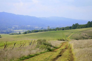
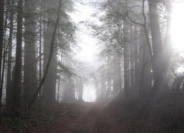
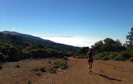
This run starts at the north end of the trail along Sir Francis Drake Blvd. You can turn around at any point along the trail, so you can do as long of a run as you want! If you do the entire out-and-back, it is 22.2 miles with 2400' of elevation gain. The trail is entirely dirt road and double-track trail. The route initially passes through rolling grassy hills, then enters a dense redwood forest. The trees become less dense toward the southern end of the trail and there are great views of the Pacific Ocean.
To begin the run, simply head up the well-marked Bolinas Ridge Trail as it climbs up the ridge. GPX Track Printable Trail Map Driving Directions |
|
|
Route Details:
|
|