Bothe-Napa Valley State Park

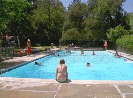
Bothe-Napa Valley State Park is located 5 miles north of St. Helena in the heart of Napa Valley. The park contains about 1,900 acres of forested hills and valleys. Even though the park is located in Napa Valley, it contains a grove of coast redwoods, the farthest inland grove of any state park. During the 1800's, this land belonged to Dr. Charles M. Hitchcock of San Francisco, who built a second home here in 1872. Later, Reinhold Bothe acquired part of the estate and developed a resort, Paradise Park, with cabins and a swimming pool. The resort was popular during the 1930's but this popularity declined after World War II. The state park system purchased Paradise Park from Bothe in 1960. Today, the swimming pool is all that remains of Paradise Park.
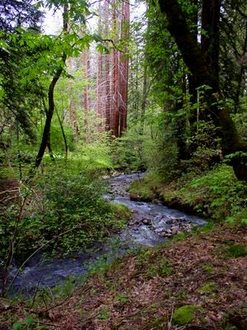
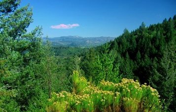
Bothe-Napa State Park offers about 10 miles of trails that are a mix of dirt roads and singletrack. The trails wind along Ritchey Creek and climb up the hills through stands of coastal redwoods as well as forests of Douglas-fir, tanoak, and madrone. The most popular trail in the park is the moderately strenuous Coyote Peak Trail, which climbs about 500' in 1.5 miles to 1,170-foot Coyote Peak. The peak offers scenic vistas of Napa Valley, Mount Saint Helena, and Upper Ritchey Canyon. Even though the trails are mostly shaded, summer temperatures in Napa Valley can easily reach 90 or 100 degrees, so bring lots of water and hike or run early in the summertime!
In addition to hiking trails, Bothe-Napa Valley State Park offers tent and RV camping as well as yurts for rent. The park also offers picnicking, including a large reserved group picnic area that contains picnic tables, a horseshoe pit, a sink, and an electrical outlet. Visitors can also swim in the park's swimming pool, although there is an additional fee to use the pool.
In 2011, Bothe-Napa Valley State Park was on the official closure list due to the California budget crisis. However, the Napa County Parks and Open Space District petitioned the state to operate the park in order to avoid closure. Today, the park is entirely operated by the Napa County Regional Park and Open Space District, and there are no state services or staff available.
|
The Dirt:
Extras:
|
Favorite Run #1: Coyote Peak Loop (4.8 mi, 900' elevation gain)
|
This loop hits most of the trails in the park. The route starts out with a gradual climb alongside Ritchey Creek through redwoods. Next, you climb up to 1,170-foot Coyote Peak for vistas of Napa Valley. This is followed by a 1.5-mile downhill back to your car.
The run starts from the Redwood Trail trailhead, about 0.2-miles past the entrance kiosk. To begin the run, start up the Redwood Trail along Ritchey Creek. GPX Track Printable Trail Map Driving Directions |
|
Route Details:
 View from the Coyote Peak Trail
- 0.0 mi: From the trailhead, start heading up the Redwood Trail. You will gradually start climbing along Ritchey Creek.
- 1.3 mi: After crossing the creek, Redwood Trail ends on Ritchey Creek Trail. Continue straight ahead on the Ritchey Creek Trail.
- 2.0 mi: Turn left onto the Spring Trail.
- 2.3 mi: Turn right onto the South Fork Trail.
- 2.7 mi: Veer right onto the Coyote Peak Trail.
- 3.1 mi: Turn right onto the small trail heading up to Coyote Peak. After visiting the peak, continue on the Coyote Peak Trail in the same direction you were heading. The next 1.5-miles are downhill back to your car!
- 4.0 mi: Coyote Peak Trail ends on the Redwood Trail. Turn right to head back to the parking lot.
- 4.8 mi: Back at your car!
