El Corte de Madera Creek Open Space Preserve

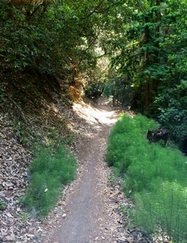
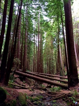
El Corte de Madera Creek Open Space Preserve is located on the ocean side of Skyline Blvd in the hills above Woodside. This 2,817-acre preserve boasts thirty-six miles of multi-use trails through densely wooded evergreen and redwood forests. The preserve is one of the few in the Bay Area that is completely open to bikes. For this reason, El Corte de Madera Creek is extremely popular with mountain bikers, who often refer to this park simply as "Skeggs", since the primary parking area used to be located at Skeggs Point. If you choose to run or hike here, please be careful and keep and eye out for mountain bikers.
Elevations in the preserve range from about 800' on the west end of the park to over 2200' along Skyline Blvd. The trails are a mix of singletrack and fire road which range from moderate to extremely steep. Keep in mind that the trailhead is on Skyline Blvd, which means that you always have a climb at the end of the run. The weather is typically mild year-round although it can get cold and foggy, especially in the winter. The trails are shaded, so this is an excellent summertime destination when the weather is hot.
There are several trailheads along Skyline Blvd. The most popular used to be the Skeggs Point trailhead on Skyline Blvd. However, in 2014 the Open Space District completed a new parking lot and staging area one mile south of Skeggs Point with 65 parking spaces and pit toilets.
There are a lot of trails in El Corte de Madera and it is easy to get turned around, so when visiting the preserve for the first time we recommend bringing a trail map or GPS!
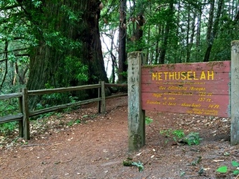 The Methuselah Tree
The Dirt:
Extras:
- Click here for the official web site with trail map.
- Click for directions to Skeggs Point parking or the new parking lot and staging area.
- There are NO DOGS allowed in the preserve.
Extras:
- After exploring the trails, be sure to visit the Methuselah Tree. This 1,800-year-old redwood tree is one of the only remaining original growth redwoods on the entire San Francisco Peninsula. It is located just off of Skyline Blvd about a half-mile south of Skeggs Point.
- There is no drinking water available in the park, so bring your own!
The Crash of British Commonwealth Pacific Airlines Flight 304

The Resolution Trail in El Corte de Madera Creek Open Space Preserve was named for and dedicated to the 19 people who lost their lives in the crash of the "Resolution", a British Commonwealth Pacific Airlines DC-6 on its way from Sydney to San Francisco.
On the evening of October 28, 1953, the Resolution left Sydney on its typical bi-weekly run of the "Southern Cross" route. The route was Sydney - Auckland - Fiji - Hawaii - San Francisco - Vancouver, and was named "Southern Cross" in honor of Sir Charles Kingsford Smith's plane, the first plane to fly cross the Pacific Ocean. The plane carried 11 passengers and 8 crew.
On the morning of October 29th, the Resolution had reached the coastline of California on its way to San Francisco. At 8:39 AM, the Resolution advised air traffic control that they were over Half Moon Bay, 500 feet above the clouds. Approach Control acknowledged the transmission, and cleared the DC-6 for the approach into Mills Field in San Francisco. The only problem, however, was that the Resolution was actually several miles south of their reported position.
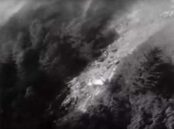 Aerial view of the crash site (from www.check-six.com)
At about 8:42 AM, the flight reported in: "Air Pacific Easy, Roger, southeast, turning inbound". It was the last transmission from the Resolution. Three minutes later, a call from air traffic control to the Resolution went unanswered. Shortly after the loss of radio contact, Coast Guard aircraft were dispatched from San Francisco to search for the plane. At 10:10 AM the Coast Guard aircrew located a single column of smoke rising from the densely-packed redwoods on the southwest side of Kings Mountain, in what is now El Corte de Madera Creek Open Space Preserve. A reporter who was one of the first on the scene described the wreck: "The sight was one of absolute devastation. Nothing moved, only great chunks of twisted, unrecognizable debris lay over the mountainside. The only thing that was left resembling a plane was a buried, torn wing. Apparently more wreckage was buried in the forest which we couldn't see. Nothing was recognizable as a human being."
In 2009, a memorial plaque was erected in memory of the 19 people who lost their lives in the crash. For more information on the history of the Resolution and the crash, check out the following sites:
The Crash of British Commonwealth Pacific Airlines Flight 304 (www.check-six.com)
Flight of the Resolution (http://flightoftheresolution.org)
Favorite Run #1: Stink-Foot (8.8 mi, ~1600' elevation gain)
|
This loop is a great introduction to El Corte de Madera Creek, covering a good part of the northern half of the park. Highlights of this loop include a swooping descent on El Corte de Madera Creek Trail, a picturesque crossing of El Corte de Madera Creek, a visit to the Old Growth Redwood, and a heart-pounding climb back to the car. Thanks to Rob of BayTrailrunners for showing us (and providing the name for) this loop.
The loop starts from the Skeggs Point parking lot along Skyline Blvd. To begin the run, turn right on Skyline Blvd and run north about 500 feet, then turn left into the park entrance. Note that there are a lot of trails in the park and it is easy to get turned around, so we advise bringing a trail map or GPS. GPX Track Printable Trail Map Driving Directions |
|
Route Details:
- 0.0 mi: From Skeggs Point parking, turn right on Skyline Blvd and run about 500 feet north.
- 0.1 mi: Turn left into the trailhead, and get on the El Corte de Madera Creek Trail. You will stay on this trail for the next three miles as it descends to El Corte de Madera Creek.
- 3.2 mi: Just after the creek crossing, turn left on North Leaf Trail.
- 4.0 mi: Turn left onto Methuselah Trail. In about a half-mile you will cross El Corte de Madera Creek which flows through a gorgeous redwood grove.
- 5.2 mi: Turn right on Giant Salamander Trail. The climbing really starts now.
- 6.2 mi: Turn left on Timberview Trail. Keep an eye out on your right for the small trail to the Old Growth Redwood. This one tree made it through the logging era while the entire forest was clear cut!
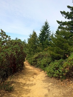
- 6.9 mi: Turn left on Manzanita Trail. This technical trail leaves the redwood forest for a bit and cuts through a small manzanita grove.
- 8.1 mi: Shortly after crossing Methuselah Trail, The Manzanita Trail ends on the Fir Trail. Turn right to head back to Skyline Blvd.
- 8.7 mi: Back at Skyline Blvd. Turn right to head back to Skeggs Point parking.
- 8.8 mi: Back at your car!
Favorite Run #2: Oljon + Friends (8.3 mi, ~1700' elevation gain)
|
A thorough description and pictures are on the way! GPX Track Route Map (Strava) (Google) Driving Directions |
|
- 0.0 mi: From the back of the parking lot (just near the bathrooms), start on the Sierra Morena Trail
- 0.3 mi: Take a hard left onto the Oljon Trail. You'll follow this wonderful singletrack for approximately 1.7 miles.
- 0.7 mi: Continue on the Oljon Trail (ignore the option to take a right onto the Steam Donkey Trail)
- 2.0 mi: Take a left, then a quick right to continue descending on the Lawrence Creek Trail (a couple of small turns, so continue to follow Lawrence Creek all the way down)
- 4.3 mi: At the intersection with Virginia Mill Trail, take a hard right to continue on Lawrence Creek Trail another 0.6 miles
- 4.9 mi: You'll reach a 'T', with Timberview Trail to your left, and Gordon Mill Trail to your right. Take the left to start climbing on Timberview Trail.
- 5.7 mi: You'll reach another intersection, continue on Timberview Trail (to your right). Giant Salamander Trail is straight ahead.
- 5.9 mi: Another intersection! Take the slight right to join Crosscut Trail.
- 6.3 mi: Hairpin turn to your right, on Crossover Trail, you'll wind down and then join Gordon Mill Trail for another stretch of climbing ;).
- 6.7 mi: Continue straight to join Gordon Mill Trail and begin climbing again.
- 7.4 mi: You reach a fork, continue to your slight left on Gordon Mill Trail.
- 8.0 mi: 5-way intersection.... continue straight (relatively), to retrace your steps on Sierra Morena Trail.
- 8.3 mi: Back at your car!
