Mount Diablo State Park
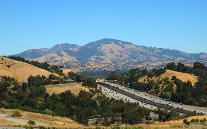
Mount Diablo is one of the San Francisco Bay Area's most distinctive landmarks. At 3,849 feet, it's also one of the tallest peaks in the Bay Area, and the second highest summit that you can drive to (Mount Hamilton is the highest drive-up summit). Mount Diablo State Park consists of approximately 20,000 acres of protected lands around the mountain. However, If you include all of the parks and open spaces surrounding Mount Diablo, the total is more than 100,000 acres. This means that you can hike or run for dozens of miles without stepping foot on a paved road!
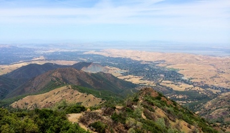
The trails in Mount Diablo State Park and the surrounding open spaces are mostly fire roads, with some sections of narrow, rocky singletrack thrown in. While some trails pass through forested areas, the trails primarily pass through rolling grassy hills. The elevations in the park range from around 300' to 3,849' at the summit, and the climbing ranges from moderate to very steep. However, the steep climbs are definitely worth the effort, as a trip to the summit rewards you with a spectacular view that extends more than 100 miles in every direction on a clear day.
The weather in Mount Diablo State Park can vary widely at all times of the year. In the winter, the weather can quickly change from mild to very cold and windy. In fact, the peak typically sees snowfall once or twice each winter. In the summer, the exposed trails can be extremely hot and temperatures often climb to the 90's. For this reason, we recommend that you bring extra layers in the winter and extra water in the summer. The only drinking water available in the park is at the summit and at several campsites along South Gate and Summit Roads (Rock City, Junction, and Juniper). Check with the ranger station for current status of drinking water, as the water may be turned off during periods of drought.
There are numerous trailheads to access the Mount Diablo trails. The trailheads on the south and west sides of the park are closer to Walnut Creek and are sometimes crowded. For this reason, we prefer to drive a bit farther and start and the trailheads on the north and east sides of the park, near Clayton or Morgan Territory Regional Preserve.
The Dirt:
Extras:
The trails in Mount Diablo State Park and the surrounding open spaces are mostly fire roads, with some sections of narrow, rocky singletrack thrown in. While some trails pass through forested areas, the trails primarily pass through rolling grassy hills. The elevations in the park range from around 300' to 3,849' at the summit, and the climbing ranges from moderate to very steep. However, the steep climbs are definitely worth the effort, as a trip to the summit rewards you with a spectacular view that extends more than 100 miles in every direction on a clear day.
The weather in Mount Diablo State Park can vary widely at all times of the year. In the winter, the weather can quickly change from mild to very cold and windy. In fact, the peak typically sees snowfall once or twice each winter. In the summer, the exposed trails can be extremely hot and temperatures often climb to the 90's. For this reason, we recommend that you bring extra layers in the winter and extra water in the summer. The only drinking water available in the park is at the summit and at several campsites along South Gate and Summit Roads (Rock City, Junction, and Juniper). Check with the ranger station for current status of drinking water, as the water may be turned off during periods of drought.
There are numerous trailheads to access the Mount Diablo trails. The trailheads on the south and west sides of the park are closer to Walnut Creek and are sometimes crowded. For this reason, we prefer to drive a bit farther and start and the trailheads on the north and east sides of the park, near Clayton or Morgan Territory Regional Preserve.
The Dirt:
- Click here to download a printable trail map of the Favorite Runs below! Note that this trail map is not very detailed and is to be used for reference only. We recommend that you purchase the excellent map from Save Mount Diablo or download the GPX track of the route to your GPS device!
- You can purchase the Save Mount Diablo trail map directly from Amazon through the Trailstompers Store!
- Click here for the Mount Diablo State Park site with a link to the park brochure.
- Click here for driving directions to the Regency Drive trailhead in Clayton. Drive to the end of Regency Drive and parallel park where the trail starts.
- Sections of Mount Diablo are loaded with poison oak. Click here to learn about preventing and treating poison oak rashes.
- Dogs are NOT allowed on trails in Mount Diablo State Park.
Extras:
- Save Mount Diablo is a non-profit organization whose mission is to preserve Mount Diablo's peaks, surrounding foothills and watersheds through land acquisition and preservation strategies. They also host very cool guided hikes, bike races, and trail running races, including the awesome and butt-kicking Diablo Trails Challenge 50k!
Interesting Facts about Mount Diablo
The "Devil Mountain"
According to the most widely accepted story, the reference to "diablo" or "devil" can be traced back to 1804 or 1805 when a Spanish military expedition visited the area in search of runaway mission Indians. At a willow thicket near present-day Buchanan Field, the soldiers encountered a Village of Chupcan people and surrounded it. But night came, and evidently all the Indians escaped unseen. Angry and confused, the Spanish called the site "Monte del Diablo," or "Thicket of the Devil". Later, English-speaking newcomers mistakenly assumed the word "monte" to mean "mountain" and applied the title to this prominent East Bay peak. A linguistic accident thus gave California its "Devil Mountain."
According to the most widely accepted story, the reference to "diablo" or "devil" can be traced back to 1804 or 1805 when a Spanish military expedition visited the area in search of runaway mission Indians. At a willow thicket near present-day Buchanan Field, the soldiers encountered a Village of Chupcan people and surrounded it. But night came, and evidently all the Indians escaped unseen. Angry and confused, the Spanish called the site "Monte del Diablo," or "Thicket of the Devil". Later, English-speaking newcomers mistakenly assumed the word "monte" to mean "mountain" and applied the title to this prominent East Bay peak. A linguistic accident thus gave California its "Devil Mountain."
|
The "Mount Diablo Meridian"
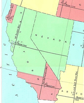
Just after the Gold Rush, federal land surveyors began the momentous task of surveying out the lands of the Wild West. To do this, reference points were chosen and lands were surveyed with respect to those "initial points" as they are called. Lines called "meridians" (north-south lines) and "base lines" (east-west lines) were extended out from the initial points. Because of the tremendous distances from which Mount Diablo was visible, in 1851 it was selected to be the initial point for the federal land surveys for northern California and Nevada. Ignoring the excitement of the Gold Rush, Leander Ransom and his men erected a flagpole at the summit of Mount Diablo and began to extend the base and meridian lines that are used to this day in our official land surveys. As a matter of fact, Mount Diablo base and meridian lines are referred to in legal descriptions of real estate throughout two-thirds of California and parts of Nevada and Oregon! |
Favorite Run #1: North Peak Loop (10.8 mi, ~3000' elevation gain)
|
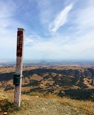
If you want to get all of the stunning Mount Diablo views without battling the Mount Diablo crowds, the trip up to North Peak is just for you! The north side of Mount Diablo sees considerably fewer hikers than the west and south sides. The North Peak is about 300' lower than the Summit, but still offers amazing 360-degree views. This route actually hits two peaks: 2,946' Mt. Olympia, and 3,557' North Peak. In addition, this route includes some excellent singletrack trails, a rarity in Mount Diablo State Park.
This run starts at the Regency Drive trailhead in Clayton. Begin the run by heading up Donner Canyon Road toward Mount Diablo. GPX Track Printable Trail Map Driving Directions |
|
Route Details:
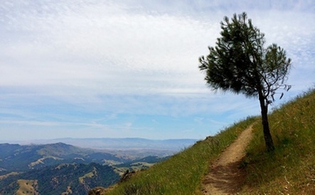
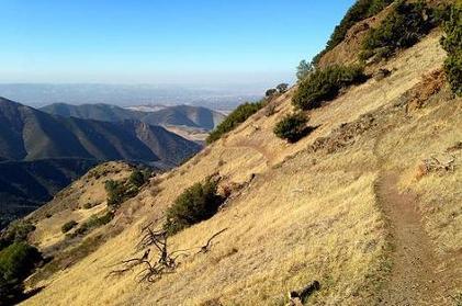 A stunning section of the North Peak Trail
- 0.0 mi: From the end of Regency Drive, head down the steep embankment and then start heading up Donner Canyon Road toward Mount Diablo.
- 1.5 mi: Turn left onto Cardinet Oaks Road and begin to climb more aggressively up a few large switchbacks. The views are starting!
- 2.2 mi: Turn right on the narrow Olympia Trail. This trail takes you up some steep switchbacks.
- 3.0 mi: Olympia Trail ends on Mt. Olympia Road. Turn right and follow Mt. Olympia Road up to Zippe Trail.
- 3.7 mi: Turn left onto the narrow Zippe Trail heading toward East Trail.
- 4.0 mi: Zippe Trail ends on East Trail. Turn right and climb steeply up to Mt. Olympia.
- 4.3 mi: At the 2,946' Mt. Olympia Summit. Take in the great views and then turn around and get on the narrow North Peak trail. You will briefly descend, and then start climbing gradually.
- 5.1 mi: North Peak Trail ends on North Peak Road. Turn left and climb up the very steep road to the summit.
- 5.4 mi: At 3,557' North Peak Summit! Enjoy the view, and then head back down North Peak Road. This time, continue on North Peak Road down to Prospectors Gap (do not head back down North Peak Trail).
- 6.2 mi: At Prospectors Gap. Continue onto the narrow singletrack Bald Ridge Trail. Be careful, as this trail is steep and rocky in places.
- 7.5 mi: Bald Ridge Trail ends on Meridian Ridge Road. Turn right and follow Meridian Ridge Road all of the way back down to Donner Canyon Road.
- 7.8 mi: Pass Prospectors Gap Road on your right. Continue on Meridian Ridge Road.
- 9.2 mi: Veer left onto Donner Canyon Road and head back to your car.
- 10.8 mi: Back at your car!
Favorite Run #2: Four Peaks Loop (16.0 mi, ~4600' elevation gain)
|
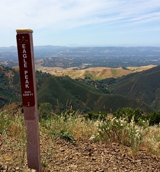
This giant loop is a mountain goat's dream! This route takes you up four different peaks in Mount Diablo State Park: Mount Olympia (2,946'), North Peak (3,557'), Mount Diablo Summit (3,849'), and Eagle Peak (2,369'). This is a very difficult route that is extremely steep in places. The best time of the year to do this run is in the early spring when the wildflowers are blooming and the temperatures are still mild. There is very little shade on this route, which means that there are excellent vistas, but also that the route is very hot in the summer!
This run starts at the Regency Drive trailhead in Clayton (see "The Dirt" above). Begin the run by heading up Donner Canyon Road toward Mount Diablo. GPX Track Printable Trail Map Driving Directions |
|
Route Details:
|

