Pulgas Ridge Open Space Preserve
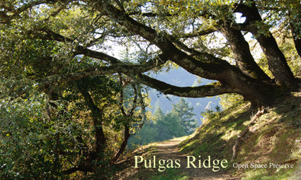
Pulgas Ridge Open Space Preserve is a little gem located just off of I-280 near Edgewood Road. Even though there are only about 6 miles of trails in the park, there are some great climbs and descents with amazing peninsula views thrown in. The trails are mainly singletrack with a few paved road sections. The weather is usually quite mild, as is the case with most parks located on the peninsula. The park is also dog friendly. Dogs are allowed on all trails and there is even a 17-acre off-leash area.
The land that is now Pulgas Ridge Open Space Preserve was once the site of a tuberculosis sanatorium which was built by the City of San Francisco in 1927. Originally called San Francisco Health Farm, the hospital was renamed Hassler Health Farm in 1931. Several buildings were added to the campus in the early 1940's as part of a Works Progress Administration (WPA) project. The sanatorium was closed in 1964 and converted to a hospital for the indigent. The hospital closed in 1972, and the vacant buildings were finally torn down in 1983.
If you are feeling particularly energetic, you can combine Pulgas Ridge and Edgewood County Park to the south. To run from Pulgas Ridge to Edgewood Park, head back out to Edgewood Road. Turn left and run along the side of the road for a few hundred feet and you will see Edgewood County Park on your right. Be careful crossing the road as the cars go very fast here!
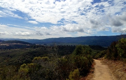 Dusky-footed Woodrat Trail
The Dirt:
- Click here to download a printable trail map the Favorite Run below!
- Click here for the official park site with trail maps.
- Click here for directions to the park via Google Maps.
- Dogs on leash are allowed on ALL TRAILS in the preserve. In addition, Pulgas Ridge offers a 17.5-acre off-leash area!
Extras:
- There is NO drinking water available in the park.
Favorite Run: Pulgas Figure-8 (5.3 mi, ~900 feet elevation gain) 🐾
|
This run is the grand tour of the park, hitting every bit of singletrack the park has to offer. This run includes amazing ridge views and a great butt-kickin' climb up the Dusky-footed Woodrat Trail. Click here if you are wondering what a "dusky-footed woodrat" is...
Begin the run by heading up the Blue Oak Trail, which starts behind the bathroom at the main parking area on Edmonds Road. GPX Track Printable Trail Map Driving Directions |
|
Route Details:
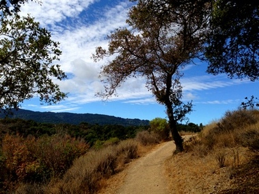 Beautiful singletrack on Dick Bishop Trail
- 0.0 mi: Start up the Blue Oak Trail, which begins behind the bathroom.
- 0.4 mi: Just before the road, turn left onto the Dick Bishop Trail (singletrack) and continue climbing.
- 1.1 mi: Cross the paved road and continue onto the Polly Geraci Trail. Begin a mile descent.
- 2.0 mi: Take a sharp left turn onto the Dusky-footed Woodrat Trail. There is about a mile of hard climbing, but you will be rewarded with great views from the ridge.
- 4.2 mi: The singletrack ends. Veer left onto the Hassler Trail, which will soon turn to pavement Follow the paved road for about a half-mile.
- 4.9 mi: Turn right through the gate to get onto Blue Oak Trail toward the main parking area.
- 5.3 mi: Back at your car!