Rancho San Antonio County Park and Open Space Preserve
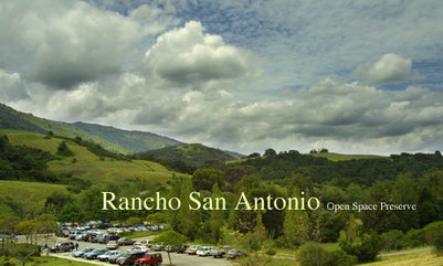
Although it seems like one park, Rancho San Antonio is actually two parks: the 165-acre County Park and the adjoining 3,988-acre Open Space Preserve. The combined Rancho San Antonio, known to locals simply as "Rancho", is one of the most accessible trail running parks in the Bay Area due to its well-maintained and well-marked trails and its close proximity to I-280 and I-85. Rancho is a great place for a beginner or advanced trail runner to experience the joy of trail running. There are many trails in the park so you can create anything from a short run to an epic 15+ mile loop to Black Mountain. Rancho also connects to Monte Bello Open Space Preserve via the Black Mountain Trail so you can do even longer multi-park runs. Elevations in the park range from about 400' at the entrance to over 2800' at Black Mountain, and the climbs range from moderate to difficult.
There are a few different trailheads at Rancho. The main parking area and trailhead is off of Cristo Rey Drive in Cupertino. There are bathrooms and drinking fountains at the main entrance. In addition, there is "back entrance" with a smaller parking area and trailhead off Rhus Ridge Road in Los Altos Hills. There is only parking for about 10 cars here, and no bathrooms or water. This trailhead provides the most direct access to the Black Mountain Trail; however, be prepared for 600 feet of climbing in the first mile!
All of the Favorite Runs on this page start at the main parking area near the bathrooms. After driving through the main park entrance, stay to your right and follow the twisty road all of the way to where it ends in the main parking lot. You will know you are there when you see the bathrooms.
In addition to great trails, Rancho San Antonio is also the home to Deer Hollow Farm, a real working farm with cows, pigs, goats, sheep, chickens, other animals, and an organic garden as well as numerous turn-of-the-century ranch buildings. An additional attraction is the restored Grant Cabin, furnished to represent living conditions in the late 1800s. The farm offers tours, classes, special events, and camps for children. Please refer to the Deer Hollow Farm page for more info.
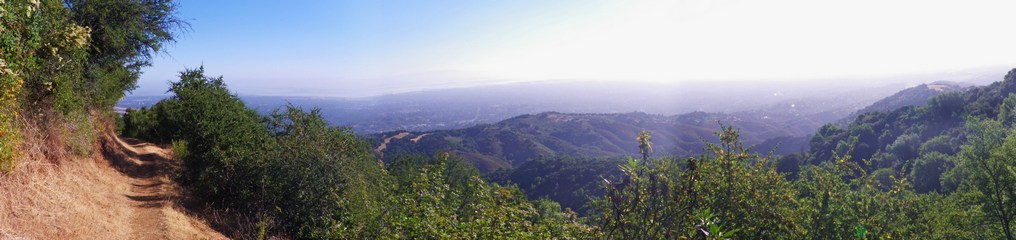
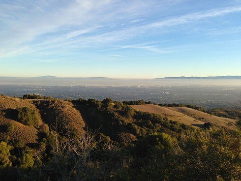
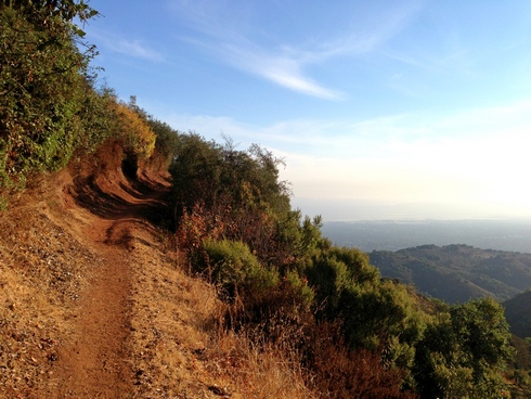
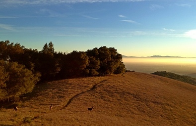 Early morning view from Upper High Meadow Trail
The Dirt:
- Download printable trail maps of Favorite Runs 1&2 or Favorite Runs 3&4!
- Click here for the official park site with trail maps.
- Click here for directions to the park via Google Maps.
- There are NO DOGS allowed in the park or preserve.
- Stevens Creek Software has a neat distance/elevation calculator specifically for Rancho.
- Drinking water is available in the main (paved) parking lot by the bathrooms, and at the farm.
- Deer Hollow Farm is a real working farm that offers many activities for the whole family.
Favorite Run #1: Intro Loop (2.9 mi, ~300 feet elevation gain)
|
This is a nice introduction to the park, with a bit of climbing thrown in. This run takes you in past Deer Hollow Farm and then back along the Coyote Trail for a mild climb along sweet singletrack.
Start this run by heading across the wooden bridge at the northwest corner of the north parking lot (the bridge by the stretching bars). GPX Track Printable Trail Map Driving Directions |
|
Route Details:
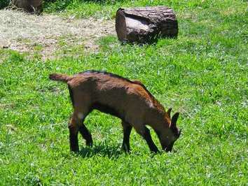 Springtime = baby goats at the farm!
- 0.0 mi: Cross the bridge and turn right onto the Permanente Creek Trail.
- 0.3 mi: Turn left onto the Lower Meadow Trail, and continue to Deer Hollow Farm.
- 1.1 mi: Just past the farm, continue past the drinking fountain and through the gate by the bike rack. Then veer left by the bathrooms to get on the Wildcat Loop Trail.
- 1.4 mi: Just before the wooden fence, make a sharp 180 degree left turn onto the Coyote Trail (singletrack). You will pass two trails on your left as you climb on the Coyote Trail, but always stay right.
- 2.2 mi: Coyote Trail ends at PG&E Trail (fire road). Turn right and head downhill on the PG&E Trail.
- 2.7 mi: At the bottom of the steep hill, turn left to head back to the main parking area
- 2.9 mi: Back at your car!
Favorite Run #2: "Morning" Loop (7.6 mi, ~1000 feet elevation gain)
|
This run is a standard "before-work" loop in the park. This run gives you a nice warm-up before a great one-mile climb up Upper Rogue Valley Trail. After a little more climbing you get a beautiful singletrack descent through Upper Wildcat Canyon and another shorter climb up Coyote Trail before descending back to your car.
Start this run by heading across the wooden bridge at the northwest corner of the north parking lot (the bridge by the stretching bars). GPX Track Printable Trail Map Driving Directions |
|
Route Details:
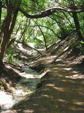 Upper Wildcat Canyon Trail
- 0.0 mi: Cross the bridge and turn right onto the Permanente Creek Trail.
- 0.3 mi: Turn left onto the Lower Meadow Trail, and continue to Deer Hollow Farm.
- 1.1 mi: Just past the farm, continue past the drinking fountain and through the gate by the bike rack. Then continue straight ahead onto the Rogue Valley Trail.
- 1.5 mi: Pass the Wildcat Loop Trail on your left (another great trail!)
- 2.3 mi: After a brief climb you'll pass a lake on your right (the lake is dry in the summer). After another half-mile the trail will make a 180 degree left turn and really start climbing!
- 3.8 mi: Top of the climb! Turn right onto the High Meadow Trail (fire road).
- 4.1 mi: Veer left onto the Upper Wildcat Canyon Trail. Continue all of the way down the canyon until you exit through a gate in a wooden fence.
- 6.1 mi: Just past the fence, veer right onto the Coyote Trail (singletrack). You will pass two trails on your left as you climb on the Coyote Trail, but always stay right.
- 6.9 mi: Coyote Trail ends at PG&E Trail (fire road). Turn right and head downhill on the PG&E trail.
- 7.4 mi: At the bottom of the steep hill, turn left to head back to the main parking area
- 7.6 mi: Back at your car!
Favorite Run #3: Power Poles (8.4 mi, ~1700 feet elevation gain)
|
The "Power Poles" trail (officially called the PG&E Trail) is a fire road that was built by PG&E up the steep walls of the canyon to run power lines all of the way up to Skyline Blvd. The trail is pretty steep in places but gives you a great workout when you want to get the maximum workout in the minimum time! The route as described here is an out-and-back, but you can make it into a loop by climbing PG&E Trail and then taking High Meadow Trail back down from the top of PG&E.
Start this run by heading across the wooden bridge at the northwest corner of the north parking lot (the bridge by the stretching bars). GPX Track Printable Trail Map Driving Directions |
|
Route Details:
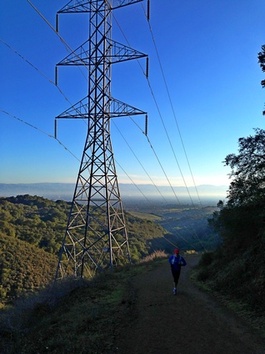 A runner heading up PG&E in the morning
- 0.0 mi: Cross the bridge and turn left onto the Meadow Trail. You will cross a paved road, then continue on the dirt trail.
- 0.2 mi: When you can't go any farther, turn right onto the Coyote/PG&E Trail (fire road) and start climbing. The climb is initially very steep, then flattens out.
- 0.7 mi: At the 4-way intersection, make a hard left turn and continue climbing up the PG&E Trail (fire road). This fire road is steep in sections.
- 1.7 mi: The first high point! YAY! Get ready for a half-mile descent.
- 2.3 mi: The low point. Boo. Start really climbing now... You will climb for the next 2 miles to the high point.
- 4.2 mi: PG&E trail ends when it intersects the Upper High Meadow Trail at an elevation of about 1600 feet. Continuing farther would take you onto the Quarry Trail (see Favorite Run #4 below). After catching your breath, turn around and retrace your steps back to the parking lot.
- 8.4 mi: Back at your car!
Favorite Run #4: Quarry Trail Figure-8 (13.3 mi, ~2200 feet elevation gain)
|
This is a great loop that covers most of Rancho San Antonio Open Space Preserve. This run starts out with a gentle climb past the farm, and the climb then gets progressively steeper as you go. The last mile or so on the Quarry Trail has some extremely steep sections. However, you are rewarded with some spectacular views from the Quarry Trail followed by a 6-mile decent on the awesome singletrack Black Mountain Trail and Chamise Trail.
Start this run by heading across the wooden bridge at the northwest corner of the north parking lot (the bridge by the stretching bars). GPX Track Printable Trail Map Driving Directions |
|
Route Details:
|
The view from the top of PG&E (mile 4.6)
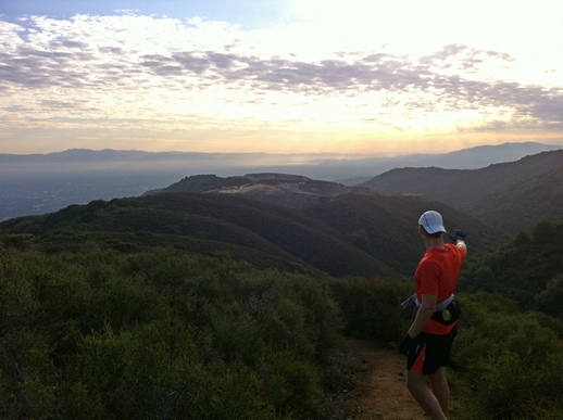
Near the top of the Quarry Trail (mile 5.7)
The Black Mountain Trail (mile 7)
|