Skyline-to-the-Sea Trail (25.4 mi, ~2600 feet elevation gain)
|
The Skyline-to-the-Sea Trail is the ultimate point-to-point trail run or hike in the South Bay. The trail runs from Saratoga Gap all of the way to Rancho del Oso along Hwy 1, a distance of almost 25 miles. Even though the trail has a net elevation loss of almost 5000 feet, there's still a good deal of climbing as you make your way to the ocean. But, the hard effort is rewarded with stunning views, gorgeous redwood forests, and some of the best singletrack trails in the area. Also, with a short side trip you can visit spectacular Berry Creek Falls. This 65-foot high misty waterfall is one of the most photographed waterfalls in the Bay Area.
Even though this is a long route, it can be done self-supported as there are two campgrounds with drinking water along the way. The Waterman Gap camp is at mile 6, and the Big Basin headquarters camp is at mile 15. The distance between water stops is up to 10 miles, so we recommend carrying at least two water bottles or a hydration pack with you. If you want to do this route as a multi-day run or hike, you can reserve spots at the camps. (Note that the campgrounds are closed in the winter.) Please keep in mind that there is no overnight parking at the Saratoga Gap parking lot! |
|
|
Since the Skyline-to-the-Sea trail is a point-to-point route, you have to either arrange a shuttle from Waddell Beach (about 20 miles north of Santa Cruz along Hwy 1), or time your arrival at Waddell Beach so that you can take the bus back to downtown Santa Cruz. The Santa Cruz Metro route 40 will pick you up at Waddell Beach and take you back to Santa Cruz.
The Dirt:
Extras:
Route Details:
In general, the route is easy to follow, since you just stay on Skyline-to-the-Sea Trail the entire time. Even so, there are a few tricky trail junctions along the way where you can take a wrong turn if you are not paying attention! In particular, from mile 2 to mile 6 the trail crosses several other trails and dirt roads, so pay attention to the trail signs!
|
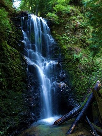
Berry Creek Falls
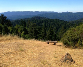
Views from the Skyline-to-the-Sea Trail
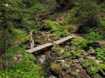
Skyline-to-the-Sea Trail crossing Waddell Creek
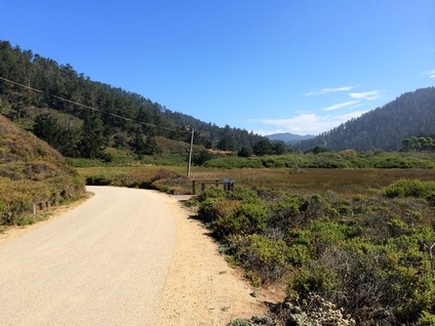
The end of the trail at Wadell Beach
|