Sunol Regional Wilderness
The 6,859 acre Sunol Regional Wilderness is situated in the hills above the Sunol Valley east of Fremont. This spectacular wilderness area contains dozens of miles of trails and offers camping, picnicking, hiking, backpacking, and equestrian trail rides. In addition, the park adjoins the 9,737-acre Ohlone Regional Wilderness which boasts trails through some of the most remote and beautiful areas in the East Bay including 3,817' Rose Peak. Long single-day or overnight multi-day trips are possible along the 28-mile Ohlone Wilderness Trail, which connects Mission Peak in Fremont to Del Valle Regional Park in Livermore. Even though these wilderness areas are only miles away from the population centers of the East Bay, they are surprisingly remote, rugged, and beautiful.
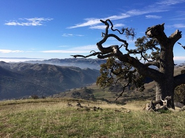
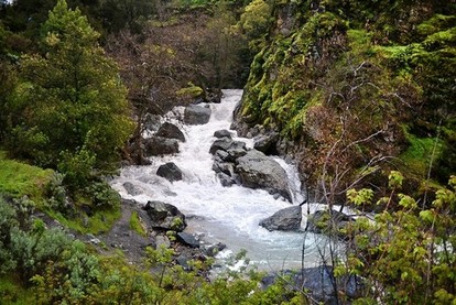
The trails in Sunol Regional Wilderness are a mix of dirt roads and singletrack trails. Elevations in the wilderness range from about 400' along Alameda Creek to over 2200' at the northwest side of the park. Heading east into Ohlone Regional Wilderness, the elevation continues to increase up to 3,817' Rose Peak. The trails are challenging and the climbs range from moderate to very steep. The landscape is dramatic, with steep grassy hills and interesting rock formations rising up from the Alameda Creek Canyon. One of the interesting features of the Sunol Regional Wilderness is a section of rocky gorge along Alameda Creek which has earned the nickname "Little Yosemite."
For the past century this land was used almost exclusively as ranch land. Today, under the East Bay Regional Park District's multi-use land management policy, cattle continue to graze in the wilderness. Therefore, you will almost certainly come across herds of cattle when hiking in the park. If you are nervous, the East Bay Regional Park District has put together Safety Tips for Hiking Near Grazing Animals. Although the cows are big and scary looking, they are typically less dangerous than the huge piles of cow poo they leave behind.
There are a few trailheads to access Sunol Regional Wilderness. The main parking lot and trailhead is off Geary Road just past the Visitor Center. All of the runs on this page start from this trailhead. Note that there is a fee to park at the Visitor Center.
The Dirt:
- For printable trail maps, refer to each Favorite Run below!
- Click here for the official park website with link to trail map.
- Click here for driving directions to the main trailhead near the Visitor Center.
- There is a parking fee to enter the park, although often there is no one in the kiosk to collect your money!
- Dogs are allowed, and may be off-leash away from trailheads, parking lots, and areas marked as on-leash only. Refer to the East Bay Regional Park page on Dogs for more information.
|
Extras:
|
The Little Yosemite Area
|
Favorite Run #1: Cave Rocks/Little Yosemite Loop (7.4 mi, 1400' elevation gain) 🐾
|
This loop takes you on a tour of the southeastern side of the Sunol Regional Wilderness. The first few miles follow the Indian Joe Creek Trail as you climb up to Cave Rocks, an area that is popular with rock climbers. The route then descends to the Ohlone Wilderness Trail and the Sunol Backpack Camp. Finally, you descend to Alameda Creek and return along the Camp Ohlone Road through the Little Yosemite Area. Although the loop is only 7.4 miles long, it has some tough climbs and most of the elevation gain occurs over a short 2-mile stretch!
To begin this run, cross over Alameda Creek on the footbridge near the Visitor Center and turn right on the Canyon View Trail toward Indian Joe Creek Trail. GPX Track Printable Trail Map Driving Directions |
|
Route Details:
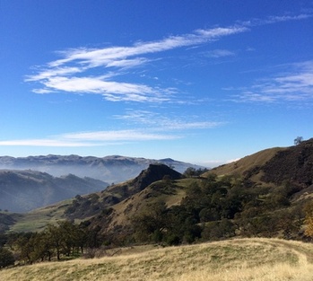
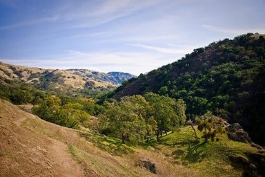 View from McCorkle Trail
- 0.0 mi: From the Visitor Center, cross the foot bridge over Alameda Creek, and turn right onto Canyon View Trail (following the Ohlone Wilderness Trail).
- 0.4 mi: Turn left on Indian Joe Creek Trail (not Indian Joe Nature Trail). This is a challenging singletrack climb up to Cave Rocks.
- 1.5 mi: Pass Cave Rocks area. Keep climbing!
- 1.7 mi: Indian Joe Creek Trail ends on Cave Rocks Road. Turn right and continue climbing for another mile.
- 2.7 mi: Cave Rocks Road ends at Cerro Este Road. At 1700' this is the high point of the run! Turn right on Cerro Este Road and start descending.
- 3.1 mi: Veer left onto the singletrack McCorkle Trail (also the Ohlone Wilderness Trail). The next mile is great rolling singletrack. Continue on McCorkle Trail to the Sunol Backpack Camp.
- 4.4 mi: Just before the Backpack Camp, turn right onto Backpack Road and descend steeply to Alameda Creek.
- 5.0 mi: Backpack Road ends on Camp Ohlone Road. This is a well-maintained dirt road the follows Alameda Creek. You will take this road all of the way back to the Visitor Center and your car.
- 6.0 mi: Pass through the Little Yosemite Area.
- 7.0 mi: The dirt road comes out onto the paved park road. Veer left and run through the small paved parking area, then veer right onto the dirt path. This path will eventually lead back to the paved road and your car.
- 7.4 mi: Back at the Visitor Center and your car!
Favorite Run #2: Rose Peak Climb (18.4 mi, ~4000' elevation gain) 🐾
|
At 3,817', Rose Peak is the tallest publicly accessible peak in Alameda County. Although lesser known, Rose Peak is only 31 feet lower than Mount Diablo. The peak is accessible only by foot, starting from either Sunol Regional Wilderness or Del Valle Regional Park in Livermore. The trip can be done as an out-and-back from Sunol or Del Valle, or a one-way from Sunol to Del Valle. Whichever route you choose, reaching Rose Peak requires a challenging 18+ mile trip with over 4000' of elevation gain.
This is a beautiful but challenging route, with little shade and a lot of elevation gain. At certain times of the year there is water available at Maggie's Half Acre camp behind Rose Peak; however, be sure to check the park website to confirm the status before you go. The water is not treated, so the EBRPD recommends that you filter the water! The climb to Rose Peak is best attempted in the late fall, winter, or early spring before the weather gets scalding hot! Late February, March, and early April are particularly good months for this route since the weather is often cool and the wildflowers are in bloom. |
|
One small caveat with the route as described here. To make a more interesting partial loop, this route incorporates a section of Camp Ohlone Road that is marked as "No Access Beyond Gate Without Reservations" and requires you to climb over a locked gate. If jumping over locked gates makes you feel squeamish, you can do this route as a pure out-and-back along the Ohlone Wilderness Trail, which adds about 0.8 miles and 500' of climbing. Also note that permits are required for hiking the Ohlone Wilderness Trail. Check out the park website for more details.
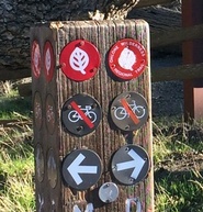
The entire route to Rose Peak follows the Ohlone Wilderness Trail, which is well-marked and easy to follow. The trail is indicated by round leaf symbols as shown to the left. The Ohlone Wilderness Trail is actually a continuous route made up of different trails, so trails will often have other names in addition to "Ohlone Wilderness Trail." Most trail marker posts also have numbers on them. These numbers are labeled on the trail map, making it easy to identify your location.
To begin this run, cross over Alameda Creek on the footbridge near the Visitor Center and turn right on the Canyon View Trail. GPX Track Printable Trail Map Driving Directions |
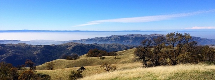
View of Goat Rock from Bluff Road (mile 13)
|
Route Details:
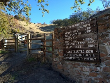 Entering Sunol Backpack Camp (mile 3.3)
- 0.0 mi: From the Visitor Center, cross the foot bridge over Alameda Creek, and turn right onto Canyon View Trail (following the Ohlone Wilderness Trail). Soon the Canyon View Trail will start climbing steeply. You will follow the Ohlone Wilderness Trail for the next 9.5 miles all of the way to Rose Peak.
- 0.7 mi: (Marker 15) Turn left on McCorkle Trail to continue on the Ohlone Wilderness Trail.
- 1.6 mi: (Marker 17) Turn left on Cerro Este Road to continue on the Ohlone Wilderness Trail.
- 2.0 mi: (Marker 18) Turn right on McCorkle Trail singletrack to continue on the Ohlone Wilderness Trail. Enjoy the next mile, it is one of the few downhill sections on the climb up to Rose Peak!
- 3.3 mi: (Marker 19) Continue through the gate into the Sunol Regional Wilderness. Continue following the Ohlone Wilderness Trail through the camp.
- 3.7 mi: Go through the gate into the SF Water District land.
- 5.2 mi: (Marker 20) Veer left onto the dirt road to continue on the Ohlone Wilderness Trail.
- 5.4 mi: (Marker 21) Veer right onto the singletrack to continue on the Ohlone Wilderness Trail.
- 5.8 mi: (Marker 22) Cross over the dirt road to continue on the Ohlone Wilderness Trail.
- 7.0 mi: (Marker 23) Turn left to continue on the Ohlone Wilderness Trail. Take note of this intersection, as this is where the route splits on the return trip.
- 7.3 mi: (Marker 24) Turn right to continue on the Ohlone Wilderness Trail.
- 7.6 mi: (Marker 25) Turn left to continue on the Ohlone Wilderness Trail. There is a brief but steep downhill, followed by a steep uphill section.
- 9.2 mi: (Marker 27) At this point the peak is in sight! Veer left towards the peak. Soon after, veer right then left up a short but steep trail to the peak.
- 9.7 mi: At 3,817' Rose Peak! Enjoy the view, then retrace your steps back to Marker 23.
- 12.4 mi: (Marker 23) Back at Marker 23 junction. This time, do not turn right. Instead, continue straight ahead on Bluff Road which will descend toward the canyon. The views are spectacular from this old road!
- 13.7 mi: Just past the old abandoned house, turn left to continue downhill.
- 14.0 mi: Just past the man-made lake, head through the gate and turn left to continue downhill.
- 14.6 mi: Road ends on Camp Ohlone Road. Continue straight ahead on Camp Ohlone Road heading back toward Sunol Regional Wilderness. The next 1.2 miles of road is marked "No Access Without Reservations" but we have not had a problem walking along this road yet...
- 15.8 mi: Climb over the locked gate to enter Sunol Regional Wilderness. You will soon pass the "Little Yosemite" area on your left.
- 18.0 mi: Camp Ohlone Road ends in the parking area. Continue straight ahead through the parking area toward the Visitor Center and your car.
- 18.4 mi: Back at your car!
The view from Rose Peak (mile 9.7)