University of California, Santa Cruz

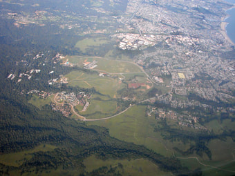
The University of California, Santa Cruz is located just outside the northwest side of Santa Cruz. The 2,000 acre campus was established in 1965 and contains a wide variety of terrain varying from beautiful wooded areas to sprawling meadows. Beginning in the 1850s, the land was owned by the Cowell Lime Works, primarily used to mine limestone. By the 1920s, due to the decline of the lime industry, all the lime kilns had been shut down and the land was sold to the University of California in 1961. Remnants of this campuses rich history can be seen in many parts of the landscape, including multiple quarries and kilns scattered throughout the forest and nearby parks.
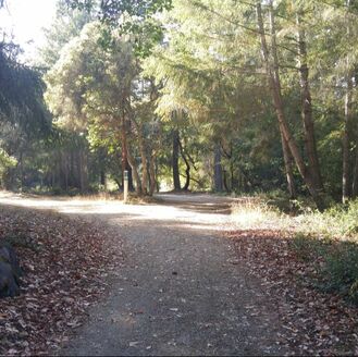
Despite the little documentation on their existence, UCSC hosts a fair amount of trails frequented by hikers, mountain bikers and runners. The northern most part of the campus, deemed 'upper campus' by the students, is by far the most popular part of UCSC for trail runners and mountain bikers. It contains flowing single track and gentle fire roads which connect into adjacent parks including Wilder Ranch State Park, Pogonip, and Henry Cowell State Park.
Parking on campus at UCSC is both a chore for students and visitors alike. Day passes can be purchased but most opt to visit on the weekends when parking restrictions relax. Visit the UCSC Transportation and Parking Services site for up to date information. We would recommend parking at lot 156 or 111A near Crown College, they are free on the weekends and federal holidays.
The Dirt:
Extras:
Despite the little documentation on their existence, UCSC hosts a fair amount of trails frequented by hikers, mountain bikers and runners. The northern most part of the campus, deemed 'upper campus' by the students, is by far the most popular part of UCSC for trail runners and mountain bikers. It contains flowing single track and gentle fire roads which connect into adjacent parks including Wilder Ranch State Park, Pogonip, and Henry Cowell State Park.
Parking on campus at UCSC is both a chore for students and visitors alike. Day passes can be purchased but most opt to visit on the weekends when parking restrictions relax. Visit the UCSC Transportation and Parking Services site for up to date information. We would recommend parking at lot 156 or 111A near Crown College, they are free on the weekends and federal holidays.
The Dirt:
- Printable custom trail map coming soon!!
- Click here for the official park web site with trail map.
- Click here for driving directions to the main parking lot via Google Maps.
- Click here for a parking map at the University of California, Santa Cruz.
- Upper Campus is a hot spot for poison oak. Click here to learn about preventing and treating poison oak rashes.
- There are NO DOGS allowed on campus at UCSC.
Extras:
- There are no water fountains or bathrooms at the trailhead, but if you take a short walk to Crown College you will be able to find them. From parking lot 156, walk down past the fire station and take a slight left onto Crown College Road. Here is a map of Crown College with restrooms marked.
Favorite Run #1: Twin Gates (4.8 mi, ~400 ft elevation gain)
|
This is a classic run in Upper Campus following Chinquapin fire road all the way up to Empire Grade and back. The fire roads are fairly buffed out so you could even do them in your road shoes if you so choose. Watch out for mountain bikers as this is a popular area for them!
While this run is on the shorter end, Chinquapin fire road continues into Wilder Ranch State Park which opens up the possibilities for longer distance runs. To begin the run, start heading east away from the fire station. GPX Track Printable Trail Map(coming soon!) Driving Directions |
Route 3,584,178 - powered by www.wandermap.net |
Route Details:

- 0.0 mi: From the parking lot 156, head east on paved East Road parallel to the array of parking lots.
- 0.1 mi: The paved road turns into the dirt Fuel Break Road and the trails begin! Descend for a second and follow the hairpin turn up the fire road. This is where the climbing begins!
- 0.2 mi: Go around the large locked gate and continue upward.
- 0.4 mi: Turn right onto Chinquapin Fire Road at the four way intersection. Follow this until Empire Grade.
- 1.2 mi: Continue straight at the four way intersection to continue on Chinquapin.
- 2.1 mi: Chinquapin leaves the wooded part of Upper Campus and travels straight across the meadow. Almost there!
- 2.3 mi: You have reached Twin Gates. Turn around and head back through the meadow.
- 3.5 mi: Continue straight to stay on Chinquapin Road.
- 4.4 mi: Turn left onto Fuel Break Road at the four way intersection.
- 4.5 mi: Go around the locked gate and continue downard.
- 4.6 mi: Continue on Fuel Break Road, veering right around the hair pin turn. The fire road soon turns back into pavement.
- 4.7 mi: Back at your car!