Wilder Ranch State Park
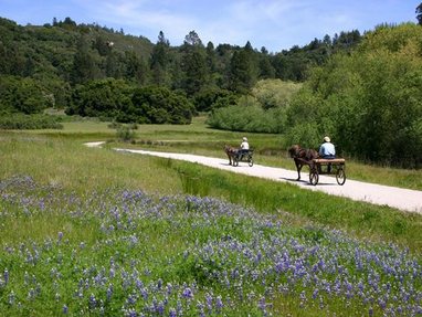
Wilder Ranch State Park is located off of Highway 1 just a few miles north of Santa Cruz. The 7,000 acre park was formerly a dairy ranch, owned and operated by the Wilder family from 1871 to 1969. In 1974, California State Parks acquired the property to preserve the land’s natural environment and cultural history. Since then, many of the old ranch buildings have been restored for use as a museum. The long trails and ocean views at Wilder Ranch make the area a favorite of hikers, equestrians and mountain bikers.
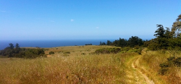
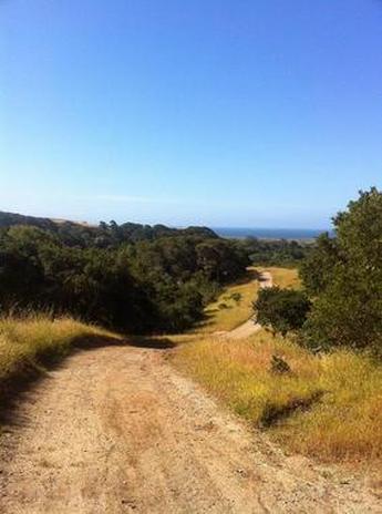
Wilder Ranch State Park offers over 30 miles of trails that wind through the coastal hills. The trails in the park are primarily fire roads, with a few singletrack trails. The park lands vary from exposed grassy hillsides to wooded gulches, with some nice redwood groves. The elevation in the park rises from about 100' along Highway 1 to about 1000' at the north end of the park. The gentle slopes mean that most of the climbing is done very gradually has you venture away from the ocean.
There is a rather hefty parking fee to park at the main parking lot off of Highway 1 ($10 as of 2013) so don't forget some cash. To avoid the fee, people park along the side of Hwy 1 near the park entrance. However, we have noticed a lot of broken window glass on the ground here. We typically just pay the $10 to park in the safer parking lot.
The Dirt:
Extras:
Wilder Ranch State Park offers over 30 miles of trails that wind through the coastal hills. The trails in the park are primarily fire roads, with a few singletrack trails. The park lands vary from exposed grassy hillsides to wooded gulches, with some nice redwood groves. The elevation in the park rises from about 100' along Highway 1 to about 1000' at the north end of the park. The gentle slopes mean that most of the climbing is done very gradually has you venture away from the ocean.
There is a rather hefty parking fee to park at the main parking lot off of Highway 1 ($10 as of 2013) so don't forget some cash. To avoid the fee, people park along the side of Hwy 1 near the park entrance. However, we have noticed a lot of broken window glass on the ground here. We typically just pay the $10 to park in the safer parking lot.
The Dirt:
- Click here for a printable trail map of the Favorite Runs below!
- Click here for the official park web site with trail map.
- Click here for driving directions to the main parking lot via Google Maps.
- Wilder Ranch is a hot spot for poison oak. Click here to learn about preventing and treating poison oak rashes.
- There are NO DOGS allowed in the park.
Extras:
- There is water available near the bathrooms at the main parking area; however, there is no water available inside the park.
- The park has docent-led tours and activities at the historic ranch buildings on the weekends. Tour the Victorian-era house and the water-powered machine shop, play Victorian games, meet the farm animals, learn about blacksmiths, or other activities. Visit the official park website for more details.
Favorite Run #1: Wilder Ridge Loop (8.0 mi, ~800 ft elevation gain)
|
This run is a great introduction to the park. The run first takes you up and along Wilder Ridge with great views of the Pacific Ocean. Then, it traverses below the ridge on a rolling singletrack that takes you back to the farm.
To begin the run, follow signs along the paved path to the Farm and Interpretive Center. GPX Track Printable Trail Map Driving Directions |
|
Route Details:
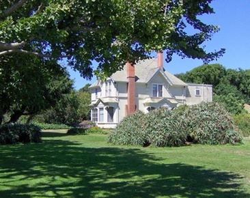 The restored Wilder Ranch House
- 0.0 mi: From the main parking lot, head up the paved trail to the farm.
- 0.1 mi: Turn left and head up the driveway toward the old farm. Continue through the farm buildings, then head through the tunnel under Hwy 1.
- 0.5 mi: Just before the creek, take a hard left onto Wilder Ridge Loop.
- 1.3 mi: Continue straight on Wilder Ridge Loop. Do not turn left onto the singletrack. Follow the Wilder Ridge Loop for the next 1.8 miles.
- 3.1 mi: Wilder Ridge Loop turns into a singletrack trail. Stay left and continue following signs for the Wilder Ridge Loop trail.
- 4.5 mi: Horsemans Trail intersection. Continue on Wilder Ridge Loop trail.
- 5.0 mi: Zane Gray Cutoff intersection. Continue on Wilder Ridge Loop trail. The next section is rolling singletrack.
- 6.7 mi: Stay right to get back on Wilder Ridge Loop trail heading back toward the farm. Now just retrace your steps through the farm and back to your car.
- 8.0 mi: Back at your car!
Favorite Run #2: Big Wilder/Coast Loop (14.1 mi, ~1100 ft elevation gain)
|
This run has it all! Exposed fire road with grand ocean views, wooded singletrack through a redwood forest, narrow trails through a ravine, and a breathtaking return trip along a bluff overlooking the Pacific Ocean. What more could you ask for?
One word of warning: The trails on this route are sometimes tricky to follow, especially toward the back of the park. We recommend that you print out the trail map or download the GPX track to your GPX device! To begin the run, follow signs along the paved path to the Farm and Interpretive Center. GPX Track Printable Trail Map Driving Directions |
|
Route Details:
View from Baldwin Loop Trail
|
Looking down Elgelsmans Loop fire road
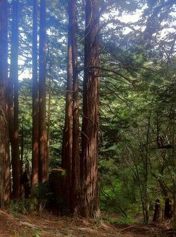
Redwoods on the Old Cabin Trail
|