Windy Hill Open Space Preserve
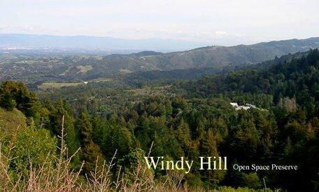
Windy Hill Open Space Preserve is a local gem located in the hills above Portola Valley. This 1,335-acre preserve features open grassland ridges and forests of redwood, fir, and oak. The highlight of the park is the Windy Hill Summit at just under 1900'. This unique grassy double peak is visible from many areas on the peninsula on a clear day. Because the summit is devoid of trees, the views from the top are spectacular on a clear day, and span from the South Bay to San Francisco, including views of the Pacific Ocean. Windy Hill Open Space Preserve is a great place for a local trail adventure, with well-maintained trails and a real feeling of accomplishment when you make it to the summit.
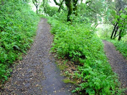
There are just over 12 miles of trails in the park, with elevations ranging from 500' at the lower trailhead to almost 1900' at the summit. The trails are primarily singletrack with the exception of the Spring Ridge Trail, a dirt road that climbs directly to the summit in just under two miles. This steep fire road is the quickest route to the summit, but offers spectacular views much of the way. The trails are great year-around, although they can be quite muddy immediately after a winter storm. Because of the proximity to the ocean, the weather is typically mild all year. It can, however, get quite windy at the top, hence the name of the summit!
The main parking lot and trailhead is at the bottom of the park off of Portola Road. There are also two parking areas along Skyline Blvd, located north and south of the Windy Hill summit. The parking area just south of the summit features bathrooms and a small picnic area. All of the Favorite Runs listed below start from the main parking lot off of Portola Road in Portola Valley.
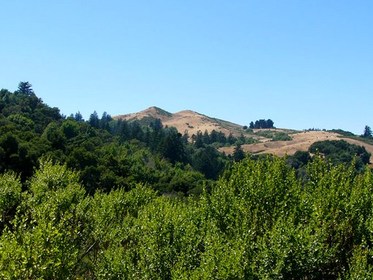 Windy Hill summit as seen from a distance
The Dirt:
Extras:
- Links to download printable trail maps are listed with each run below!
- Click here for the official website with park map.
- Click here for driving directions to the main parking lot via Google maps.
- Dogs on leash are allowed on all trails EXCEPT the Razorback Ridge Trail and the Lost Trail between Razorback Ridge and Hamms Gulch Trail.
Extras:
- There is no "official" drinking water available in the park. There is a pipe coming out of the ground near the intersection of Razorback Ridge Trail and Lost Trail, and spring water flows out of the pipe year-round. We do drink it, even through it is not marked as potable. Drink at your own risk!
- Check out the giant Portola Valley Super-Loop Run for a 17.5-mile adventure that connects Windy Hill, Coal Mine Ridge, Coal Creek, and Russian Ridge preserves!
Favorite Run #1: Hamms-Spring Ridge Loop (7.4 mi, ~1400 feet elevation gain) 🐾
|
This loop takes you up the lush Hamms Gulch Trail for a great singletrack climb up to the ridge, followed by a visit to Windy Hill summit for spectacular views of the Bay Area. You then descend back to your car via the wide Spring Ridge Trail, with great views most of the way down.
This run starts from the main parking lot area off of Portola Road. Begin the run by heading up the trail at the far end of the parking lot by the bathroom. GPX Track Printable Trail Map Driving Directions |
|
|
Route Details:
|
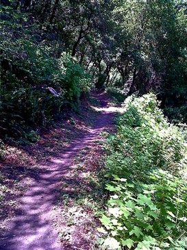
Hamms Gulch Trail in the springtime
Enjoying the view at Windy Hill Summit
|
Favorite Run #2: Razorback-Hamms Loop (9.6 mi, ~1800 feet elevation gain)
|
This loop incorporates a challenging climb up the Razorback Ridge Trail, which zig-zags through dense forest as it climbs up to Skyline. You are then rewarded with a beautiful lush section of singletrack on the Lost Trail, and a swooping descent down Hamms Gulch Trail.
This run starts from the main parking lot area off of Portola Road. Begin the run by heading up the trail at the far end of the parking lot by the bathroom. GPX Track Printable Trail Map Driving Directions |
|
Route Details:
|
The Lost Trail
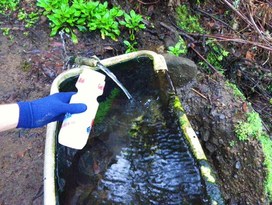
The "pipe" - drink at your own risk!
|
Favorite Run #3: Summit Out-and-Back (14.4 mi, ~2400 feet elevation gain)
|
This run is the ultimate out-and-back to the summit at Windy Hill Open Space Preserve. After a challenging zig-zag climb up Razorback Ridge Trail, you are rewarded with a beautiful lush section of singletrack on the Lost Trail, and a visit to Windy Hill summit. After taking in the view, you retrace your steps back to your car. The return descent on Razorback Ridge Trail is a two-mile joyride down amazing singletrack.
This run starts from the main parking lot area off of Portola Road. Begin the run by heading up the trail at the far end of the parking lot by the bathroom. GPX Track Printable Trail Map Driving Directions |
|
Route Details:
|
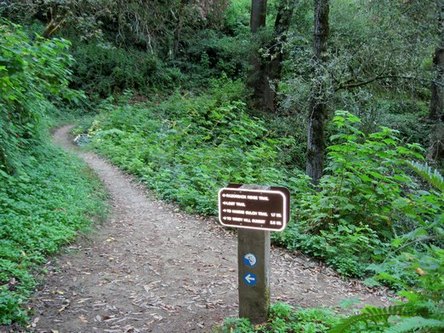
Intersection of Razorback Ridge and Lost Trail
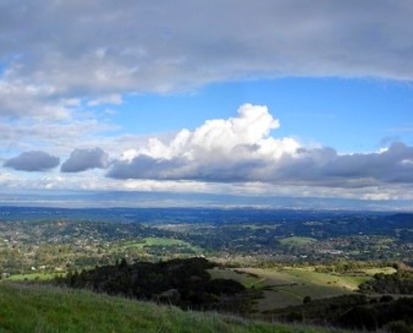
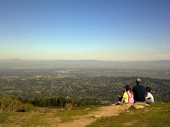
View from Windy Hill summit
|