Almaden Quicksilver to Lexington Reservoir (16.6 mi, ~3700 feet elevation gain)
|
This run links Almaden Quicksilver County Park in San Jose with Sierra Azul Open Space Preserve in Los Gatos for a challenging 17-mile point-to-point run. This challenging route follows the Bay Area Ridge Trail through Almaden Quicksilver and then over Mt. El Sombroso which, at 2999', is the highest publicly accessible point in Sierra Azul. The climb up to Mt. El Sombroso offers sweeping views of the entire South Bay. The trails are almost entirely fire roads. This route is exposed and can get quite hot in the summer, so we recommend attempting this route in the spring or fall when the temperatures are more mild. There is no drinking water available along this route.
The run starts from the Mockingbird Hill park entrance at Almaden Quicksilver County Park, and ends at the Priest Rock Trailhead on Alma Bridge Road just east of Lexington Reservoir. There is free parking at both locations |
|
The Dirt:
Extras:
- Click here for a two-page printable trail map of the run.
- Click here for driving directions to the start of the run (Mockingbird Hill park entrance).
- Click here for driving directions to the end of the run (parking lot near Priest Rock Trailhead).
- Click here to download this route as a GPX track!
- Dogs are not allowed on this route due to the Woods Trail section.
Extras:
- There is no water along this difficult route, so bring a LOT of water with you!
- The Quicksilver Running Club holds a yearly 50k/100k race that includes many of these trails.
Route Details:
The run starts from the large paved parking lot at the Mockingbird Hill entrance of Almaden Quicksilver County Park. Begin the run by proceeding to the far end of the parking lot and turning left onto the Virl O. Norton Trail.
The run starts from the large paved parking lot at the Mockingbird Hill entrance of Almaden Quicksilver County Park. Begin the run by proceeding to the far end of the parking lot and turning left onto the Virl O. Norton Trail.
|
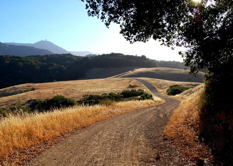
Woods Road heading toward Sierra Azul
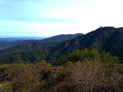
The view from Mt. El Sombroso (2999')
|
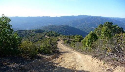
The long descent on Priest Rock Trail