Sierra Azul Open Space Preserve (and Lexington Reservoir County Park)
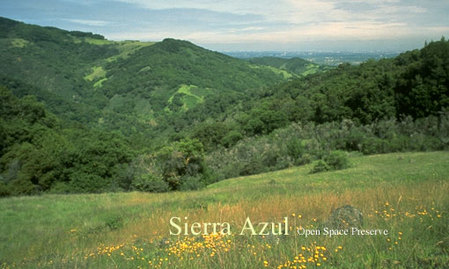
Overlooking the town of Los Gatos and the entire South Bay, Sierra Azul Open Space Preserve is the District's largest preserve, encompassing over 18,000 acres of mostly rugged and steep terrain. The park, located only minutes from Los Gatos, offers over 25 miles of trails that are perfect for a quick hill workout or a longer adventure all of the way up to 3,486' Mount Umunhum. One of the tallest peaks in the Santa Cruz mountain range. Mount Umunhum used to be home to the Almaden Air Force Station, which was deactivated in 1980 and only recently opened to the public in 2017. (Scroll down for more about Mount Umunhum's fascinating history.) Sierra Azul also borders Almaden Quicksilver County Park, which offers an additional 30 miles of trails. By combining these two parks, very long adventures are possible such as a 16.6-mile Almaden Quicksilver to Lexington Reservoir run.
The name "Sierra Azul," meaning "Blue Mountains," was given by the colonizing Spanish. The southern part of the Santa Cruz mountain range is divided into two parts by a valley which contains present-day California Highway 17. The Spanish called the portion to the north the "Sierra Morena" or "Brown Mountains," and the portion to the south the "Sierra Azul" or "Blue Mountains."
Due to its immense size, Sierra Azul is divided into four distinct areas:
- The Kennedy-Limekiln Area contains about 15 miles of trails and is accessible from Kennedy Road near Los Gatos or through Lexington Reservoir County Park off of Highway 17 a few minutes south of Los Gatos. There is parking along the side of Alma Bridge Road near the Limekiln trailhead. Dogs on leash are allowed only in the Kennedy-Limekiln Area.
- The Mount Umunhum Area offers about 10 miles of trails and encompasses the preserve's three highest peaks: Bald Mountain (2,387'), Mount El Sombroso (2,999'), and Mount Umunhum (3,486').
- The two remaining areas, the Cathedral Oaks Area and the Rancho de Guadalupe Area, are not yet opened to the public.
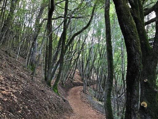
The trails in Sierra Azul are primarily dirt roads that range from moderate to very steep. One notable except is the new 3.7-mile Mount Umunhum Trail, a beautiful singletrack trail that gradually climbs over 1,100' from the Bald Mountain Parking Area to the summit of Mount Umunhum. The elevation in the park varies from around 700' at Lexington Reservoir to 3,486' at the summit of Mount Umunhum, the highest peak in the preserve. Temperatures in Sierra Azul can vary widely, ranging from below freezing and windy at the summit of Mount Umunhum in the winter, to the 90's or even 100's in the heat of summer. Many of the trails are not shaded, and there is no drinking water available in the preserve, so please dress accordingly and carry plenty of water!
The Dirt:
The Dirt:
- Click here to download a printable map of Favorite Runs #1 and #2 below!
- Click here to download a printable map of Favorite Run #3 below!
- Click here for the official Sierra Azul Open Space Preserve site with trail map.
- Click here for the official Lexington Reservoir County Park site with trail map.
- Driving directions to the trailhead are given with each Favorite Run below.
- Dogs on leash are ONLY allowed on the Priest Rock, Limekiln, and Kennedy Trails in the Kennedy-Limekiln area.
Mt. Umunhum: A Local Landmark Finally Opened to the Public
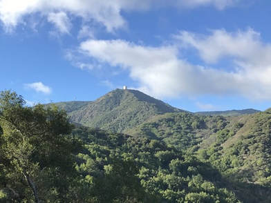 View of Mt. Umunhum from the Woods Trail
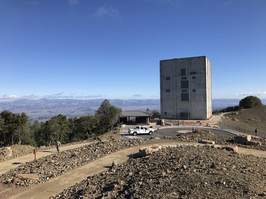
At 3,486', Mount Umunhum is the second highest peak in the Santa Cruz Mountains and the highest peak in the Sierra Azul region. The name "Umunhum" is said to mean a "hummingbird resting place" in the native Ohlone language. The summit is easily recognizable from much of the South Bay because of the large cement "box" on top. This structure was once the base of a huge radar system, an enduring symbol of the Cold War.
Mount Umunhum has a long and varied history. The mountain was sacred to local native people. In 1850, it was part of California's first mining claim and was inhabited, explored, and timbered by settlers. From 1957-1980 the summit was occupied by the Almaden Air Force Station, one of dozens of radar stations operating along the west coast of the United States during the cold war. The Midpeninsula Regional Open Space District purchased the summit in 1986, but it remained off-limits to the public due to the hazardous conditions of the slowly decaying Air Force Station. In 2009, the district received $3.2 million in federal funding to clean up the site and began an extensive planning process to open the summit to the public. The summit and trails officially opened to the public in September 2017, giving all of us the opportunity to visit the peak and take in the history and breathtaking views. Check out Favorite Run #3 below for instructions on how to hike or run to the summit of Mount Umunhum!
Mount Umunhum has a long and varied history. The mountain was sacred to local native people. In 1850, it was part of California's first mining claim and was inhabited, explored, and timbered by settlers. From 1957-1980 the summit was occupied by the Almaden Air Force Station, one of dozens of radar stations operating along the west coast of the United States during the cold war. The Midpeninsula Regional Open Space District purchased the summit in 1986, but it remained off-limits to the public due to the hazardous conditions of the slowly decaying Air Force Station. In 2009, the district received $3.2 million in federal funding to clean up the site and began an extensive planning process to open the summit to the public. The summit and trails officially opened to the public in September 2017, giving all of us the opportunity to visit the peak and take in the history and breathtaking views. Check out Favorite Run #3 below for instructions on how to hike or run to the summit of Mount Umunhum!
The Almaden Air Force Station (1957 - 1980)
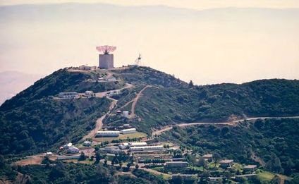 Almaden Air Force Station, 1960s
In the late 1950s, the United States government procured Mount Umunhum to build the Almaden Air Force Station (AFS), an early warning radar station that operated from 1957 to 1980. The station was constructed as part of a network of radar stations used to keep watch over the United States' airspace during the Cold War. The radar tower on Mount Umunhum was one of a system of 23 similar stations in California, and one of hundreds across the country that fed radar signals into the Semi-Automatic Ground Environment (SAGE) defense system.
At its peak, Almaden AFS housed approximately 120 people including employees and their families, and contained eighty-four buildings and structures. On average, the facility employed approximately 30 stationed military personnel and 50 to 100 civilian personnel. In addition to basic support facilities, the station also catered to community needs with facilities for medical and dental care, postal services, a commissary and exchange, a chapel, and a barber shop. Recreational facilities
consisted of a pool table, a half-court gymnasium, weight room, ping pong tables, a foosball table, a nine-foot swimming pool with a diving board, and a two-lane bowling alley with automatic pin-setters. There were no schools on the mountain, so dependent children attended nearby schools in San Jose via a bus service.
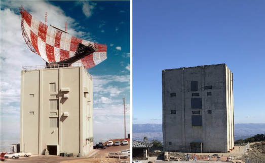 The AN/FPS-24 radar facility in the 1960s (left) and in 2017 (right)
The centerpiece of the Almaden AFS was the General Electric 85.5 ton AN/FPS‐24 search radar, which was mounted atop a five‐story concrete tower constructed between 1959 and 1961. The tower and its massive red-and-white checkered radar "sail" was visible from most of the South Bay. The AN/FPS‐24 radar had a 250‐mile range designed to detect incoming hostile aircraft. In 1961, Almaden AFS joined the SAGE system, feeding data to a center at Beale AFB, California.
In 1968, as the result of defense budget cuts and a reduction in the Department of Defense’s emphasis on protection of the country against Soviet‐manned bombers, Air Defense Command started deactivating its remaining long‐range radar sites in the interior of the country. On June 30, 1980, the 682nd Radar Squadron was rendered inactive at Almaden AFS. At this time, the giant radar "sail" was removed from the building, in addition to all of the associated electronics and mechanics to operate the radar. From 1980 onward, the buildings deteriorated due to damage from the 1989 Loma Prieta earthquake, as well as ongoing vandalism and a significant amount of weather exposure that damaged both the exteriors and interiors. In 2009, $3.2 million in federal funding was obtained to clean up hazardous materials and remove the dilapidated structures from the former station. From 2012-2017, new parking areas and trails were constructed, which were finally opened to the public in September 2017.
References:
[1] Mount Umunhum: Sierra Azul Open Space Preserve brouchure, published by the Midpeninsula Regional Open Space District.
[2] "Mt. Umunhum Radar Tower Historical Evaluation". Accessible at: https://www.sccgov.org/sites/dpd/DocsForms/Documents/HHC_Umunhum_20151217.pdf
Favorite Run #1: Limekiln/Priest Rock Loop (4.8 mi, ~1100 feet elevation gain) 🐾
|
With over 1000' feet of climing in less than 4.8 miles, this run is a great hill workout with some pretty good views thrown in. From Lexington Reservoir, this run takes you up the bottom section of the Limekiln Trail and then loops back down Priest Rock Trail. All of the trails on this run are fire roads.
This run starts from the Limekiln Trailhead along Alma Bridge Road. GPX Track Printable Trail Map Driving Directions |
|
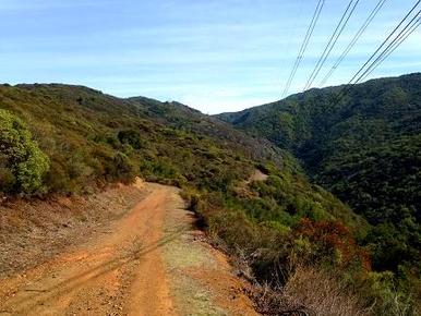 The climb up Limekiln Trail
Route Details:
- 0.0 mi: Head through the gate and start up the Limekiln Trail. The trail is fairly flat for the first half-mile and then starts climbing.
- 2.0 mi: Trail junction. Turn right onto Priest Rock Trail. You will climb for another half-mile and then start descending sharply.
- 4.4 mi: Priest Rock Trail ends on Alma Bridge Road. Turn right and follow the road back to your car. Watch for cars on the road!
- 4.8 mi: Back at your car!
Favorite Run #2: Mt. El Sombroso Figure-8 (12.0 mi, ~2900 feet elevation gain) 🐾
|
This run is the ultimate hill climb in Sierra Azul Open Space Preserve. While the view from Mt. El Sombroso is not the most spectacular summit view in the Bay Area, it does give you a unique perspective of the South Bay. Starting from Lexington Reservoir, this run takes you on an unrelenting 5-mile climb all of the way to the 3,000' foot summit, and then on a long, rolling descent back down to the trailhead. All of the trails on this route are fire roads.
This run also starts from the Limekiln Trailhead on Alma Bridge Road. 🐾 Note that dogs are not allowed past the Limekiln/Kennedy junction, so you can't make it all of the way to Mt. El Sombroso. GPX Track Printable Trail Map Driving Directions |
|
Route Details:
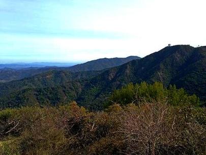 Mt. Umunhum from Mt. El Sombroso
- 0.0 mi: Head through the gate and start up the Limekiln Trail. The trail is fairly flat for the first half-mile and then starts climbing.
- 2.0 mi: Trail junction. Cross over Priest Rock Trail to continue on Limekiln Trail.
- 5.0 mi: Intersection with Kennedy Trail. Continue straight onto Woods Trail to Mt. El Sombroso. (🐾 If you have your dog, you cannot continue onto Woods Trail. Instead, turn left onto Kennedy trail and skip ahead to mile 6.4 below...)
- 5.7 mi: At Mt. El Sombroso. Veer left under the power lines to the actual summit. Unfortunately you have to share the peak with two high-voltage transmission towers... When you are done basking in the glow of the electromagnetic radiation coming from the power lines, retrace your steps back to the Kennedy/Limekiln Trail junction.
- 6.4 mi: Back at the junction of Kennedy and Limekiln Trail. Turn right onto Kennedy Trail. There is a bit of climbing here.
- 7.8 mi: Turn left onto Priest Rock Trail. You will follow Priest Rock Trail all of the way back to Alma Bridge Road.
- 9.2 mi: Trail junction. Cross over Limekiln trail to continue on Priest Rock Trail.
- 11.6 mi: Priest Rock Trail ends on Alma Bridge Road. Turn right and follow the road back to your car. Watch for cars!
- 12.0 mi: Back at your car!
Favorite Run #3: Mt. Umunhum Summit (7.8/16.4 mi, ~1200/3000 feet elevation gain)
|
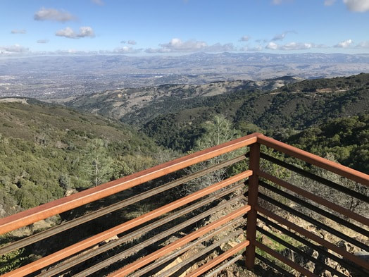
Sure, you *could* drive to the summit of the newly opened Mount Umunhum, but why would you do that when you can run or hike there? Constructed in 2017, the beautiful 3.7-mile Mount Umunhum Trail gradually climbs 1,100' from the Bald Mountain parking area to the summit, crossing through varied habitats and offering incredible views of the valley below. The summit offers sweeping views of Mount Diablo, Mount Tamalpais, and the Santa Clara Valley below. On the way up, don't miss the spectacular Guadalupe Creek Overlook, located about 1 mile past Barlow Road. Starting from the Bald Mountain parking area, the trip to the summit is 7.8-miles round trip with about 1,200 feet of climbing.
If you are up for a longer (and more challenging) route to the summit, you can start from the Jacques Ridge parking area at the intersection of Hicks Road and Mt. Umunhum Road. From here, the summit is accessed via Woods Trail to Barlow Road to Mt. Umunhum Trail, for a total of 16.4 miles round trip with 3,000' of elevation gain! There is no drinking water available along the route, so don't forget to bring your own! GPX Track (16.4-mile route) Printable Trail Map Driving Directions to Bald Mountain Parking or Jacques Ridge Parking |
|
Route Directions, from Bald Mountain parking area (7.8 miles, 1200' elevation gain):
|
Route Directions, from Jacques Ridge parking area (16.4 miles, 3000' elevation gain):
|
