Coal Creek Open Space Preserve

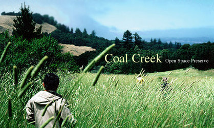
Coal Creek Open Space Preserve is small 500-acre preserve located just south of Portola Valley. It is the gateway connects the upper part of Alpine Road to the open spaces of the South Skyline Region such as Russian Ridge and Monte Bello. Coal Creek Open Space is a particular favorite of ours in the spring, when the Meadow Trail area turns into a showy field of wildflowers.
There are about 5 miles of trails in the Preserve. The most notable is the Old Alpine Road Trail that connects Alpine Road to Page Mill Road near Skyline. This old road is now a favorite trail for mountain bikers but also makes a great hill climb for hikers or runners. The Meadow and Clouds Rest Trails are also great for running and hiking. The preserve adjoins several other parks in the South Skyline Region, which gives access to literally dozens of miles of trails.
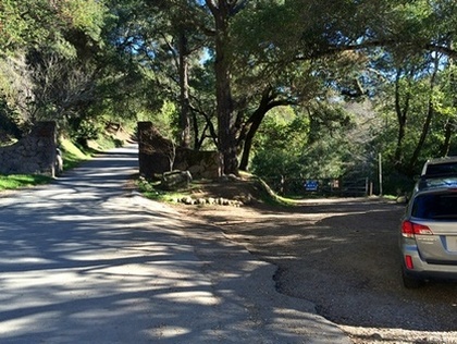
There is no official parking area for Coal Creek Open Space Preserve. The trails can be accessed either from the trailhead at the top of Alpine Road (there is parking for 2-3 cars) or from the Vista Point parking on Skyline Blvd near Borel Hill.
|
The Dirt:
Extras:
|
Favorite Run #1: Crazy Pete's Loop (5.8 mi, ~1100 feet elevation gain) 🐾
|
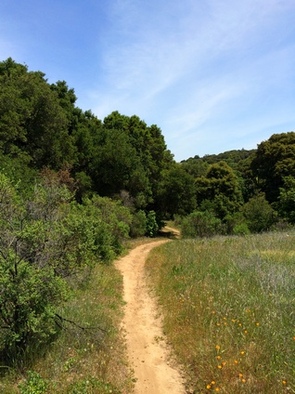
This route takes you on the best trails in the preserve, but there is a catch. Trailhead parking is at the end of Alpine Road where there is only room for 2-3 cars. So if you want to do this loop, start early so you can get a parking space! This route makes a lollipop loop in the preserve by connecting two trails via Skyline Blvd. You start out with a 1000' climb up to Skyline, then a 3-mile descent back to your car. One of the highlights of this route is the Meadow Trail which runs through fields of wildflowers in the spring.
To begin this run, go around the gate and start up the Old Alpine Road Trail. GPX Track Printable Trail Map Driving Directions |
|
Route Details:
 The Meadow Trail
- 0.0 mi: From the end of Alpine Road, go around the gate and start up Old Alpine Road Trail.
- 0.8 mi: Alpine Road Trail is closed due to a landslide. Veer right onto the Bypass Trail. In a quarter-mile you will rejoin Alpine Road Trail
- 1.2 mi: Turn right onto Crazy Pete's Trail, and continue climbing. You will follow Crazy Pete's Trail all of the way to Skyline Blvd.
- 1.5 mi: Stay right on Crazy Pete's Trail.
- 2.0 mi: Stay right on Crazy Pete's Trail, which turns into a road as you near Skyline Blvd.
- 2.4 mi: Turn left onto Skyline Blvd. You will run alongside Skyline for a half-mile. Watch out for crazy drivers!
- 2.9 mi: Turn left onto Clouds Rest Road and start heading downhill. The road is initially paved but will soon turn to dirt after a gate.
- 3.3 mi: At the first junction, veer right up a small hill onto Meadow Trail. The next half-mile is great singletrack!
- 3.9 mi: After two switchbacks Meadow Trail ends at Old Alpine Road Trail. Turn left and follow Old Alpine Road all of the way back to your car.
- 5.8 mi: Back at your car!
