Huddart Park & Phleger Estate
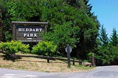
Set in the wooded hills above Woodside, Huddart Park & Phleger Estate are a trail runner's and hiker's paradise. These parks offer some of the most beautiful and well-maintained trails in the Bay Area, climbing through dramatic redwood forests. Huddart Park and Phleger Estate combined offer about 20 miles of trails through 2000 acres acres of oak, fir, and second-growth redwood forest. In addition to great trails, Huddart Park also offers several group picnic areas, sand volleyball courts, and a walk-in campground.
Huddart Park and Phleger Estate were once the site of extensive logging operations. In 1850, the California Gold Rush was booming, and so was the demand for lumber to build San Francisco. Five sawmills operated in this area between 1853 and 1860, including Richard's sawmill. From this mill, Richard's Road led down the mountain and wagons loaded with lumber and drawn by teams of oxen traveled down it to Redwood City, where the lumber was barged to San Francisco. Today, Richard's Road Trail follows the route of this old road. Before his death on in 1935, the wealthy lumberman James Huddart deeded 900 acres of his property to the county with the provision that it would be developed into a public park. The County of San Mateo has owned and operated the land as a public park since 1944. In the hundred years since the Huddart Park area was logged, a new forest of redwoods and other trees has grown, covering much of the evidence of this early logging activity.
Huddart Park and Phleger Estate were once the site of extensive logging operations. In 1850, the California Gold Rush was booming, and so was the demand for lumber to build San Francisco. Five sawmills operated in this area between 1853 and 1860, including Richard's sawmill. From this mill, Richard's Road led down the mountain and wagons loaded with lumber and drawn by teams of oxen traveled down it to Redwood City, where the lumber was barged to San Francisco. Today, Richard's Road Trail follows the route of this old road. Before his death on in 1935, the wealthy lumberman James Huddart deeded 900 acres of his property to the county with the provision that it would be developed into a public park. The County of San Mateo has owned and operated the land as a public park since 1944. In the hundred years since the Huddart Park area was logged, a new forest of redwoods and other trees has grown, covering much of the evidence of this early logging activity.
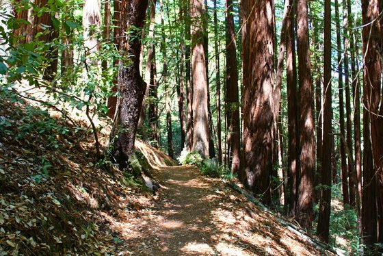
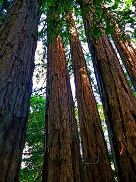 Redwoods in Huddart Park
The trails in Huddart Park and Phleger Estate are primarily well-maintained singletrack, with the exception of Richards Road and the Campground Trail which are rough dirt roads. Elevations in the park range from around 500' at the bottom of Richards Road to just over 2000' at Skyline Blvd. The trails are almost entirely shaded and the temperature is usually mild which makes this an excellent summertime destination.
A word of caution: While it's difficult to get permanently lost in Huddart Park, it's very easy to get on the wrong trail, since there are many spurs leading off the main trails. Often these spurs appear to be the main trail, while the main trail turns off to the right or left. Take care to read signs carefully at each trail junction!
The Dirt:
Extras:
A word of caution: While it's difficult to get permanently lost in Huddart Park, it's very easy to get on the wrong trail, since there are many spurs leading off the main trails. Often these spurs appear to be the main trail, while the main trail turns off to the right or left. Take care to read signs carefully at each trail junction!
The Dirt:
- Click here for a printable trail map of the favorite runs below!
- Click here for the Huddart Park web site with link to trail map.
- Click here for the Phleger Estate web site with link to trail map.
- Click here for driving directions to the trailhead via Google Maps (there is an entrance fee).
- There are NO DOGS allowed in the park.
Extras:
- There are drinking fountains at several of the main picnic areas and also at Toyon group campground.
- Huddart Park can be connected to the surrounding parks to make "super-loops" between Huddart & Purisima Creek Redwoods, or Huddart & Wunderlich Park
The History of Phleger Estate
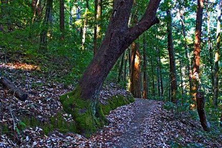
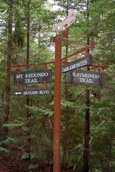 Trail signs in Phleger Estate
About 1908, William Bourn completely acquired the Spring Valley Water Company which closed its lands (including what was to become Phleger Estate) to agriculture, logging and vineyards. Just before Bourn sold the Spring Valley Water Company to the city of San Francisco, he allowed a Company Vice President, Samuel P. Eastman, to create a private estate on the land which he called "Mountain Meadow". The 8,000-square foot house was situated to permit views of both the second-growth redwoods and oak woodlands. In 1937, Herman and Mary Elena Phleger began acquiring this watershed property, ultimately assembling an estate of 1,315 acres. The Phlegers lived at Mountain Meadow for the rest of their lives.
After Herman died in 1984, his wife Mary wanted their beautiful lands to be protected. In 1990 she began negotiating with the Peninsula Open Space Trust (POST) to acquire the land which was then valued at $30 million. After the purchase, POST would turn the land over to the National Park Service. Despite Mary Elena's death in December 1990, the family agreed to sell the property. In 1994 the sale to POST was completed for only $21 million, significantly below the market value. POST then turned over the Phleger Estate to the National Park Service. However, because the NPS did not want the Phleger mansion, Audrey Rust convinced Gordon Moore, the founder of Intel Corporation, to purchase the home and 24 acres for $6 million. Finally, on April 29, 1995, the Phleger Estate was dedicated as part of the Golden Gate National Recreation Area (GGNRA). ~ Adapted from Wikipedia
After Herman died in 1984, his wife Mary wanted their beautiful lands to be protected. In 1990 she began negotiating with the Peninsula Open Space Trust (POST) to acquire the land which was then valued at $30 million. After the purchase, POST would turn the land over to the National Park Service. Despite Mary Elena's death in December 1990, the family agreed to sell the property. In 1994 the sale to POST was completed for only $21 million, significantly below the market value. POST then turned over the Phleger Estate to the National Park Service. However, because the NPS did not want the Phleger mansion, Audrey Rust convinced Gordon Moore, the founder of Intel Corporation, to purchase the home and 24 acres for $6 million. Finally, on April 29, 1995, the Phleger Estate was dedicated as part of the Golden Gate National Recreation Area (GGNRA). ~ Adapted from Wikipedia
Favorite Run #1: The Huddart loop (8.7/6.0 mi, ~1600/1100 feet elevation gain)
|
This run is the full tour of Huddart Park, from the lowest creek to the highest redwoods along Skyline Blvd. After a brief descent, you will gradually climb for 5 miles to Skyline. Then you are rewarded with an awesome 3-mile singletrack descent through a dense redwood forest on the Chinquapin Trail. Note that if you are not up for the full 8.7 miles, you can shorten the run to 6.0 miles (and about 1100 feet of climbing) by following the short-cut listed in the directions.
This run starts from the parking lot near the Zwierlein picnic area. After paying the fee at the entrance kiosk, continue straight after the stop sign and park near the volleyball nets. The run starts on the Bay Tree Trail on the opposite side of the parking lot from the volleyball nets. GPX Track Printable Trail Map Driving Directions |
|
Route Details:
|
The Bay Tree Trail
Climbing the Crystal Springs Trail
The Chinquapin Trail
|
Favorite Run #2: The Phleger/Huddart loop (10.4 mi, ~1700 feet elevation gain)
|
This run explores both parks with a large loop. Phleger is less traveled than Huddart, so the trails are more rocky and rough. Also, sections of the Lonely Trail are very steep. But, your effort is rewarded with an awesome climb and beautiful scenery along the way!
This run starts from the parking lot near the Zwierlein picnic area. After paying the fee at the entrance kiosk, continue straight after the stop sign and park near the volleyball nets. The run starts on the Bay Tree Trail on the opposite side of the parking lot from the volleyball nets. GPX Track Printable Trail Map Driving Directions |
|
Route Details:
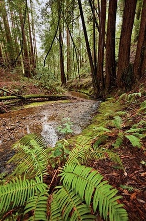 Union Creek flowing through Phleger Estate
- 0.0 mi: From the south end of the parking area, head downhill on the Bay Tree Trail.
- 0.7 mi: When the trail ends, take a hard left onto Richards Road Trail. You will follow Richards Road as it gradually climbs for the next 0.9 miles.
- 1.6 mi: Veer right onto Miramontes Trail and enter Phleger Estate. You will follow Union Creek on a beautiful singletrack trail for the next mile.
- 3.0 mi: Turn right at the intersection with Mt. Redondo Trail, head downhill briefly, then turn left onto Raymundo Trail. Get ready for some steep climbing!!
- 4.6 mi: Just after the Raymundo trail flattens out, turn right onto Lonely Trail for more climbing!! (You didn't think you were done, did you??)
- 5.2 mi: Pass the first bench.
- 5.5 mi: Pass the second bench.
- 6.1 mi: The trail flattens out and reaches an intersection. Turn left to continue on the Lonely Trail. (Note: If you want to get water at the Kings Mountain Fire Station, turn right at this intersection. In 0.1 mile you will see the fire station, and there is a water hose out back. After filling your bottle, retrace your steps on the Lonely Trail).
- 6.4 mi: The Lonely Trail ends at Richards Road Trail. Turn left (downhill), then immediately turn right onto the Skyline Trail (singletrack).
- 6.9 mi: The Skyline Trail singletrack ends on a fire road. Turn left on the fire road (away from Skyline Blvd).
- 7.1 mi: Turn left onto Chinquapin Trail, and start an awesome 3-mile descent!
- 8.9 mi: CONFUSING INTERSECTION! The Chinquapin Trail runs along the left side of Archery Fire Road. Stay left on the singletrack and then around a left-hand switchback. The Chinquapin Trail will then end on the Dean Trail (fire road). Cross the fire road and take a sharp right on the Dean Trail singletrack doing downhill. Make sure you are following signs for the "Ranger Station" and not "Crystal Springs Trail"!
- 9.1 mi: Cross the Archery Fire Road - continue on Dean Trail.
- 9.5 mi: Cross the Archery Fire Road again - continue on Dean Trail.
- 9.7 mi: At the paved road - turn left to stay on the Dean Trail.
- 10.0 mi: Continue past the paved road and stay on the Dean Trail.
- 10.2 mi: Dean Trail ends on the Crystal Springs Trail, turn right toward the parking area.
- 10.4 mi: Back at the parking lot and your car!