Mount Tamalpais State Park and Watershed
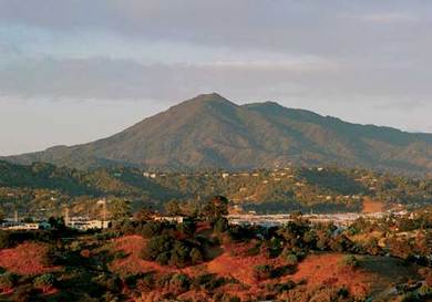
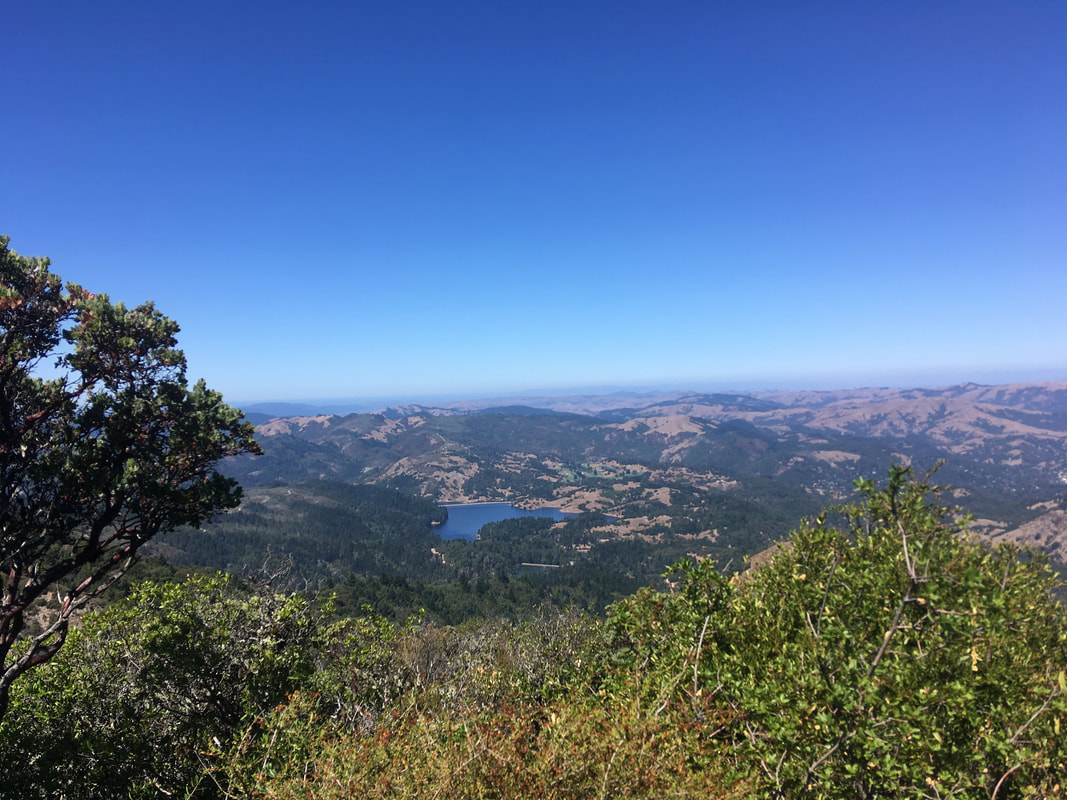
Mount Tamalpais (or "Mount Tam" as it is known locally) is the highest and most distinctive mountain in Marin County. The mountain actually has two peaks: the East Peak, its highest point, rises to 2,571 feet, while the West Peak is only slightly lower at 2,563 feet. The mountain is clearly visible from the city of San Francisco, most of Marin, and the East Bay region. The majority of the mountain consists of protected public lands, including Mount Tamalpais State Park, Muir Woods National Monument, and the Mount Tamalpais Watershed. It adjoins the Golden Gate National Recreation Area (GGNRA) as well as several Marin County Open Space Preserves. This provides nearly 40 miles of continuous publicly accessible open space stretching from the Golden Gate northward to Bolinas.
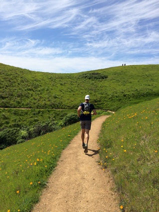
Mount Tamalpais State Park and Watershed is a trail running and hiking paradise, with over 100 miles of trails and fire roads, ranging from sea level to over 2,500' at the summit of Mount Tam. The trails to the east of the summit are primarily fire roads that were the birthplace of mountain biking. To the west of the summit, challenging singletrack runs from the summit all of the way to the beach. To the south, the area connects to Muir Woods and the Marin Headlands area of the GGNRA. To the north, the area connects to the Bolinas Ridge area of the GGNRA.
There are too many trailheads for the Mount Tamalpais area to list all of them here. The Favorite Runs described below start from the town of Stinson Beach. Other possible starting locations for runs include the Mountain Home Inn, the town of Mill Valley, or a multitude of other locations along Highway 1 or the Panoramic Highway
|
The Dirt:
Extras:
|
The Matt Davis Trail
|
History of the Old Railroad Grade
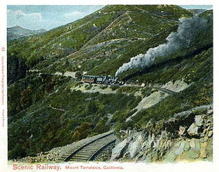
The Mount Tamalpais & Muir Woods Railway was a scenic tourist railway operating between Mill Valley and the east peak of Mount Tamalpais. The railroad, which was in operation from 1896 through 1930, was powered by steam locomotives. Billed as the "Crookedest Railroad in the World," the line was renowned for its steep and serpentine route, winding through picturesque terrain to a mountaintop tavern that provided striking views of the Bay Area.
Despite its popularity, the railway met its ultimate demise following a devastating fire in 1929, accompanied by diminished ridership resulting from increased automobile use and the Great Depression. Today, the Old Railroad Grade Fire Road follows the upper four miles of the original railway and provides users a gentle route to the peak.
~ Adapted from Wikipedia
Favorite Run #1: Stinson to Pantoll loop (7.3 mi, ~1600' elevation gain)
|
This run starts from Stinson Beach and ascends the spectacular Steep Ravine Trail through a stunning redwood forest. Along the way you will climb the infamous 10-foot ladder! After a stop at Pantoll Ranger Station, the route follows the Matt Davis Trail along the ridge and then down dozens of steps to return to Stinson Beach.
You can park anywhere in town for this run, but our favorite place to start is Stinson Beach State Park which has bathrooms, drinking water, and a great beach to hang out on after your run! To begin the run, head away from the beach and through the gate that leads to Arenal Avenue. Turn right on Arenal Avenue and keep going until it ends at Highway 1. GPX Track Printable Trail Map Driving Directions |
|
Route Details:
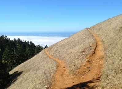 Intersection of Matt Davis Trail and Coastal Trail
- 0.0 mi: From the Stinson Beach State Park parking lot, head through the gate and turn right on Arenal Avenue.
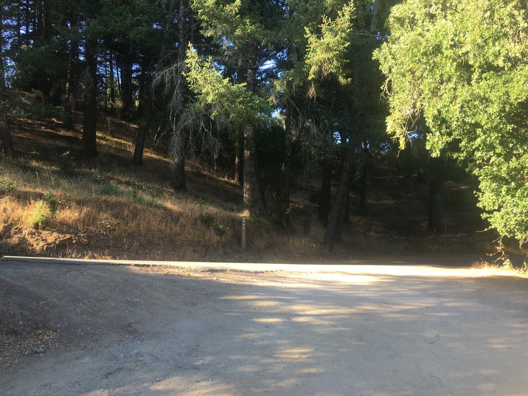
- 0.2 mi: When Arenal Ave ends, cross over Highway 1 and go slightly to your right to get onto the Dipsea Trail. The climbing starts immediately.
- 0.3 mi: Dipsea Trail crosses over Panoramic Highway.
- 1.3 mi: Dipsea Trail crosses the Hill Trail (fire road). Continue straight toward Steep Ravine Trail.
- 1.5 mi: Veer left onto Steep Ravine Trail. The next 1.5 miles are a steep but beautiful climb up Webb Creek ravine and through a redwood forest.
- 2.3 mi: Climb up the 10-foot ladder!
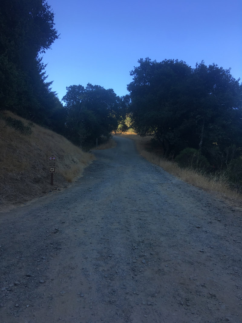
- 3.1 mi: (Water available) At Pantoll Ranger Station. Cross over Panoramic Highway, and look to your left for the trailhead for the Matt Davis Trail. (Note: Matt Davis trail is a singletrack, not a fire road!) After a mile of singletrack through the forest, the trail comes out onto a grassy hillside for excellent views of the coast.
- 4.7 mi: Matt Davis and Coastal Trail split. Veer left to stay on the Matt Davis Trail. The next two miles is a long descent with sections of wooden steps. Be careful and watch your footing!
- 7.0 mi: Matt Davis Trail ends on Belvedere Ave. Turn left to head to Highway 1, then turn right on Highway 1. Turn left at the next street, Calle Del Mar, and continue straight ahead through the gate back to Stinson Beach State Park.
- 7.3 mi: Back at your car!
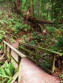
Steep Ravine Trail
|
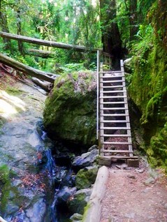
The ladder on Steep Ravine Trail
|
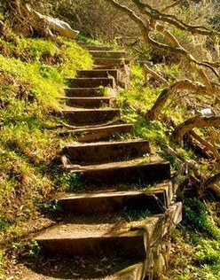
The steps on Matt Davis Trail
|
Favorite Run #2: Stinson to East Peak and back (15.4 mi, ~3100 feet elevation gain)
|
This run combines the loop in Favorite Run #1 with an out-and-back to Mount Tam's East Peak which offers stunning views of Marin, San Francisco, and the Pacific Ocean. After climbing to Pantoll Ranger Station, you follow the Old Stage Road on a gradual climb to the intersection with Old Railroad Grade at West Point Inn. This inn has been operating since 1904, originally as a stopover for passengers riding the "crookedest railroad in the world" to the summit of Mount Tam. You then follow Old Railroad Grade to the summit, where you take the Plank Walk up to the fire lookout for spectacular 360-degree views! After taking in the scenery, you head back to Pantoll Ranger Station and finish the loop down the Matt Davis Trail to Stinson Beach and your car.
Note: If you want to experience the trip up Old Railroad Grade to the East Peak but aren't up for the entire 15.4 miles, you can park at Pantoll Ranger Station and start from there (mile 3.1 in the description below). This makes the route 8.1 miles round trip with 1500' of climbing. Click here for driving directions to the Pantoll Ranger Station. |
|
To begin the run, park in Stinson Beach State Park and head away from the beach and through the gate that leads to Arenal Avenue. Turn right on Arenal Avenue and keep going until it ends at Highway 1.
GPX Track
Printable Trail Map
Driving Directions
Route Details:
GPX Track
Printable Trail Map
Driving Directions
Route Details:
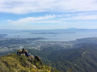 The view from Mount Tam's East Peak
- 0.0 mi: From the Stinson Beach State Park parking lot, head through the gate and turn right on Arenal Avenue.
- 0.2 mi: When Arenal Ave ends, cross over Highway 1 and go slightly to your right to get onto the Dipsea Trail. The climbing starts immediately.
- 0.3 mi: Dipsea Trail crosses over Panoramic Highway.
- 1.3 mi: Dipsea Trail crosses the Hill Trail (fire road). Continue straight toward Steep Ravine Trail.
- 1.5 mi: Veer left onto Steep Ravine Trail. The next 1.5 miles are a steep but beautiful climb up Webb Creek ravine and through a redwood forest.
- 2.3 mi: Climb up the 10-foot ladder!
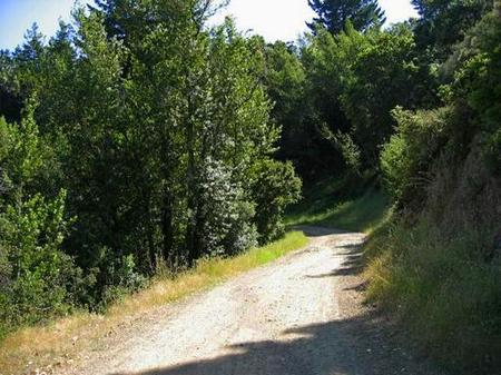
- 3.1 mi: (Water available) At Pantoll Ranger Station. Cross over Panoramic Highway, and look to your right for the trailhead for the Old Stage Road. The road is initially paved but soon turns to dirt. It is a very gradual climb that can be exposed and hot in the summer.
- 5.2 mi: Intersection with Old Railroad Grade at West Point Inn. Turn left onto Old Railroad Grade to continue climbing up to the summit. You will follow the Old Railroad Grade all of the way up to East Peak.
- 6.6 mi: Old Railroad Grade ends at the paved Ridgecrest Blvd. Turn right and then veer right onto the narrow paved road to the summit.
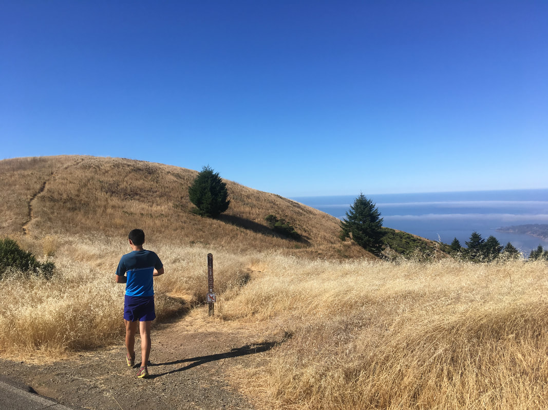
- 6.9 mi: (Water available) At the parking lot. Continue through the parking lot onto the Plank Walk Trail to the actual summit. The first part of this trail is on wooden boards, but then it becomes narrow and rocky as it heads up to the fire lookout.
- 7.2 mi: At the fire lookout! Pick out your favorite rock and enjoy the view! Then retrace your steps back down to the parking lot, and then back down to Pantoll Ranger Station.
- 9.2 mi: Back at the West Point Inn. Turn right onto Old Stage Road to head back to Pantoll.
- 11.2 mi: (Water available) Back at Pantoll Ranger Station. After getting water, cross over Panoramic Highway, and look to your left for the trailhead for the Matt Davis Trail. (Note: Matt Davis trail is a singletrack, not a fire road!) After a mile of singletrack through the forest, the trail comes out onto a grassy hillside for excellent views of the coast.
- 12.8 mi: Matt Davis and Coastal Trail split. Veer left to stay on the Matt Davis Trail. The next two miles is a long descent with sections of wooden steps. Be careful and watch your footing!
- 15.1 mi: Matt Davis Trail ends on Belvedere Ave. Turn left to head to Highway 1, then turn right on Highway 1. Turn left at the next street, Calle Del Mar, and continue straight ahead through the gate back to Stinson Beach State Park.
- 15.4 mi: Back at your car!
Old Railroad Grade heading to East Peak
|
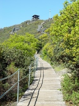
The Plank Walk Trail up to East Peak
|
Favorite Run #3: Mt. Tam Super Loop (26.0 mi, ~5100 feet elevation gain)
|
This run combines the all of run #1 and #2 into one massive loop, covering a ton of ground both in Mt. Tamalpais SP as well as Mt. Tamalpais Watershed. The route has it all, lakes, peaks, redwoods, waterfalls, easy fire roads, flowing single track, and even some short sections of rocky technical trails. If you want the full Mt Tamalpais experience, this run is for you.
Best to do this run in the Fall, Winter or Spring. It can get quite warm on this run and much of the end of it is exposed to sunlight so you'll be finishing your miles in the heat of the day without any shade Thankfully water is fairly available on this route, but some water stops may or may not be available depending on the time of year. Starting off of Lagunitas Road in the Mt. Tamalpais Watershed, the directions to the start of the run are quite different from the others on this page, so just be aware of that. |
|
To begin the run, park at the trailhead at he end of Lagunitas Road in San Anselmo. Cross under the metal gate and over the bridge onto Phoenix Lake Fire Road.
GPX Track
Driving Directions
GPX Track
Driving Directions
 The dam
- 0.0 mi: From the parking lot, cross under the metal gate and go over the bridge to start up onto Phoenix Lake Fire Road.
- 0.2 mi: You'll now be able to see Phoenix Lake. Veer right to stay on Phoenix Lake Road.
- 0.3 mi: (Water Available) On the right hand side you will see a water fountain. Take the leftmost fire road to continue skirting around the edge of Phoenix Lake.
- 0.6 mi: Continue left on Phoenix Lake road to continue along the edge of Phoenix Lake.
- 0.9 mi: Come to a large intersection. Take the right most fire road to continue onto Shaver Grade Road. Follow signs for Five Corners. You will continue on fire road for the next 1.5 miles.
- 1.8 mi: Continue straight on Shaver Grade Road. Follow signs for Five Corners.
- 1.9 mi: You've reached the Five Corners intersection. Take the leftmost fire road to stay on Shaver Grade Road.
- 2.7 mi: Shaver Grade Road will drop you onto Sky Oaks Road. Cross the paved road onto Dam Trail. It is some tight single track. It runs parallel to Bon Tempe Road (that will be on your right hand side).
- 3.0 mi: Eventually the single track will run out and you will end up on Bon Tempe Road. Continue on the left hand side into the parking lot. Follow the leftmost fire road starting from the parking lot which has a short steep climb. Within 50 yards of the start of the fire road, veer towards the right most fire road (Rocky Ridge Road) which will place you right on top of the dam.
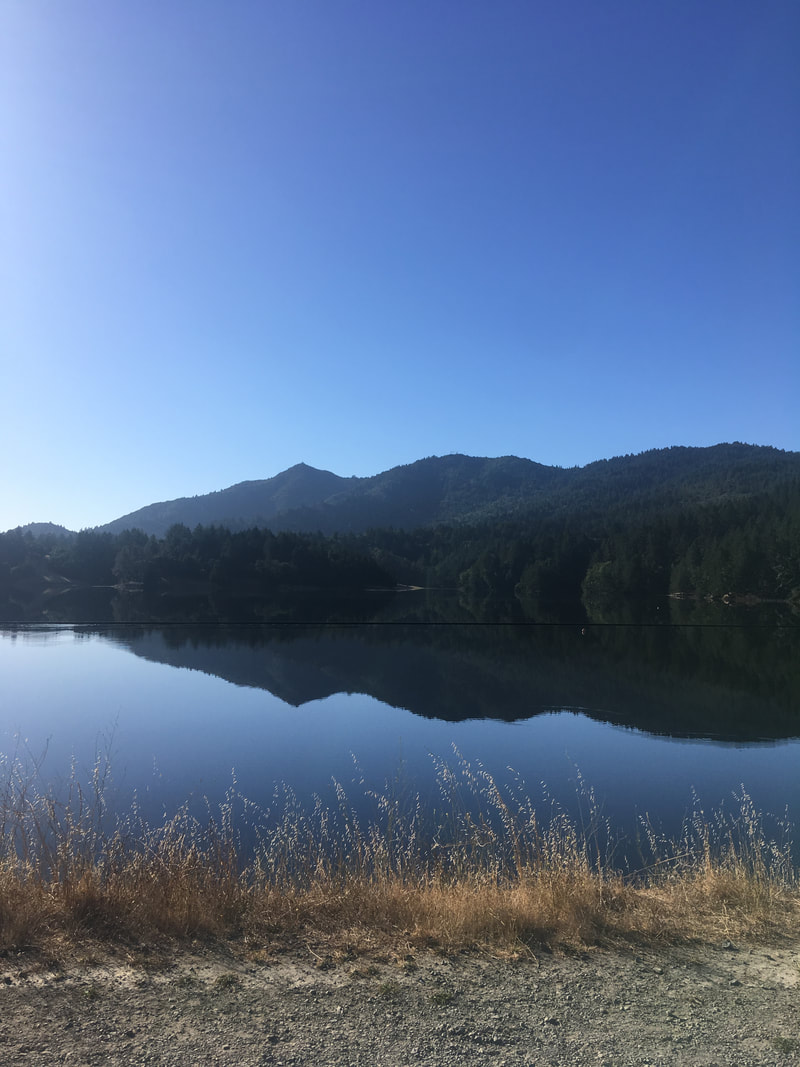
- 3.3 mi: After crossing the dam, turn right onto Kent Fire Road. Continue along Kent Fire Road which will eventually turn into Kent Trail.Follow Kent Trail which follows the edge of Alpine Lake for about 1.9 miles. While most of the trail is flowing single track, be careful as there are a few technical rocky sections to be aware of.
- 5.2 mi: Continue straight onto Helen Markt Trail. This will keep you on the edge of Alpine Lake.
- 6.7 mi: Turn left onto Cataract Trail. This is where some of the steeper climbing begins.
- 7.6 mi: Cross Laurel Dell Picnic area and take a right onto the obvious and somewhat rocky Laurel Dell Fire Road. Enjoy a short flat section and then start the climb up to Ridgecrest Blvd.
- 8.3 mi: You've reached Ridgecrest Blvd. Now it's time to enjoy some great views of the Pacific and some flowing descent. Look leftwards across the road and you will see a trail with a marker saying Willow Camp. Take that trail veering leftwards. After about 50/75 yards the trail will begin to split into multiple options. As long as you continue downwards you will end up in the same place.
- 8.4 mi: All the trails will converge eventually. Look left and continue onto Coastal Trail which hugs the slope, losing and gaining minimal amounts of elevation. You will continue on Coastal Trail for 2 miles.
- 10.4 mi: Make a right turn onto Matt Davis Trail. The true steep descending begins now. Be aware as this is a popular trail to not go too fast or you'll most likely end up running into someone.
- 12.1 mi: After a 1.7 mile descent, Matt Davis will empty you onto a road. Continue straight. On the left side of the road will be the community center. In the summer months there is occasionally a hose that you can fill up a water bottle with. Your mileage may vary. Run down the road and take a left on Highway 1.
- 12.3 mi: Now back to climbing! Take a left onto Dipsea Trail.
- 12.4 mi: Cross the Panoramic Highway to continue onto the Dipsea Trail. Continue on the Dipsea Trail for about a mile.
- 13.5 mi: Veer left onto Steep Ravine Trail. The next 1.5 miles are a steep but beautiful climb up Webb Creek ravine and through a redwood forest.
- 14.3 mi: Climb up the 10-foot ladder!
- 15.0 mi: (Water available) At Pantoll Ranger Station. Cross over Panoramic Highway, and look to your right for the trailhead for the Old Stage Road. The road is initially paved but soon turns to dirt. It is a very gradual climb that can be exposed and hot in the summer.
- 17.0 mi: Intersection with Old Railroad Grade at West Point Inn. There may be a hose to fill up water at the front of the Inn but your mileage may vary. Turn left onto Old Railroad Grade to continue climbing up to the summit. You will follow the Old Railroad Grade all of the way up to East Peak.
- 18.4 mi: Old Railroad Grade ends at the paved Ridgecrest Blvd. Turn right and then veer right onto the narrow paved road to the summit.
- 18.7 mi: (Water available) At the parking lot. Continue through the parking lot onto the Plank Walk Trail to the actual summit. The first part of this trail is on wooden boards, but then it becomes narrow and rocky as it heads up to the fire lookout.
- 19.0 mi: At the fire lookout! Pick out your favorite rock and enjoy the view! Then retrace your steps back down to the parking lot and continue back as if you were going to go back down Railroad Grade Fire Road.
- 19.6 mi: When dumped back onto Ridgecrest Blvd, look right and continue down Eldridge Grade Fire Road. This will take you back to Phoenix Lake.
- 22.1 mi: Continue left to stay on Eldridge Grade Fire Road.
- 23.1 mi: Make a sharp right to stay on Eldridge Grade Fire Road.
- 23.9 mi: There are two fire roads going off to the right within 20 yards of one another. Do not take them!! Continue left to stay on Eldridge Grade Fire Road.
- 24.4 mi: (Water Available) At a large fire road intersection, there will be a water fountain on the left hand side. Fill up your bottle and then continue down and to the right to stay on Eldridge Grade Fire Road.
- 25.1 mi: Reach a large familiar intersection. Take the rightmost fire road which will put you onto Phoenix Lake Road. Continue on Phoenix Lake Road mirroring Phoenix lake and retrace your steps back to the trailhead.
- 26.0 mi: Cross the bridge and you've made it back to your car!