Arastradero to Page Mill Road (8.2/18.1 mi, ~2500/3000 feet elevation gain)
|
This section of the Bay-to-Ridge Trail is one of the hidden gems in the Bay Area. First of all, did you even know that a "Bay-to-Ridge Trail" existed? Also, did you know that it boasted some of the best singletrack trails and most amazing views in the South Bay area? Well, now you do! And, best of all, the run is only minutes from Palo Alto, so you can spend the day on the trails instead of driving!
This route starts at Pearson-Arastradero Preserve, and then runs through Palo Alto Foothills Park and Los Trancos Open Space Preserve all of the way to Page Mill Road. The run can either be done as a 8.2-mile one-way-with-shuttle run, or as a 18.1 mile out-and-back. (The return route modified slightly, so the out-and-back is not twice the distance of the one-way run.) The climb is gradual, so the 2500' elevation gain doesn't feel that bad, or maybe the awesome singletrack trails just take the pain away? The highlight of this run is the Los Trancos Trail in Palo Alto Foothills Park. Entrance into Foothills Park is restricted to Palo Alto residents only; however, you may run/hike through the park as part of the Bay-to-Ridge Trail. Because of the limited access, the trails in Foothills Park are narrower and less disturbed than trails in most other Bay Area parks. Even though you are never more than a few miles from a main road, this makes the trails feel mysterious and remote. |
|
The run starts at the main parking lot for Pearson-Arastradero Preserve along Arastradero Road.
The Dirt:
Extras:
The Dirt:
- Click here to download a printable 3-page map of the run!
- Click here for driving directions to the START of the run at Pearson-Arastradero Preserve.
- Click here for driving directions to the END of the run, if you're doing the one-way-with-shuttle.
- Download the GPX track of the one-way route (8.2 mi) or the out-and-back route (18.1 mi)!
Extras:
- There is drinking water available at the Interpretive Center in Palo Alto Foothills Park (at miles 2.5 and 15.6 if doing the out-and-back), and along Page Mill Road (at mile 8.1).
- Even though the "Bay-to-Ridge Trail" is marked on some trail maps, there are hardly any signs along the way marking the route. In fact, it is a bit unclear as to exactly which trails comprise the route. So it is strongly advised to print out the trail maps or upload the GPX to your GPS device.
|
Route Details:
|
View from Los Trancos Trail in Foothills Park
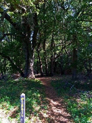
Los Trancos Trail
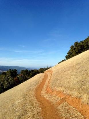
Page Mill Trail in Los Trancos OSP
|
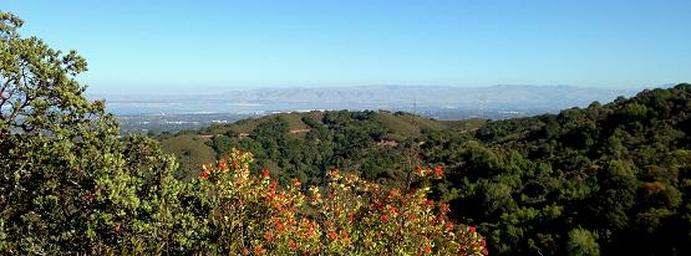
View from Los Trancos Trail in Foothills Park