Palo Alto Foothills Park

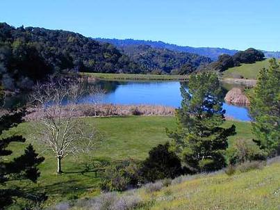
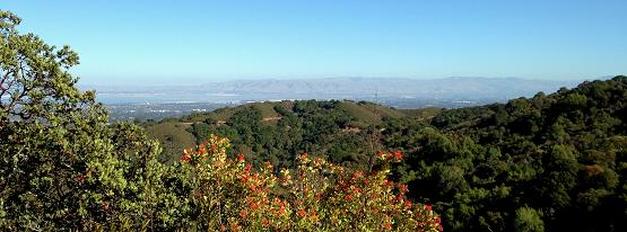
Bounded by Portola Valley, Los Altos Hills, Pearson-Arastradero Preserve and Los Trancos Open Space Preserve, the 1,400-acre Palo Alto Foothills Park boasts over 15 miles of trails. The park contains rugged chaparral, woodlands, fields, streams, and a lake, and provides spectacular views of the Bay Area. Wildlife abounds, and it is common to see deer and coyotes, and even a bobcat. Because of the "access restrictions" of the park, the trails are narrower and less disturbed than most other Bay Area parks. Even though you are never more than a few miles from a main road, the trails feel mysterious and remote.
Unfortunately, Foothills Park is officially off-limits to anyone that is not a Palo Alto resident or their accompanied guest. Why would they make this rule? In 1959 the City of Palo Alto was looking to purchase the land and asked the cities of Portola Valley and Los Altos Hills to chip in. They refused, and the city of Palo Alto footed the entire $1.3M bill. Because of this, the City of Palo Alto restricted the use of the park to Palo Alto residents only.
Fortunately, however, there is one exception to the Palo Alto residency rule, which can be found on the park's Rules and Regulations page: "...Non-resident hikers (and hikers only) may enter from Pearson Arastradero Preserve or from Los Trancos Open Space Preserve as part of the Bay to Ridge Trail..." When they say "hikers" we assume they also mean "trail runners." So, if you are not a Palo Alto Resident but want to check out Foothills Park, the easiest way is to park at Pearson-Arastradero Preserve and hike/run through to Foothills Park, a distance of about 2 miles one way.
 Los Trancos Trail
The Dirt:
Extras:
- Click here to download a printable trail map of the Favorite Run below!
- Click here for the official Palo Alto Foothills Park site with trail map.
- Click here for directions to the parking area near Orchard Glen picnic area via Google Maps. Note that you can only drive into the park if you are a Palo Alto resident or accompanied by one!
- Foothills Park is loaded with poison oak. Click here to learn about preventing and treating poison oak rashes.
- Dogs on leash are allowed on all trails, but only on WEEKDAYS and NON-HOLIDAYS!
Extras:
- An interesting article from Palo Alto Online explaining why Foothills Park is only open to Palo Alto residents.
- There are several spots along the paved roads in the park where drinking water is available. However; there is no drinking water along any of the dirt roads or trails.
- If you are looking for a very long adventure, you can run/hike from Arastradero Road to Skyline Blvd on the Bay-to-Ridge Trail. This route passes through Pearson-Arastradero Preserve, Foothills Park, and Los Trancos Open Space Preserve.
Favorite Run #1: Los Trancos Loop (7.2 mi, ~1500 feet elevation gain) 🐾
|
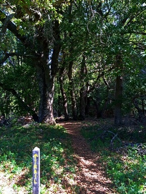
The Los Trancos Trail loop is the highlight of Palo Alto Foothills Park. This 7.2-mile loop passes through beautiful woodlands and forest and has a few excellent vistas of the Bay Area and the surrounding ridges and valleys. The loop is primarily challenging and technical singletrack with about 1500 feet of total elevation gain, but it is well worth the effort.
The run starts from the parking area near Orchard Glen picnic area. Begin the run by heading south on Wildhorse Valley Road, which soon turns into a dirt road. 🐾 Dogs on leash are allowed on weekdays and non-holidays only. GPX Track Printable Trail Map Driving Directions (Palo Alto residents only!) |
|
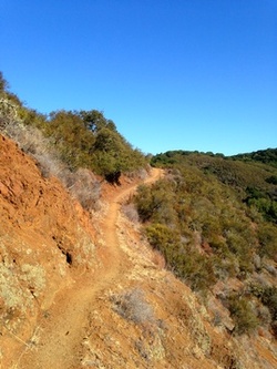
 Beautiful singletrack on Los Trancos Trail
Route Details:
- 0.0 mi: Start heading south down Wildhorse Valley Road toward Los Trancos Trail. The road will soon turn into a dirt road.
- 0.3 mi: Turn right onto the singletrack Los Trancos Trail and start climbing. You will follow the Los Trancos Trail for the entire remainder of the route. The trail will initially be shaded, but will become more open as you climb.
- 2.6 mi: Cross Trappers Fire Road. This is the high point of the run! You will soon descend into a gulch and follow Los Trancos Creek. Parts of this section of trail are narrow and technical, so watch your footing!
- 5.6 mi: Begin a short 0.5-mile climb. Don't worry, you'll soon begin a fun switchback descent.
- 6.9 mi: Shortly after the final switchbacks, the Los Trancos Trail ends in a grassy field. Run across the field and turn right on the paved road to head back to the Orchard Glen picnic area and your car.
- 7.2 mi: Back at your car!
