Briones Reservoir (EBMUD Trails - North Watershed)

The East Bay Municipal Utility District (EBMUD) is a public utility that was established in 1923 to supply drinking water to the residents of the East Bay. The district was founded after a severe drought proved that a local system of reservoirs was inadequate. The district constructed Pardee Dam on the Mokelumne River in the Sierra Nevada, and a large steel pipe aqueduct to transport the water from Pardee Reservoir across the Central Valley to San Pablo Reservoir, located in the East Bay hills east of Richmond. In 1929, the aqueduct started delivering water to residents of the East Bay. In subsequent years, two additional aqueducts were constructed and the water distributed to several other East Bay reservoirs. From the various large regional reservoirs, water is transported to treatment plants and delivered to local reservoirs and tanks, and then distributed by gravity to households. In addition to providing drinking water, in 1951 EBMUD opened the first wastewater treatment plant to protect the waters of the San Francisco Bay. Click here to learn more about the history of EBMUD.
Today, EBMUD manages the reservoirs and surrounding watershed lands to protect water quality. Fortunately for us, EBMUD also maintains about 80 miles of trails on 27,000 acres of watershed lands. The EBMUD lands stretch from Castro Valley in the south to Pinole Valley in the north, with Highway 24 cutting through the center. The lands to the north of Highway 24 are referred to as the North Watershed area, while the area south of Highway 24 is called the South Watershed area. This page covers some of the popular trails in the South Watershed area. More info on the North Watershed area can be found here.
The EBMUD lands also connect to adjoining parks such as Anthony Chabot Regional Park, Redwood Regional Park, and Wildcat Canyon Regional Park. By combining multiple parks it is possible to do very long loop or point-to-point runs and hikes.
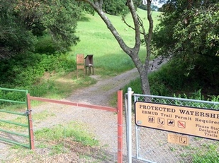
Note that a permit is required to use EBMUD trails. As of 2016, the permits cost $10/year and are easily purchased online.
The Dirt:
- Click here to download a printable trail map of the Favorite Run below!
- Click here for the official EBMUD trails site, where you can print maps of all 80 miles of trails and buy permits online.
- Click here for driving directions to the Bear Creek trailhead via Google Maps.
- Dogs are allowed ONLY on the Oursan and Hampton Trails, so the loop is NOT dog-friendly. :(
Favorite Run: Briones Reservoir Loop (13.2 mi, 1500' elevation gain)
|
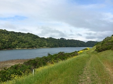
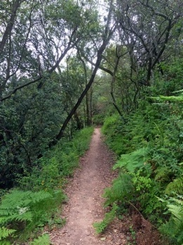
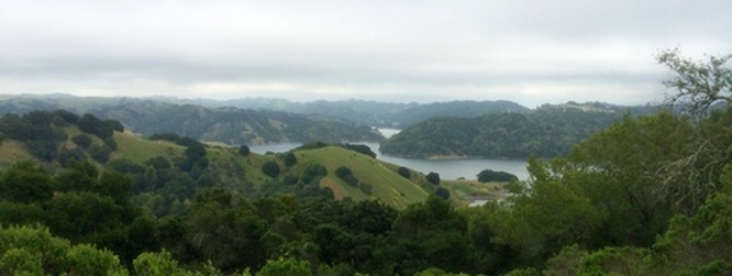
This 13.2 mile route encircles the entire Briones Reservoir. The run goes in a counter-clockwise direction, which saves the best singletrack section for last! The route starts out on the wide Oursan Trail, which follows the shoreline of the north side of the reservoir for about 5 miles before climbing up to a 1000' ridge for great views of the reservoir and the Berkeley hills. The route then descends and crosses over the dam, where you can see the giant overflow spillway which funnels water from Briones Reservoir to San Pablo Reservoir below. The final three miles of the loop is on the singletrack Bear Creek trail, which climbs 300' through dense forest and then descends to the Bear Creek Staging Area.
Start the run by heading through the gate to the well-marked Oursan Trail. GPX Track Printable Trail Map Driving Directions |
|
|
NOTICE: Last time we visited the Bear Creek Staging Area, we noticed piles of broken window glass in the parking lot. Please take all valuables with you or hide them in your car!
Route Details:
|


