Big Basin Redwoods State Park
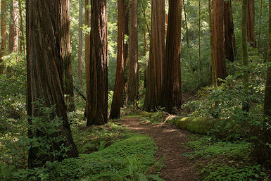
Established in 1902, Big Basin Redwoods is California's oldest State Park, earning its designation as a California Historical Landmark. Located in the Santa Cruz Mountains and extending to the coast, this 18,000 acre park is home to the largest continuous stand of ancient Coast Redwoods south of San Francisco. It contains 10,800 acres of old-growth forest as well as recovering redwood forest, with mixed conifer, oaks, chaparral and riparian habitats.
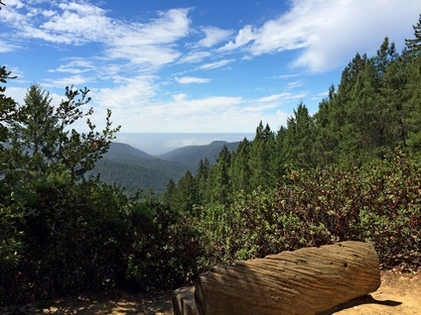
Big Basin Redwoods State Park has over 80 miles of trails, and many of these miles consist of stunning singletrack through dense redwood forest. In addition, there are connector trails that link Big Basin to Castle Rock State Park and Portola Redwoods State Park enabling very long multi-park routes. There are multiple waterfalls in the park, the most well-known and photographed being Berry Creek Falls, a 65' waterfall set in a small canyon among the redwoods. The famous Skyline-to-the-Sea Trail also passes through the park, and is the last link of the 26-mile route from Saratoga Gap to Waddell Beach and Highway 1. In addition to hiking and trail running, Big Basin makes an excellent camping and backpacking destination, and offers several drive-in and hike-in campgrounds.
Big Basin Redwoods State Park has over 80 miles of trails, and many of these miles consist of stunning singletrack through dense redwood forest. In addition, there are connector trails that link Big Basin to Castle Rock State Park and Portola Redwoods State Park enabling very long multi-park routes. There are multiple waterfalls in the park, the most well-known and photographed being Berry Creek Falls, a 65' waterfall set in a small canyon among the redwoods. The famous Skyline-to-the-Sea Trail also passes through the park, and is the last link of the 26-mile route from Saratoga Gap to Waddell Beach and Highway 1. In addition to hiking and trail running, Big Basin makes an excellent camping and backpacking destination, and offers several drive-in and hike-in campgrounds.
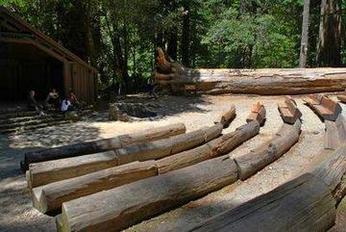 The campfire center in Big Basin
Another attraction in Big Basin Redwoods State Park is the campfire center, a rustic outdoor theater where the seats are carved from fallen old-growth redwood trees. The campfire center was built in 1935 by Franklin Roosevelt’s Civilian Conservation Corps and since then has been serving generations of campers and visitors to the park. The campfire center had suffered in recent years, but has finally been restored thanks to the non-profit Sempervirens Fund. The restoration includes 139 new redwood benches for the over 1 million visitors to the park each year. The campfire center offers activities for the whole family, including ranger-led talks and campfires.
The weather in the park is typical of the weather throughout the Santa Cruz mountains: often cold and foggy in the winter and warm/hot and dry in the summer. However, the trails are mostly shaded which makes Big Basin a great place to hike or run year round!
The weather in the park is typical of the weather throughout the Santa Cruz mountains: often cold and foggy in the winter and warm/hot and dry in the summer. However, the trails are mostly shaded which makes Big Basin a great place to hike or run year round!
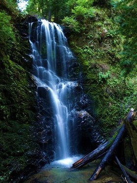 Berry Creek Falls
The Dirt:
Extras:
- For printable trail maps, see each Favorite Run below!!
- Click here for the official Big Basin web site with link to brochure and trail map.
- Click here for driving directions to the Park Headquarters via Google Maps.
- Click here for driving directions to the Rancho Del Oso entrance off Hwy 1 at Waddell Beach.
- Big Basin is a hot spot for poison oak. Click here to learn about preventing and treating poison oak rashes.
- Dogs are not allowed on trails in the park.
Extras:
- There are several drive-in and hike-in campgrounds in Big Basin. Reservations are encouraged. More information can be found here.
- Big Basin is home to one of the most photographed waterfalls in the Bay Area, Berry Creek Falls. The falls is the most dramatic in the late winter or early spring after heavy rains.
- The only drinking water in the park is at the Park Headquarters, so bring extra on your run.
Favorite Run #1: Ocean View Summit Loop (5.7 mi, ~1000' elevation gain)
|
Don't let this route fool you! It's less than six miles but there is some serious climbing. The highlight of this run is the Ocean View Summit on the Middle Ridge Road trail. The run is basically up and down, with a nice rolling section alongside Opal Creek on the way back to the start.
The run starts from the Park Headquarters. Head past the campfire center following the signs toward the Skyline-to-the-Sea Trail. Just after crossing the creek, turn right onto the Skyline-to-the-Sea Trail. You'll know you are going the correct direction if the creek is on your right. GPX Track Printable Trail Map Driving Directions |
|
Route Details:
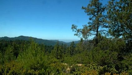 The view from Ocean View Summit
- 0.0 mi: Start from the Park Headquarters. Head past the campfire center following signs toward the Skyline-to-the-Sea Trail.
- 0.1 mi: Just after crossing the creek, turn right onto the Skyline-to-the-Sea Trail. The creek should now be on your right.
- 0.4 mi: Cross Gazos Creek Road and stay on Skyline-to-the-Sea Trail.
- 0.5 mi: Turn left on Creeping Forest Trail and start climbing.
- 1.8 mi: Creeping Forest Trail ends at Dool Trail. Turn right onto Dool Trail.
- 1.9 mi: Dool Trail ends at Middle Ridge Road. Turn right and climb (steeply) toward Ocean View Summit.
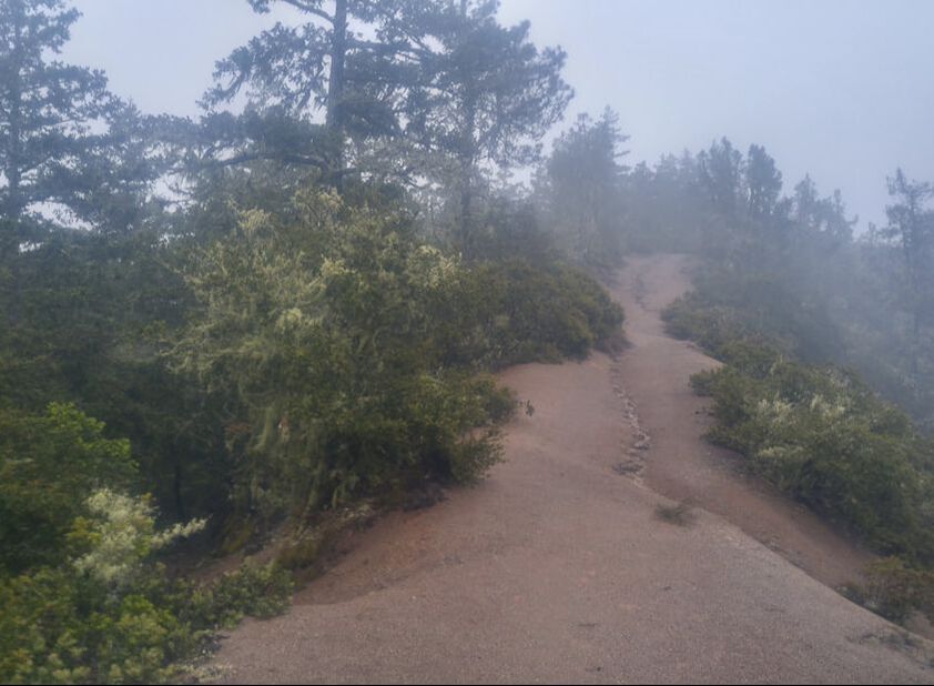
- 2.6 mi: At 1685' Ocean View Summit! Enjoy the view and then keep going on Middle Ridge Road.
- 3.1 mi: Turn right onto the Meteor Trail, and enjoy the descent.
- 3.9 mi: Meteor Trail ends on Skyline-to-the-Sea Trail. Turn right and follow the Skyline-to-the-Sea Trail back toward the Park Headquarters.
- 5.3 mi: Cross Gazos Creek Road.
- 5.6 mi: Turn left toward the campfire center and the Park Headquarters.
- 5.7 mi: Back at the Park Headquarters and your car!
Favorite Run #2: Berry Creek Falls Loop (10.0 mi, ~1900' elevation gain)
|
This run takes you to the stunning Berry Creek Falls Trail for a visit to Berry Creek Falls. Not only do you get to experience Berry Creek Falls, but also the smaller falls and cascades that are upstream. In addition, the trip to and from the falls takes you through gorgeous redwood groves along some of the nicest singletrack trails in the area.
The run starts from the Park Headquarters. Head past the campfire center following signs toward the Skyline-to-the-Sea Trail. Just after crossing the creek, turn right onto the Skyline-to-the-Sea Trail. You'll know you are going the correct direction if the creek is on your right. GPX Track Printable Trail Map Driving Directions |
|
Route Details:
Note: There is a steep, rocky section of Berry Creek Falls Trail near the falls that is often wet and slippery. Use extreme care through these sections and hold onto the cable!
|
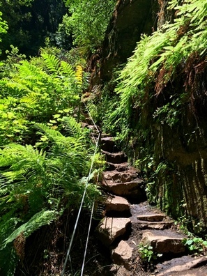
Rocky section of Berry Creek Falls Trail
|
Favorite Run #3: Coast to HQ Big Loop (21.5 mi, ~3800' elevation gain)
|
This is a challenging lollipop loop that explores the lesser-traveled west side of Big Basin Redwoods State Park. Unlike the previous two runs, this route starts from the Rancho Del Oso entrance on Highway 1 at Waddell Beach and climbs inland toward the park headquarters. Highlights of this run include the spectacular views from the steep McCrary Ridge Trail which climbs over 1200' in 2.5 miles, the vista from 1,739' Mt. McAbee Overlook, and several waterfalls and cascades including Berry Creek Falls. The route even loops past the park headquarters at mile 10 so you can get water.
In addition to a butt-kicking run, this route makes a great two-day backpack trip. In this case you would follow the route exactly as described, but camp overnight near the headquarters. Please refer to the park website for campsite reservation details. Note that overnight parking is not allowed at Waddell Beach, so you would have to arrange for a drop-off/pick-up to do this route as a two-day trip. |
|
The well-marked Rancho Del Oso trailhead is located 18 miles north of Santa Cruz on Highway 1. There is plenty of parking and bathrooms on the beach side of the road. To begin the run, go around the gate and start heading up the paved road toward the Horse Camp.
GPX Track
Printable Trail Map
Driving Directions
GPX Track
Printable Trail Map
Driving Directions
Route Details:
- 0.0 mi: From the parking area along Highway 1, go around the gate and head up the paved road toward the Horse Camp.
- 0.4 mi: Just past the Horse Camp, veer left onto the Skyline-to-the-Sea Trail Bypass (singletrack). This trail climbs briefly and then parallels the dirt road for 1.5 miles.
- 1.9 mi: After crossing Waddell Creek, turn left and continue up the Skyline-to-the-Sea Trail (dirt road).
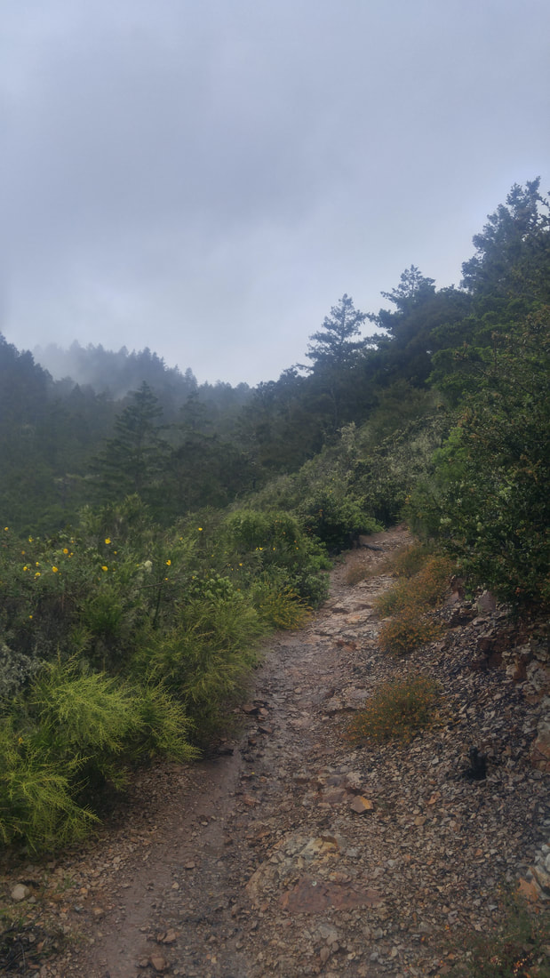
- 3.5 mi: Turn right onto the narrow McCrary Ridge Trail. The trail immediately starts climbing steeply, and climbs for the next 3 miles. Some sections are very steep, rocky, and loose, so watch your footing!
- 6.1 mi: The McCrary Ridge Trail ends at Hihn Hammond Road. Turn right and continue gradually climbing toward Mt. McAbee.
|
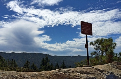
View from the Hihn Hammond Road
View from Mt. McAbee overlook (1,739')
|
Favorite Run #4: Chalk Mountain (16.2 mi, ~3400' elevation gain)
|
This run winds it way upwards toward the coastal peak known as Chalk Mountain. Starting from the Rancho Del Oso end of Big Basin Redwoods State Park, the run begins with a brutal climb heading upwards. After a few miles of tough uphill, the ridge is gained and you get to enjoy awesome views over the Pacific Ocean and the redwood forests. After following the groomed fire roads you transition back onto single track with a flowing descent back down to Waddell Creek. From there the route continues among the redwoods back towards the trail head.
This route is no slouch of a run. The climbs can be very tough and these trails tend not to be traveled very often making navigation tough at certain places. But with difficulty comes isolation, the likelihood of you seeing another person for most of this run is very low. It definitely feels like a miniature adventure. The run begins at Waddell Beach. Park across the street from the beach parking and head in on the Skyline to the Sea Trail heading north-east. Before starting this route, check with the park whether or not the seasonal bridges in the are up. If they are not you may have to do some waist deep or more creek crossings. |
|
|
Route Details:
|
Half a mile up on the climb towards Chalk Mountain
|
|
Tricky Intersection. Don't be tempted by the trail on the left. Go straight and stay on the ridge.
|