EBMUD Trails - South Watershed Area
The East Bay Municipal Utility District (EBMUD) is a public utility that was established in 1923 to supply drinking water to the residents of the East Bay. The district was founded after a severe drought proved that a local system of reservoirs was inadequate. The district constructed Pardee Dam on the Mokelumne River in the Sierra Nevada, and a large steel pipe aqueduct to transport the water from Pardee Reservoir across the Central Valley to San Pablo Reservoir, located in the East Bay hills east of Richmond. In 1929, the aqueduct started delivering water to residents of the East Bay. In subsequent years, two additional aqueducts were constructed and the water distributed to several other East Bay reservoirs. From the various large regional reservoirs, water is transported to treatment plants and delivered to local reservoirs and tanks, and then distributed by gravity to households. In addition to providing drinking water, in 1951 EBMUD opened the first wastewater treatment plant to protect the waters of the San Francisco Bay. Click here to learn more about the history of EBMUD.
Today, EBMUD manages the reservoirs and surrounding watershed lands to protect water quality. Fortunately for us, EBMUD also maintains about 80 miles of trails on 27,000 acres of watershed lands. The EBMUD lands stretch from Castro Valley in the south to Pinole Valley in the north, with Highway 24 cutting through the center. The lands to the north of Highway 24 are referred to as the North Watershed area, while the area south of Highway 24 is called the South Watershed area. This page covers some of the popular trails in the South Watershed area. More info on the North Watershed area can be found here.
The EBMUD lands also connect to adjoining parks such as Anthony Chabot Regional Park, Redwood Regional Park, and Wildcat Canyon Regional Park. By combining multiple parks it is possible to do very long loop or point-to-point runs and hikes.
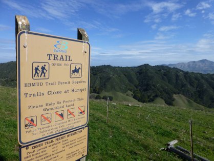
Note that a permit is required to use EBMUD trails. As of 2016, the permits cost $10/year and are easily purchased online.
Today, EBMUD manages the reservoirs and surrounding watershed lands to protect water quality. Fortunately for us, EBMUD also maintains about 80 miles of trails on 27,000 acres of watershed lands. The EBMUD lands stretch from Castro Valley in the south to Pinole Valley in the north, with Highway 24 cutting through the center. The lands to the north of Highway 24 are referred to as the North Watershed area, while the area south of Highway 24 is called the South Watershed area. This page covers some of the popular trails in the South Watershed area. More info on the North Watershed area can be found here.
The EBMUD lands also connect to adjoining parks such as Anthony Chabot Regional Park, Redwood Regional Park, and Wildcat Canyon Regional Park. By combining multiple parks it is possible to do very long loop or point-to-point runs and hikes.
Note that a permit is required to use EBMUD trails. As of 2016, the permits cost $10/year and are easily purchased online.
|
The Dirt:
|
|
Favorite Run #1: King’s Canyon Loop (6.5 mi, ~800’ elevation gain)
|
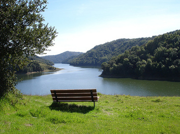
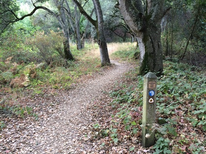
This pretty lollipop loop offers great views of the Upper San Leandro Reservoir in addition to vistas of rolling East Bay hills. The loop is fairly easy, except for a 400' climb at mile 4. The loop can be done in either direction, however doing the loop counterclockwise as described here gives you more of a warm up before the big climb!
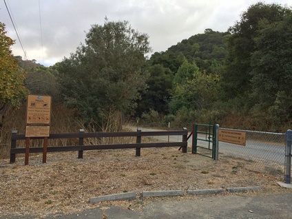
This loop starts from the Valle Vista Staging Area, on Canyon Road just south of Moraga. The main trailhead is on the far side of the parking lot, on the opposite side of the parking lot from the bathroom. Start the run by heading through the gate and turning left (southeast) onto the Riche Loop Trail. GPX Track Printable Trail Map Driving Directions |
|
|
Route Details:
Note: There seems to be some confusion as to whether this area is "King Canyon" or "King's Canyon". The signs refer to "King Canyon" but the map shows "King's Canyon".
|
The Valle Vista Staging Area
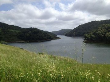
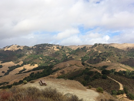
Upper San Leandro Reservoir
|
Favorite Run #2: Rocky Ridge Point-2-Point (15.3 mi, ~3500’ elevation gain)
|
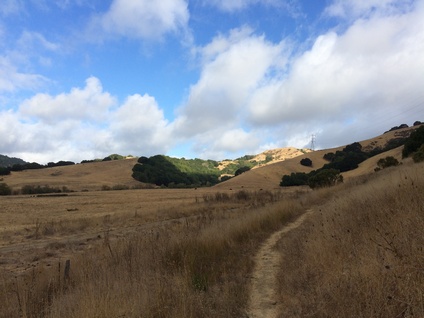
This is an epic 15.3-mile run through some of the most rugged and remote areas in the East Bay. This route is truly a challenge with over 3500' of climbing, no water along the way, and very few (if any) people on the trail. In addition, it is a point-to-point run, so you need to figure out the shuttle logistics.
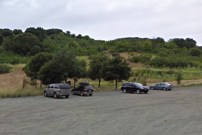
The route starts from the EBMUD Chabot Staging Area along Redwood Road, about two miles north of Castro Valley. (Note that this is NOT the staging area for Anthony Chabot Park!) The first six miles are a beautiful singletrack climb up to 1348' Ramage Peak. The peak itself is on private property, although a well-maintained dirt road to the peak does exist. After a brief descent, a steep dirt road takes you up to 2000' Rocky Ridge. This part is really tough, with some sections of the road seeming almost vertical. Rocky Ridge, which was once home to a Nike missile installation, boasts excellent views of the East Bay Hills and interesting sandstone rock formations. After a few miles of dirt road descent, the trail turns back into singletrack for one final climb and ends at Rancho Laguna Park in Moraga. Start the run by heading through the EBMUD gate at the far side of the parking lot. GPX Track Printable Trail Map Driving Directions to the START Driving Directions to the FINISH |
|
|
Route Details:
|
The trailhead at EBMUD Chabot Staging Area
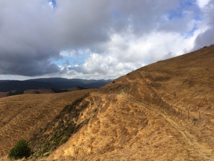
Great singletrack climb on Ramage Peak Trail
Climbing toward Ramage Peak
|
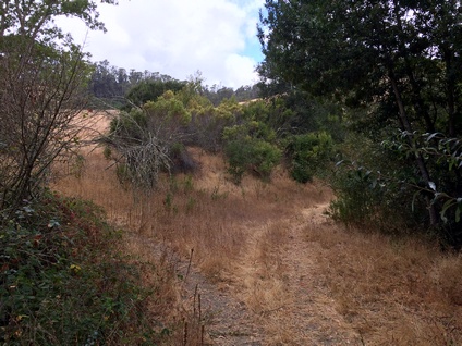
Confusing split at mile 4.7 - go right
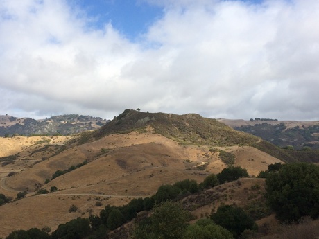
Ramage Peak
|
Rocky Ridge (from Ramage Peak)
Descending the Rocky Ridge Trail toward Moraga
|